Project
Community
News
My maps
Mapa catalogado
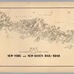
Map Exhibiting The ... Lines for the New-York and New-Haven Rail-Road.
Título completo:
Map Exhibiting The ... Lines for the New-York and New-Haven Rail-Road.
Editorial:
Manuscript
Tamaño físico:
20 x 30 cm
Escala del mapa:
1:20 000
Historia