Maps of Alps

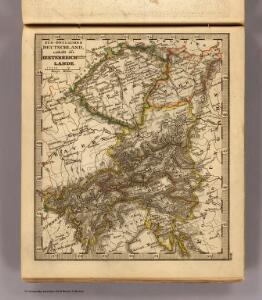
SO Deutschland, Oesterreich. Lande.
1 : 5500000 Brudin, J. L.; Stieler, Adolf
Die Kaiserl. Oesterreichischen Provinzen in Deutschland nebst dem Fürstenthume Liechtenstein
Österreich
[Habsburská monarchie]
1 : 4440000 Evropa jihovýchodní
[Habsburská monarchie]
1 : 4440000 Evropa jihovýchodní
States of the Late Germanic Confederation.
1 : 2344320 Fullarton, A. & Co.
[Süd-Östliches Deutschland]
Schul-Atlas über alle Theile der Erde nach dem neuesten Zustande, und über das Weltgebäude Stieler, Adolf Justus Perthes
Übersichts-Karte der Weinbau-Gebiete Österreich's
1 : 800000 Rakousko-Uhersko k. u. k. milit.-geographisches Institut
Ungarn, Galizien.
1 : 1600000 Kiepert, Heinrich, 1818-1899
Ungarn mit seinen Nebenländern und Galizien
1 : 1600000 Kiepert, Heinrich, 1818-1899 geografisches Institut
Deutsch-Oesterreichische Länder
1 : 5000000 Österreich
Süd-Östliches Deutschland, enthält die Oesterreichischen Lande
Schul-Atlas über alle Theile der Erde nach dem neuesten Zustande, und über das Weltgebäude Stieler, Adolf bei Justus Perthes
Übersichtskarte für die Operationen der k. k. Nordarmee im Jahre 1866
1 : 1900000 Evropa střední Ditfurth, Moritz von des K. u. k. Militärgeographischen Instituts

Süddeutsche Bundesstaaten
Evropa střední
Süddeutsche Bundesstaaten
Evropa střední
Süddeutsche Bundesstaaten
Evropa střední

Karte der totalen Sonnenfinsterniss am 8. July 1842
Evropa střední Littrow, Carl Ludwig Lehmann, Jacob Heinrich Wilhelm Verlag der lithographischen Anstalt des Ludwig Mohn
S. R. I. circvlvs Avstriacvs quem componunt archid. Avstriae, dvcatvs Stiriae, Carinthiae, Carnioliae, comit. Tyrolensis, ditionesque Sveviae austriacae, cum suis confiniis
1 : 1730000 Korutansko (Rakousko) Mayer, Tobias curantibus Homannianis Heredibus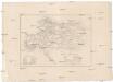
[Rakousko]
Evropa jihovýchodní Rothenburg, R. von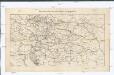
Weltverkehrslinien Oesterreich-Ungarn's und deren Lücken
1 : 2371000 Rakousko-Uhersko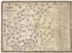
Reise und Influenz-Karte der Eil- Post- und Brancard-Wagen-Course in dem Oesterreichischen Kaiserstaate
Evropa střední Raffelsperger, Franz Bermann, J. Franz Raffelsperger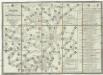
Reise und Influenz-Karte der Eil- Post- und Brancard-Wagen-Course in dem Oesterreichischen Kaiserstaate
Evropa střední Raffelsperger, Franz Haupt-Direction der k. k. Fahrposten
S. R. I. Circulus Austriacus quem componunt Archid. Austriae, Ducatus Stiriae, Carinthiae, Carnioliae, Comit. Tyrolensis, ditionesque Sueviae austriacae, cum suis confiniis
1 : 1800000 Mayer, Tobias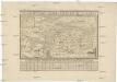
General-Charte der Oesterreichishen Staaten
1 : 6530000 Evropa jihovýchodní Blum von Kempen, Heinrich Wilhelm von Prixner, Gottfried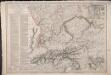
Carte du Théâtre de la Guerre en Allemagne, en Autriche et en Italie; où se trouvent tracés les Marches, Positions, Batailles et Combats, de la Grande-Armée, commandée en personne par S. M. l'Empereur Napoléon; pendant la Campgane de 1805, et ceux de l'Armée d'Italie, commandée par S. Ex. le Maréchal Masséna
Picquet, Charles; Magimel, Denis-Simon
Völker-, Telegrafen- und Eisenbahn- Karte des Kaiserthumes Österreich
1 : 2500000 Chorvatsko Raffelsperger, Franz Kunst-Anstalt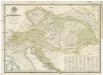
Karte des Kaiserthumes Österreich
1 : 2900000 Evropa jihovýchodní Raffelsperger, Franz Franz Raffelsperger
Karte des Kaiserthumes Österreich
1 : 2900000 Evropa jihovýchodní Raffelsperger, Franz im typographischen Landkarten-Verlage
Karte des Kaiserthumes Österreich
1 : 2900000 Evropa jihovýchodní Raffelsperger, Franz im typographischen Landkarten-Verlage