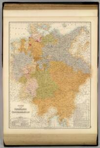
Maps of Germany

States of the Late Germanic Confederation.
1 : 2344320 Fullarton, A. & Co.
Deutschland.
1 : 2300000 Weiland, C. F. (Carl Ferdinand), d. 1847
Germany, Switzerland, N. Italy.
1 : 5300000 Mitchell, Samuel Augustus
Deutschland
Hypsometrischer Atlas Ziegler, Jakob Melchior Topogr. Anstalt v. J. Wurster u. Comp.
Deutschland
1 : 3500000 Evropa střední Handtke, Friedrich Carl Flemming
Deutschland
[Allgemeiner Atlas über alle Theile der Erde in 29 Blättern] Ziegler, Jakob Melchior Top. Anstalt v. J. Wurster u. Comp.
Germany.
1 : 2429000 Johnson, A.J.

Deutschland
1 : 2350000 Evropa střední Weiland, Karl Ferdinand Geographisches Institut
Deutschland
1 : 2350000 Evropa střední Weiland, Karl Ferdinand Geographisches Institut
Deutschland
1 : 2350000 Evropa střední Weiland, Karl Ferdinand Geographisches Institut
Prag 103, uit: Special-Karte von Mittel-Europa / nach amtlichen Quellen bearbeitet von W. Liebenow
1 : 300000 titelvariant: W. Liebenow's Mittel-Europa; Annotatie: Titel boven de bladen: W. Liebenow's Mittel-Europa Johannes Wilhelm Liebenow 1822-1897 Frankfurt a. M. : Ludwig Ravenstein
Deutsches Reich nebts Deutsch-Österreich und Schweiz
1 : 1825000 Evropa střední Handtke, Friedrich Carl Flemming
Empire of Germany.
1 : 2450000 Johnson, A.J.
Der Deutsche Bundesstaat in 23 Republiken nach Struve's Grundrechten des deutschen Volks
1 : 4500000 Lithogr. von F. Bruder in Basel Basel : [s.n.]
Karte von Deutschland
Grosser Hand-Atlas über alle Theile der Erde in 170 Karten Meyer, J. Verlag des Bibliographischen Instituts
Deutschland.
1 : 3400000 Flemming, Carl
Empire of Germany.
1 : 2450000 Johnson, A.J.
Empire of Germany.
1 : 2450000 Johnson, A.J.
Neueste Karte von Deutschland, der Schweiz und Ober-Italien in 4 Blättern
1 : 1700000 Ravenstein, Ludwig Bibliographisches Institut

Deutschland
1 : 4500000 Německo Grimm, Johann Ludwig Scharrer Simon Schropp
Deutschland
1 : 2350000 Evropa střední Weiland, Karl Ferdinand Geographisches Institut
Mitteleuropa 1867
Mitteleuropa Kunz, Andreas ; Moeschl, Joachim Robert
Germaniae Veteris, typus. [Karte], in: Novus atlas absolutissimus, Bd. 2, S. 8.
1 Karte aus Atlas Janssonius Offizin
Mitteleuropa 1991
Mitteleuropa Kunz, Andreas ; Treiling, Thomas
Mitteleuropa 1860
Mitteleuropa Kunz, Andreas ; Moeschl, Joachim Robert
Mitteleuropa 1848
Mitteleuropa Kunz, Andreas ; Moeschl, Joachim Robert
Mitteleuropa 1957
Mitteleuropa Kunz, Andreas ; Treiling, Thomas