Maps of Germany
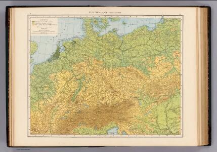
Deutschland physikalisch.
1 : 3400000 Andree, Richard
Tabula Moderna Germanie [Karte], in: Claudii Ptolemei viri Alexandrini mathematice discipline philosophi doctissimi geographie opus [...], S. 245.
1 Karte aus Atlas Waldseemüller, Martin [und Ptolemaeus, Claudius] Übelin, Georg
Post- und Eisenbahn-Reisekarte von Central-Europa
1 : 2000000 Evropa střední Franz, J. Handtke, Friedrich Carl Flemming
Reise-Karte von Mittel-Europa : mit Angabe der Bahnstationen und Postverbindungen / nach den neuesten Quellen entw. u. gezeichnet. von M. Hermann
1 : 2800000 Annotatie: Bijlage bij: J.C. König und Erhardt's Tages-Notizbuch Hermann, M. [S.l. : s.n.] / (Glogau : Flemming)
Post und Eisenbahn Reisekarte von Central Europa

Střední Evropa v zájmu světového míru
1 : 5000000 Evropa střední Kuffner, Hanuš
Neueste Eisenbahn-Karte von Central-Europa
1 : 1900000 Evropa střední Hendschel, U. Carl Jügel
Deutsches Reich. Niederlande, Belgien & Schweiz
Adolf Stieler's Handatlas über alle Theile der Erde und über das Weltgebäude Stieler, Adolf Justus Perthes
Special-karte von Deutschland: nebst einem Theile der angrenzenden Länder mit Gesonderer Berücksichtigung der Gebirge und Gewässer
Fried, Franz
Deutschland 1648
Deutschland Kunz, Andreas ; Moeschl, Joachim Robert
Deutschland 1792
Deutschland Kunz, Andreas ; Moeschl, Joachim Robert
Deutschland 1555
Deutschland Kunz, Andreas ; Moeschl, Joachim Robert
XII. Preußen innerhalb Deutschlands mit den angrenzenden Staatengebieten
1 : 6000000 Mitteleuropa, Deutschland
Germania, Raetia, Noricum.
1 : 3800000 Menke, Th.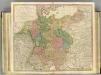
German Empire.
1 : 2150000 Faden, William, 1750?-1836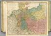
German Empire.
1 : 2150000 Faden, William, 1750?-1836
Deutschland 1803 nach dem Reichsdeputationshauptschluss
Deutschland Reichsdeputationshauptschluss Kunz, Andreas ; Moeschl, Joachim Robert
Deutschland
Allgemeiner Atlas [Walch, Johannes] im Verlag bei Johannes Walch
Deutschland um 1500
Deutschland Kunz, Andreas ; Moeschl, Joachim Robert
Post- Reise-Karte durch Deutschland und die angraenzenden Staaten zwischen London und Lublin, Koppenhagen und Mantua
Evropa střední Schmidt, O. F. Schropp, Simon Simon Schropp & Comp.
Mitteleuropa Übersicht der politischen Verhältnisse und Hauptverkehrswege
1 : 5000000 Mitteleuropa Verkehrsnetz
Deutschland um 1378
Deutschland Kunz, Andreas ; Moeschl, Joachim Robert
Special-Karte der Eisenbahnen Deutschlands und der angrenzenden Länder
1 : 2000000 Haeberlin, R. Ramdohr
Mitteleuropa
1 : 3500000 Evropa střední Köcher
Übersicht der Schnellpost und Eilwagen, ... Deutschland

Mitteleuropa Übersicht der Bodenverhältnisse
1 : 5000000 Mitteleuropa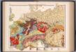
Mitteleuropa, Geologische Übersicht
1 : 3500000 Scobel, Albert
Deutschland, Übersicht des Deutschen Reichs
Handatlas über alle Theile der Erde und über das Weltgebäude Stieler, Adolf Justus Perthes
Deutschland mit der Kreis-Eintheilung von 1512
Evropa střední Benecke Bormann, E. F. Tempsky