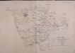
Maps of Sachsen-Anhalt

Allemagne Centrale.
1 : 1370000 Malte-Brun, Conrad, 1775-1826
Kriegsschauplatz in Sachsen, Westphalen, und Preusen
1 : 1000000 Prusko Tranquillo Mollo
Kriegsschauplatz in Sachsen, Westphalen, und Preusen
1 : 1000000 Prusko Tranquillo Mollo
Politische Übersicht vom Mittleren Nord-Deutschland
E. von Sydow's Schul-Atlas in sechs und dreissig Karten Sydow, Emil von bei Justus Perthes
Germany Central.
1 : 1100000 Hall, S. (Sidney)
Germany.
1 : 1500000 Colton, G.W.
[No. 5. Allemagne, Saxe], uit: [Carte de l'Europe]
1 : 490000 Paris : Piquet
Ducatus Saxoniae Superioris :
1 : 720000 Mollova mapová sbírka Zollmann, Friedrich Homann, Johann Baptista - dědici
Friderico Augusto vere Augusto Polon. Lithuan. Borus. Pomer. Regi, Duci, Principi, Saxon. Utr. Duci S. Imp. Elect. Haec. Imperii Sui Regna D.D.D.
1 : 3100000 Mollova mapová sbírka Schenk, Pieter Schenk, Peter I
Hanc Regni Poloniarvm Magniqve Dvcatvs Lithvaniae Rvssiae, Prvssiae, Mazoviae, Samogitiae, Kioviae, Volhyniae, Podoliae, Podlachiae, Livoniae, Smolensci, Severia e. Czern.
1 : 3000000 Mollova mapová sbírka Homann, Johann Baptist Homann, Johann Baptista - dědici
Operations-Karte für die Bewegung der alliirten und der ihr gegenüberstehenden Französischen Armee vom 7ten Februar bis 8ten März.
1 : 600000

Misniae et Lvsatiae Tabvla
1 : 1200000 Mollova mapová sbírka Scultetus, Bartholomaeus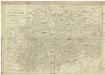
Charte von dem Königreich Sachsen
1 : 690000 Sasko (Německo) Zuccheri, Edmund von Kunst und Industrie Comptoirs
Übersichtskarte von Mittel - Europa

[42][42]Circuli Saxoniae Superioris pars meridionalis ..., uit: Atlas sive Descriptio terrarum orbis
Annotatie: Gedigitaliseerde versie. Amsterdam. Heiloo : Picturae (vervaardiger), 2015. tiff-bestand. Gedigitaliseerd: 07-01-2015; Origineel: Universiteitsbibliotheek Vrije Universiteit (XL.05127.-) ; Netherlands; Titelpagina ontbreekt Wit, Frederik de Amsterdam : Frederick de Wit
Charte von dem Königreiche Sachsen
1 : 673000 Sasko (Německo) Zuccheri, Edmund von im Verlage des Kunst und Industrie Comptoirs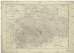
Charte von dem Königreiche Sachsen
1 : 673000 Sasko (Německo) Zuccheri, Edmund von im Verlage des Kunst und Industrie Comptoirs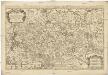
Le cercle de la Haute Saxe
1 : 593000 Braniborsko (Německo) Sanson, Nicolas Iean Cóvens et Corneille Mortier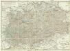
Karte von den Kurfürstlich- und Herzöglich- Saechsischen Laendern
1 : 550000 Sasko (Německo) von den k. k. privileg. Schneider u. Weigelschen Kunst u. Buchhandlung
Das Königreich Sachsen mit den Kurfürstlich- und Herzoglich- Saechsischen Laendern / ... neu entw. von D.F. Sotzmann
1 : 600000 Sotzmann, Daniel Friedrich Nürnberg : Schneider u. Weigelschen Kunst u. Buchhandlung
Sachsen, Anhalt.
1 : 950000 Flemming, Carl
Charte vom Königreich Sachsen
1 : 694000 Sasko (Německo) Güssefeld, Franz L. Christoph Fembo
Die preussische Provinz Sachsen nebst den anhaltischen Ländern
1 : 540000 Sasko (Německo) Gräf, Adolf Biedermann, E. Geographisches Institut

Charte von dem Königreiche Westphalen
1 : 100000 Vestfálsko (Německo) Streit, Friedrich Wilhelm
Charte von dem Königreiche Westphalen
1 : 100000 Vestfálsko (Německo) Streit, Friedrich Wilhelm F. W. Streit
CHARTE von dem KÖNIGREICHE WESTPHALEN
1 : 980000 Vestfálsko (Německo) Streit, Friedrich Wilhelm
Charte von dem Königreiche Westphalen
1 : 100000 Vestfálsko (Německo) Streit, Friedrich Wilhelm F. W. Streit


