Maps of Saxony-Anhalt

Politische Übersicht vom Mittleren Nord-Deutschland
E. von Sydow's Schul-Atlas in sechs und dreissig Karten Sydow, Emil von bei Justus Perthes
Kriegsschauplatz in Sachsen, Westphalen, und Preusen
1 : 1000000 Prusko Tranquillo Mollo
Kriegsschauplatz in Sachsen, Westphalen, und Preusen
1 : 1000000 Prusko Tranquillo Mollo
Allemagne Centrale.
1 : 1370000 Malte-Brun, Conrad, 1775-1826
Theatrum Belli in Saxonia Inferiori praesertim in terris Brunsvicensibus, electoralibus et ducalibus, ubi nempe conspiciuntur Ducatus Luneburgicus, Grubenhagensis, Bremensis, Principatus Verdensis, Calenbergicus, Comitatus Hoya et Diepholt, porro Ducatus Brunsvico-Guelpherbytanus, Princ. Blankenburgensis et Abbatia Walkenried. cum finitimis aliis provincus et regionibus
1 : 720000 [S.l.] : [s.n.]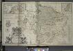
A new & exact map of the electorat of Brunswick-Lunenburg and ye rest of ye Kings Dominions in Germany.
from The world described, or, A new and correct sett of maps : shewing the kingdoms and states in all the known parts of the earth, with the principal cities, and most considerable towns in the world ... / ... by Herman Moll, geographer ...
Sachsen, Anhalt.
1 : 950000 Flemming, Carl
[No. 5. Allemagne, Saxe], uit: [Carte de l'Europe]
1 : 490000 Paris : Piquet
Ducatus Saxoniae Superioris :
1 : 720000 Mollova mapová sbírka Zollmann, Friedrich Homann, Johann Baptista - dědici
Friderico Augusto vere Augusto Polon. Lithuan. Borus. Pomer. Regi, Duci, Principi, Saxon. Utr. Duci S. Imp. Elect. Haec. Imperii Sui Regna D.D.D.
1 : 3100000 Mollova mapová sbírka Schenk, Pieter Schenk, Peter I
Hanc Regni Poloniarvm Magniqve Dvcatvs Lithvaniae Rvssiae, Prvssiae, Mazoviae, Samogitiae, Kioviae, Volhyniae, Podoliae, Podlachiae, Livoniae, Smolensci, Severia e. Czern.
1 : 3000000 Mollova mapová sbírka Homann, Johann Baptist Homann, Johann Baptista - dědici


Die preussische Provinz Sachsen nebst den anhaltischen Ländern
1 : 540000 Sasko (Německo) Gräf, Adolf Biedermann, E. Geographisches Institut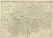
Charte von dem Königreich Sachsen
1 : 690000 Sasko (Německo) Zuccheri, Edmund von Kunst und Industrie Comptoirs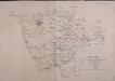
Operations-Karte für die Bewegung der alliirten und der ihr gegenüberstehenden Französischen Armee vom 7ten Februar bis 8ten März.
1 : 600000
Theatrum Belli in SAXONIA INFERIORI
1 : 900000 Braunschweig (Německo : historické území) Homann Heredes
Theatrum belli in Saxonia inferiori
1 : 35000 Braunschweig (Německo : historické území)
Charte von dem Königreiche Sachsen
1 : 673000 Sasko (Německo) Zuccheri, Edmund von im Verlage des Kunst und Industrie Comptoirs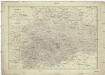
Charte von dem Königreiche Sachsen
1 : 673000 Sasko (Německo) Zuccheri, Edmund von im Verlage des Kunst und Industrie Comptoirs
Braunswyck Et Meydburg cum terris adiacentibus. [Karte], in: Gerardi Mercatoris et I. Hondii Newer Atlas, oder, Grosses Weltbuch, Bd. 1, S. 283.
1 Karte aus Atlas Mercator, Gerhard und Hondius, Jodocus Jansson, Jan
[48][48] Archiepiscopatus Maghdeburgensis, ..., uit: Atlas sive Descriptio terrarum orbis
Annotatie: Gedigitaliseerde versie. Amsterdam. Heiloo : Picturae (vervaardiger), 2015. tiff-bestand. Gedigitaliseerd: 07-01-2015; Origineel: Universiteitsbibliotheek Vrije Universiteit (XL.05127.-) ; Netherlands; Titelpagina ontbreekt Wit, Frederik de Amsterdam : Frederick de Wit
Archiepiscopatus Maghdeburgensis, Et Anhaltinus Ducatus; Cum terris adjacentibus. [Karte], in: Novus Atlas, das ist, Weltbeschreibung, Bd. 1, S. 102.
1 Karte aus Atlas Blaeu, Joan Blaeu, Willem Janszoon
Braunswyck & Meydburg cum ceteris adiacentibus. [Karte], in: Gerardi Mercatoris Atlas, sive, Cosmographicae meditationes de fabrica mundi et fabricati figura, S. 373.
1 Karte aus Atlas Mercator, Gerhard Montanus, Petrus
Archiepiscopatus Maghdeburgensis, Et Anhaltinus Ducatus; Cum terris adiacentibus [Karte], in: Theatrum orbis terrarum, sive, Atlas novus, Bd. 1, S. 188.
1 Karte aus Atlas Blaeu, Joan Blaeu, Willem Janszoon

Archiepiscopatus Maghdeburgensis, Et Anhaltinus Ducatus; Cum terris adiacentibus. [Karte], in: Le théâtre du monde, ou, Nouvel atlas contenant les chartes et descriptions de tous les païs de la terre, Bd. 1, S. 131.
1 Karte aus Atlas Blaeu, Willem Janszoon und Blaeu, Joan Blaeu, Willem Janszoon

Charte von dem Königreiche Westphalen
1 : 100000 Vestfálsko (Německo) Streit, Friedrich Wilhelm
Charte von dem Königreiche Westphalen
1 : 100000 Vestfálsko (Německo) Streit, Friedrich Wilhelm F. W. Streit
CHARTE von dem KÖNIGREICHE WESTPHALEN
1 : 980000 Vestfálsko (Německo) Streit, Friedrich Wilhelm
Charte von dem Königreiche Westphalen
1 : 100000 Vestfálsko (Německo) Streit, Friedrich Wilhelm F. W. Streit


