Maps of Guttenberg

Data for population from census of 1910, Borough of Manhattan
From Manhattan
8B - N.Y. City (Aerial Set).
from Sectional aerial maps of the City of New York / [photographed and assembled under the direction of the chief engineer, July 1st, 1924].
Sheet 13: [Bounded by W. Ninty First Street, (New Reservoir) 5th Avenue, Fifty Ninth Street and 12th Avenue.]
from Plan of New York City, from the Battery to Spuyten Duyvil Creek. Showing every lot and building thereon; old farm lines, strreet numbers at the corners of blocks, railroads, steamboat landings, bulkhead and pier lines, etc. Based on the surveys made by Messrs. Randall & Blackwell, and on the special survey by J. F. Harrison.
5D - N.Y. City (Aerial Set).
from Sectional aerial maps of the City of New York / [photographed and assembled under the direction of the chief engineer, July 1st, 1924].
Central Park
From Manhattan
Manhattan V. 7, Plate No. 55 [Map bounded by Columbus Ave., Cathedral Parkway, Central Park West, W. 108th St.]
From Atlas 121. Vol. 7, pt. 1, 1912.
Central Park
from Manhattan
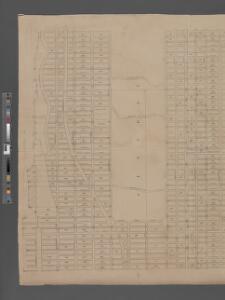
Sheet 14: [Bounded by E. Ninety Second Street, Avenue A, E. Nintieth Street, Avenue B, E. Seventy Second Street, Avenue A, [E. Fifty Ninth Street] and 5th Avenue.]
from Plan of New York City, from the Battery to Spuyten Duyvil Creek. Showing every lot and building thereon; old farm lines, strreet numbers at the corners of blocks, railroads, steamboat landings, bulkhead and pier lines, etc. Based on the surveys made by Messrs. Randall & Blackwell, and on the special survey by J. F. Harrison.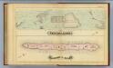
41. Central Park, Blackwells Island.
1 : 6000 G.W. Bromley & Co.; Geo. W. Bromley & E. Robinson
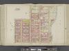
Sheet 11: [Bounded by Fifty Ninth Street, Seventh Avenue, W. Fortieth Street and Thirteenth Avenue.]
from Plan of New York City, from the Battery to Spuyten Duyvil Creek. Showing every lot and building thereon; old farm lines, strreet numbers at the corners of blocks, railroads, steamboat landings, bulkhead and pier lines, etc. Based on the surveys made by Messrs. Randall & Blackwell, and on the special survey by J. F. Harrison.
[Plate 22: Bounded by Sixth Avenue, Central Park South, Fifth Avenue, E. 64th Street, Lexington Avenue, and E. 47th Street.]
from Atlas of the city of New York, borough of Manhattan. From actual surveys and official plans / by George W. and Walter S. Bromley.
Sackersdorff Farm set.
from Maps of farms commonly called the Blue book, 1815 : drawn from the original on file in the street commissioner's office in the City of New York, together with lines of streets and avenues / laid out by John Randel, jr., 1819-20.
Sackersdorff Farm Set.
from Maps of farms commonly called the Blue book, 1815 : drawn from the original on file in the street commissioner's office in the City of New York, together with lines of streets and avenues / laid out by John Randel, jr., 1819-20.
Sackersdorff Farm set.
from Sackersdorf Farm Set.
Sackersdorff Farm Set.
from Maps of farms commonly called the Blue book, 1815 : drawn from the original on file in the street commissioner's office in the City of New York, together with lines of streets and avenues / laid out by John Randel, jr., 1819-20.
Sackersdorff Farm Set.
from Maps of farms commonly called the Blue book, 1815 : drawn from the original on file in the street commissioner's office in the City of New York, together with lines of streets and avenues / laid out by John Randel, jr., 1819-20.
Page 8: [Bounded by W. 57th Street, Eighth Avenue (Fashion Center), W. 37th Street and Hudson River.]
from Sackersdorf Farm Set.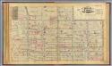
16. Ward 22.
1 : 2400 G.W. Bromley & Co.; Geo. W. Bromley & E. Robinson
25. Wards 12, 22.
1 : 2400 G.W. Bromley & Co.; Geo. W. Bromley & E. Robinson
Part of Wards 12 & 22, New York City.
from Atlas of the city of New York : embracing all territory within its corporate limits from official records, private plans & actual surveys / by and under the supervision of E. Robinson & R.H. Pidgeon, civil engineers.
Plate 19: Bounded by E. 76th Street, East River (Avenue A), E. 64th Street, and Fifth Avenue.
from Atlas of the city of New York : embracing all territory within its corporate limits from official records, private plans & actual surveys / by and under the supervision of E. Robinson & R.H. Pidgeon, civil engineers.
Pl. 23: ward 22.
1 : 1800 Bromley, George Washington; Bromley, Walter Scott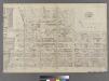
Part of Ward 22, New York City.
from Atlas of the city of New York : embracing all territory within its corporate limits from official records, private plans & actual surveys / by and under the supervision of E. Robinson & R.H. Pidgeon, civil engineers.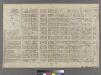
[Plate 18: Bounded by E. 64th Street, Avenue A, E. 52nd Street, W. 52nd Street, Sixth Avenue, W. 59th Street and Fifth Avenue.]
from Atlas of the city of New York : embracing all territory within its corporate limits from official records, private plans & actual surveys / by and under the supervision of E. Robinson & R.H. Pidgeon, civil engineers.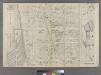
Part of Ward 22, New York City.
from Atlas of the city of New York : embracing all territory within its corporate limits from official records, private plans & actual surveys / by and under the supervision of E. Robinson & R.H. Pidgeon, civil engineers.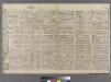
Plate 15: Bounded by W. 52nd Street, Sixth Avenue, W. 40th Street, and (Hudson River) Twelfth Avenue.
from Atlas of the city of New York : embracing all territory within its corporate limits from official records, private plans & actual surveys / by and under the supervision of E. Robinson & R.H. Pidgeon, civil engineers.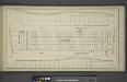
[Block No. 579 Map bounded by 95th Street, 5th Avenue, 94th Street, 6th Avenue]
from Maps & profiles of ground for new reservoir situated between 86th and 96th streets and between 5th and 7th avenues.
[Plate 29: Bounded by Second Avenue, e. 84th Street, Avenue B, E. 79th Street, Avenue A (East River), and E. 68th Street.]
from Atlas of the city of New York, Manhattan Island. From actual surveys and official plans / by George W. and Walter S. Bromley.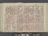
Manhattan, Double Page Plate No. 28 [Map bounded by 5th Ave., E. 80th St., 2nd Ave., E. 64th St.]
From Atlas of the city of New York, Manhattan Island. From actual surveys and official plans