Maps of Kings County

Queens V. 8, Plate No. 103 [Map bounded by Rockaway Point, Breezy Point]
From Atlas 145a. Vol. 8, 1912.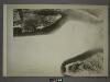
29C - N.Y. City (Aerial Set).
from Sectional aerial maps of the City of New York / [photographed and assembled under the direction of the chief engineer, July 1st, 1924].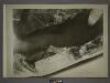
29D - N.Y. City (Aerial Set).
from Sectional aerial maps of the City of New York / [photographed and assembled under the direction of the chief engineer, July 1st, 1924].
Height District Map Section No. 29
from Height district map / City of New York, Board of Estimate and Apportionment.
Coney Island
1 : 24000
Coney Island
1 : 24000
Coney Island
1 : 24000
Coney Island
1 : 24000
Coney Island
1 : 24000
Coney Island
1 : 24000
Coney Island
1 : 24000
Flatlands. Kings Co. L.I.
from Atlas of Long Island, New York. From recent and actual surveys and records.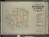
Index to Volume Six. Atlas of the Borough of Brooklyn. Sections 17, 18 & 19. Ward 30. City of New York. E. Belcher Hyde, 97 Liberty St., Brooklyn Borough. 1905.
from Ward 30.
Map of Staten Island, Richmond County, New York City, from surveys under the direction of H. F. Walling.
From Staten Island
Index Map to Volume Two. Atlas of the Brooklyn Borough of the City of New York.
from Atlas of the Brooklyn borough of the City of New York : originally Kings Co.; complete in three volumes ... based upon official maps and plans ... / by and under the supervision of Hugo Ullitz, C.E.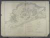
Jamaica Bay and Rockaway Inlet, Long Island, New York.
from U.S. Coast and Geodetic Survey. Nautical chart ; no. 542.
Map of Kings County including the city of Brooklyn.
From Brooklyn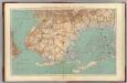
Narrows-Jamaica Bay, Brooklyn.
1 : 31680 Vermeule, C. C. (Cornelius Clarkson), 1858-1950
Guide map of Brooklyn, Kings County, N.Y. ....for Brooklyn daily eagle almanac.
From Brooklyn
Map of the borough of Brooklyn, City of New York.
From Brooklyn
Guide map of the borough of Brooklyn, Kings County, New York.
From Brooklyn
City of New York, Borough of Brooklyn ; map showing section stations, stables, and dumps.
From Brooklyn
Map of Brooklyn.
From Brooklyn
Map of New-York Bay and Harbor and the environs / founded upon a trigonometrical survey under the direction of F.R. Hassler, superintendent of the Survey of the Coast of the United States ; triangulation by James Ferguson and Edmund Blunt assistants ; th
from New York harbor
A chart of the bar of Sandy Hook : the entrance of Hudsons River in the province of New Jersey / survey'd in 1782, by Lieutt. Hills, of the 23d. Regt. and private draftsman to His Excellency the Commander in Chief.
from New York harbor
Brooklyn
1 : 62500
Brooklyn
1 : 62500
Brooklyn
1 : 62500
Brooklyn
1 : 62500
Brooklyn
1 : 62500
Brooklyn
1 : 62500
Brooklyn
1 : 62500
Brooklyn
1 : 62500
Brooklyn
1 : 62500
Brooklyn
1 : 62500
Brooklyn
1 : 62500
Brooklyn
1 : 62500
Brooklyn
1 : 62500
![Queens V. 8, Plate No. 103 [Map bounded by Rockaway Point, Breezy Point]](https://images-1.georeferencer.com/images/iiif/373847069312/full/,300/0/native.jpg)

