Maps of Netherlands

Holland and the other provinces of the United Netherlands.
from New & accurate description of the earth in all its empires, kingdoms and states
Pas-caert van Texel tot aen de Hoofden
1 Karte : Kupferdruck ; 43 x 53 cm Doncker bÿ Hendrick Doncker boekverkoper en graadbooghmaker in de Nieubrugsteegh in 't Stuurmans gereetschap

Niederlande und Belgien
Plastischer Schul-Atlas über alle Theile der Erde : in 24 Karten Woldermann, G Verlag von P. Eckerlein
Neue und richtige Landtafel der XVII Niderländische Provincien : abbildende alle befestigte, bemauerte, offene Stedte und Schantzen, etc.
1 : 1260000 Annotatie geografische gegevens: Noordwest boven Nürnberg : Jacob Sandrart
69. North France, South West Belgium, Netherlands. The World Atlas.
1 : 500000 USSR (Union of Soviet Socialist Republics).
L'Empire, d'Allemagne
1 : 1200000 Mollova mapová sbírka Sanson, Nicolas Quasy, Robert
Postarum seu Veredariorum Stationes Per Germaniam et Provincias Adiacentes.
1 : 400000 Mollova mapová sbírka Danckerts, Justus Danckerts, Cornelis
Rheinprovinz, Westphalen, Holland und Belgien
Schul-Atlas in 36 Karten Völter, Daniel Verlag der J.M. Dannheimer'schen Buchhandlung
Holland and Belgium.
1 : 2060000 Mitchell, Samuel Augustus
Holland and Belgium.
1 : 2060000 Mitchell, Samuel Augustus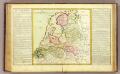
La Hollande.
1 : 1100000 Clouet, J. B. L. (Jean-Baptiste Louis), b. 1730
(Provinces-Unies)
1 : 2900000 Bruyset, Jean-Marie; Schneider, J. H.
Holland or the United Provinces.
from A new systeme of the mathematicks: containing I. Arithmetick, as well natural and decimal, as in species, or the principles of algebra. II. Practical geometry, together with the first six books of Euclid's Elements, as also the eleventh and twelfth, symbo
Belgii Veteris Typus
1 : 1400000 Mollova mapová sbírka Ortelius, Abraham Visscher, Claes Jansz.
Belgii Veteris Typus
1 : 1400000 Mollova mapová sbírka Ortelius, Abraham Visscher, Claes Jansz.
Charte über die saemtlichen zum Westphaelischen Kreis gehörige Laender
1 : 840000 Evropa severozápadní Güssefeld, Franz L. bey den Homaennischen Erben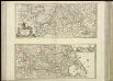
[37][37] Totius fluminis Rheni novissima descriptio, uit: Atlas sive Descriptio terrarum orbis
Annotatie: Gedigitaliseerde versie. Amsterdam. Heiloo : Picturae (vervaardiger), 2015. tiff-bestand. Gedigitaliseerd: 07-01-2015; Origineel: Universiteitsbibliotheek Vrije Universiteit (XL.05127.-) ; Netherlands; Titelpagina ontbreekt Wit, Frederik de Amsterdam : Frederick de Wit
Artificiosa et geographica tabula sub leonis figura XVII. inferiori Germaniae provincias representans, cui addita sunt singularum insignia, una cum ordinaria praefecturarum distinctione, longe elimatius quam hactenus unquam expressa
1 : 1480000 Belgie Visscher, Claes Jansz. C.I. Visscher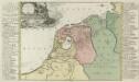
Summaria Descriptio Fresiae Vniversae; cum latissimè patuit nomen Post emigrationem Francorvm; Saxonvmq; accessionem
1 : 1400000 Mollova mapová sbírka Alting, Menso Broen, Gerrit de
Holland And Belgium.
1 : 2100000 Tanner, Henry S.
Holland And Belgium.
1 : 2050000 Tanner, Henry S.
Postkarte von dem Westphaelischen und Burgundischen Kreise
Burgundsko (Francie) Kühn, Ignaz im von Reilly'schen Landkarten und Kunstwerke Verschleiss Komptoir
Holand and Belgium.
1 : 1290000 Colton, G.W.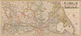
Totius Fluminis Rheni Novissima Descriptio [Karte, Teil 2], in: Novus atlas absolutissimus, Bd. 2, S. 150.
1 Karte aus Atlas Janssonius Offizin
Kaart behoorende bij de statistiek der scheepvaartbeweging in Nederland in 1916
1 : 600000 Annotatie: Op- en afvoer tezamen in 1000-tallen van M3 [S.l. : Topographische Inrichting]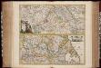
Totius fluminis Rheni : novissima descriptio / ex. officina N. Visscher
1 : 950000 Annotatie: Origineel is Blad 116 in atlas factice; Annotatie geografische gegevens: 2 schaalstokken op kaart met de schaalaanduidingen: Milliaria Germanica com:, Gemeene Duytsche Mylen, en: Milliaria Gallica communia, en: Uren gaans; Zuidwest boven Nicolaes Jansz. Visscher jr. 1649-1702 [Amsterdam : Nicolaes Visscher]
Summaria descriptio Fresiae Universae, cum latissime patuit nomen post emigrationem Francorum, Saxonumq. accessionem
auctore Mensone Alting Gerard de Broen fecit Amstelodami. [Amstelaedami] : [apud Henricum Wetstenium]
Niederlande, Luxemburg.
1 : 1900000 Reichard, C. G.


