Maps of Southeast

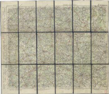
G. Freytag – Autostrassenkarten: 20. Brünn

Geologische Karte der Markgrafschaft Mähren und des Herzogthumes Schlesien
Foetterle, Franz
Královehradecká dieceze
1 : 250000
Moravia

Operations-Karte des nördlichen-Kriegsschauplatern Mähren
Moravia
1 : 931000 Morava (Česko) Keere, Pieter van den
Tabula almae diocesis amplissimi episcopatvs Olomucensis in 32 decanatus divisae complectens omnes ejusden parochias et capellanatus locales una cum locis singulis cuilibet parocho quoad curam animarum subjectis
1 : 180000 Morava (Česko) Freyenfels, Johann Wenzl Xaver Frey von Hamilton, Maximilian von Homannianos Heredes
Die Markgrafschaft Mähren nebst dem Herzogthum Schlesien
1 : 750000 Lázně Jeseník (Česko) Berghaus, Heinrich Karl Wilhelm Berghaus, Hermann Justus Perthes
Das Markgraftum Maehren mit der Aelteren und im Jahr 1783 abgeaenderten Eintheilung der Kreisen, auch Bezeichnung der Granze der Olmütz Dioeces in Schlesien
1 : 322000 Morava (Česko) Venuto, Jan Antonín Engelmann, J. W.
Das Markgraftum Maehren mit der Aelteren und im Jahr 1783 abgeaenderten Eintheilung der Kreisen, auch Bezeichnung der Granze der Olmütz Dioeces in Schlesien
1 : 322000 Morava (Česko) Venuto, Jan Antonín
Mapa Moravy
1 : 400000
Jihovýchodní [Čechy a západní Morava]
1 : 300000 Morava západní (Česko) Edv. Fastr
Theile des Königreichs Böhmen u. der Markgrafs. Maehren
Česko Schorrer, Josef, von Liechtenstern, Joseph Marx von Jos. List
Carte Particuliere de la Moravie divisée en six cercles
1 : 650000 Mollova mapová sbírka Le Rouge, Georges-Louis Le Rouge, Georges-Louis
Přehledná hydrografická mapa povodí Moravy ; Přehledná hydrografická mapa povodí Odry na Moravě a ve Slezsku
1 : 750000 Morava (Česko) Čs. státní ústav hydrologický
Přehledná hydrografická mapa povodí Moravy
1 : 750000 Morava, řeka-povodí Čs. státní ústav hydrologický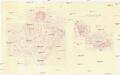
Přehledná hydrografická mapa povodí Moravy ; Přehledná hydrografická mapa povodí Odry na Moravě a ve Slezsku
1 : 750000 Morava (Česko) Čs. státní ústav hydrologický
Moraviae nova et post omnes priores accuratissima delineatio
1 : 650000 Kraj Vysočina (Česko : 2000-) Komenský, Jan Amos Nicolaus Visscher
Moraviae nova et post omnes priores accuratissima delineatio
1 : 650000 Brno (Česko) Komenský, Jan Amos Visscher, Nicolaus Nicolao Iohannide Piscatore
Moraviae nova et post omnes priores accuratissima delineatio
1 : 650000 Brno (Česko) Komenský, Jan Amos Visscher, Nicolaus Nicolao Iohannide Piscatore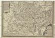
Moraviae nova et post omnes priores accuratissima delineatio
1 : 650000 Morava (Česko) Komenský, Jan Amos Visscher, Nicolaus Nicolao Iohannide Piscatore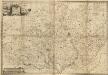
Das Markgraftum Maehren mit der Aelteren und im Jahr 1783 abgeaenderten Eintheilung der Kreisen
1 : 390000 Mollova mapová sbírka Venuto, Jan Antonín Engelmann, Johann Wenzel
Carte générale du marquisat de Moravie divisée en six cercles drefsée sur les Memoires les plus nouveaux :
1 : 510000 Mollova mapová sbírka Homann, Johann Baptist Condet, Johannes Covens, Johannes I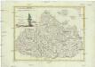
La Moravia divisa ne suoi circoli di nuova projezione
1 : 550000 Morava (Česko) Pitteri, Marco Alvise Antonio Zatta
Darstellung des Standes der öffentl. Volksschulen in Mähren im Jahre 1848= Zobrazení stavu veřej. škol obecných na Moravě v roce 1848

Moraviae olim regnum nunc Marchionatus
1 : 475000 Mollova mapová sbírka Komenský, Jan Amos Dvořák, Samuel
Das Markgraftum Maehren mit der Aelteren und im Jahr 1783 abgeaenderten Eintheilung der Kreisen
1 : 390000 Mollova mapová sbírka Venuto, Jan Antonín Engelmann, Johann Wenzel
Partie de la Boheme du nord est
Chrudim-oblast (Česko) Kindermann, Joseph Karl Benedict, Ant. im Verlage des Kunst- und Industrie Comptoirs