Maps of Petrovice

Výškopisný plán hlavního města Prahy s okolím

Jižní Město. - Háje Orientační plán 1. souboru
1 : 3500
Augezd - c8237-1-002 - Kaiserpflichtexemplar der Landkarten des stabilen Katasters
1 : 2880
Augezd - c8237-1-003 - Kaiserpflichtexemplar der Landkarten des stabilen Katasters
1 : 2880
Augezd - c8237-1-001 - Kaiserpflichtexemplar der Landkarten des stabilen Katasters
1 : 2880
Mapa půd státních pokusných objektů zemědělských Průhonice. Severní část území
Najmr, Stanislav
Mapa půd státních pokusných objektů zemědělských Průhonice
1 : 6000 Průhonice (Česko) Najmr, Stanislav Státní výzkumný ústav pro půdoznalství
Křeslitz - c3632-1-001 - Kaiserpflichtexemplar der Landkarten des stabilen Katasters
1 : 2880
Křeslitz - c3632-1-002 - Kaiserpflichtexemplar der Landkarten des stabilen Katasters
1 : 2880
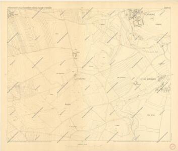
Petrowitz (Petrowice) - c5734-1-001 - Kaiserpflichtexemplar der Landkarten des stabilen Katasters
1 : 2880
Petrowitz (Petrowice) - c5734-1-002 - Kaiserpflichtexemplar der Landkarten des stabilen Katasters
1 : 2880
Jižní Město. - Opatov Orientační plán 2. souboru
1 : 2500
Orientierungsplan der Hauptstadt Prag
Jiřík, Rudolf
Hostiwarz (Hostiwarze) - c2250-1-004 - Kaiserpflichtexemplar der Landkarten des stabilen Katasters
1 : 2880
Hostiwarz (Hostiwarze) - c2250-1-005 - Kaiserpflichtexemplar der Landkarten des stabilen Katasters
1 : 2880
Hostiwarz (Hostiwarze) - c2250-1-003 - Kaiserpflichtexemplar der Landkarten des stabilen Katasters
1 : 2880
Hostiwarz (Hostiwarze) - c2250-1-006 - Kaiserpflichtexemplar der Landkarten des stabilen Katasters
1 : 2880
Hostiwarz (Hostiwarze) - c2250-1-001 - Kaiserpflichtexemplar der Landkarten des stabilen Katasters
1 : 2880
Hostiwarz (Hostiwarze) - c2250-1-002 - Kaiserpflichtexemplar der Landkarten des stabilen Katasters
1 : 2880
Jižní Město. - Litochleby Orientační plán 3. souboru
1 : 2500
Orientační plán Hlavního města Prahy

Umgebung von Prag

Umgebung von Prag IV.

Výškopisný plán hlavního města Prahy s okolím

III. vojenské mapování 3953/3
1 : 25000
Bez titulu: Jihovýchodní okolí Prahy

[Praha - projekt podzemní a nadzemní dráhy].
Praha (Česko) Poláček, K. Wallenfels, F.
[Praha - projekt podzemní dráhy]
Praha (Česko)