Maps of Metropolitan France

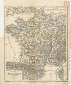
Kaiserthum Frankreich

Tableau de la France
1 Karte : Kupferdruck ; 48 x 50 cm Dupain-Triel; Cassini de Thury chez l'auteur rue des Noyers St. Jacques près St. Yves
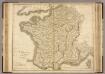
France.
1 : 3065000 Colton, G. Woolworth
Carte des postes de France
1 Karte : Kupferdruck ; 64 x 54 cm Jean; Mondhare chez Mondhare et Jean rue St. Jean de Beauvais n.o 4
France.
1 : 1950000 Arrowsmith, John
Karte von Frankreich
1 : 2500000 Francie Fried, Franz Artaria & Comp.
France.
1 : 3200000 Tanner, Henry S.
Frankreich.
1 : 4700000 Reichard, C. G.
Carte particuliere des postes de France
1 Karte auf 2 Blättern : Kupferdruck ; 65 x 59 cm Jaillot; Sanson chez H. Iaillot
France.
1 : 1964160 Arrowsmith, John
Charte von Frankreich
1 : 2090000 Francie Weiland, Karl Ferdinand Beyer, Leonh. im Verlage des Geogr. Instituts
Frankreich.
1 : 3500000 Radefeld, Carl Christian Franz, 1788-1874
Frankreich
Plastischer Schul-Atlas über alle Theile der Erde : in 24 Karten Woldermann, G Verlag von P. Eckerlein
France.
1 : 3200000 Mitchell, Samuel Augustus
France.
1 : 3200000 Mitchell, Samuel Augustus
Carte Particuliere Des Postes De France [Karte], in: Atlas nouveau, contenant toutes les parties du monde [...], Bd. 1, S. 147.
1 Karte aus Atlas Sanson, Nicolas Jaillot, Alexis Hubert und Mortier, Pieter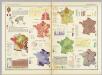
France (Republique Francaise). Pergamon World Atlas.
Polish Army Topography Service
France.
1 : 2476000 Hammond, C.S.
France.
1 : 3000000 Colton, G.W.
France.
1 : 3000000 Colton, G.W.
France Politique.
1 : 2500000 Vivien St Martin, L.
Carte generale des postes de France 1728
1 Karte : Kupferdruck ; 42 x 39 cm Fer; Danet chez Danet gendre de l'auteur sur le pont de Nôtre Dame â la sphere royale
Les routes des postes du royaume de France
1 Karte : Kupferdruck ; 42 x 39 cm Fer; Inselin chez l'auteur dans l'isle du Palais sur le quay de l'orloge à la sphere royale
France.
1 : 3000000 Colton, G.W.
Carte des routes de postes de l'Empire Français
1 : 2200000 Francie Pachoux, J. J. Tardieu, Pierre François
Frankreich

Frankreich mit besonderer Rücksicht auf die Unebenheiten
1 : 20000000 Francie Berghaus, Heinrich Karl Wilhelm Brose, Heinr. im Magazin für Kunst, Geographie und Musik
Carte Physique de la Region Francaise.
1 : 2550000 Jouvet et Cie.
France.
1 : 3000000 Colton, G.W.