Maps of Austria
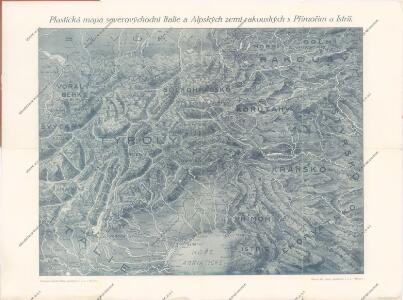
Plastická mapa severovýchodní Italie a Alpských zemí rakouských s Přímořím a Istrií
Korutany, Krajina, Salcbursko, Štýrsko, Tyrolsko a Vorarlbersko
Korutansko (Rakousko) Köb, Kajetano Luther, Th. nákladem J. Otty
Kärnten, Krain, Steiermark, Tirol und Vorarberg
1 : 1750000 Korutansko (Rakousko) F.A. Brockhaus' geogr.-artist. Anstalt
Ost-Alpenländer
Neuer Handatlas über alle Theile der Erde Kiepert, Heinrich Verlag von Dietrich Reimer
Hütten-Karte
1 : 800000 Alpy (pohoří : oblast) Edler von Prybila, Carl Kartogr. Institut v. H. Petters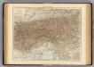
Austrian Alps.
1 : 1125000 Andree, Richard; Times (London, England)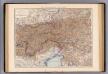
Oesterreich. Alpenlander.
1 : 1125000 Andree, Richard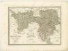
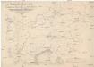
Bez titulu: Slepá hydrografická mapa jihovýchodní Evropy

Der südwesten der Österreichis - ungarischen Monarchie mit den angrenzenden Gebieten
Übersichtskarte der evangelischen Kirche Augsb. und Helv. Confession
1 : 864000 Chorvatsko Strehl, Anton k. k. evangel. Oberkirchenrathe
Leopoldi Magni Filio Iosepho I. Avgvsto Romanorvm et Hvng: Regi Ad capeßendum Rhenanae Militia Imperium in Castra proficiscenti Hanc Germaniae Avstriacae Generalem Tabvlam
1 : 1430000 Mollova mapová sbírka Homann, Johann Baptist Homann, Johann Baptista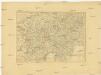
Charte von Oestreich Steyermark, Illyrien und Tyrol
1 : 1600000 Ilýrie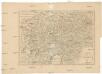
Charte von Oestreich Steyermark Illyrien und Tyrol
1 : 1550000 Ilýrie
Generalcharte von Oesterreich, Tyrol, Steyermark und Illyrien
1 : 1600000 Horní Rakousko (Rakousko) Schönberg, Johann bey Johann Schönberg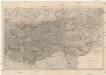
Karte der Alpen
1 : 850000 Alpy (pohoří) Petters, Hugo Lampart's Alpiner Verlag
Die Ostalpenländer
1 : 2750000 Alpenländer Skizzenbuch
Géographie. croquis n4, Entre Pô et Danube
1 : 1000000 Molard, Jules, Commandant [Paris] : Service Géographique de l'Armée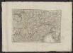
Théatre de la guerre actuelle, en Allemagne, en Pologne et en Turquie. n17, Lac de Constance et Venise
1 : 900000 Chanlaire, Pierre Grégoire 1758-1817 Paris : chez l'auteur P. G. Chanlaire
[Oesterreich]
Neuester Schul-Atlas Walch, Johann im Verlag bei Joh. Walch
Oestereichischer Kreis
Allgemeiner Atlas [Walch, Johannes] im Verlag bei Johannes Walch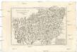
Cercle d'Autriche
1 : 1740000 Rakousko Bonne, Rigobert André
Karte der Republik Österreich
1 : 1500000 Rakousko Rothaug, Johann Georg Kartogr. Anstalt G. Freytag & Berndt
Der oesterreichische Kreis ohne die Vorlande
1 Karte : Kupferdruck ; 50 x 63 cm Mannert in der kais. priv. Kunsthandlung Adam Gottl: Schneider u: Weigel
Süd-Östliches Deutschland
Stieler's Hand-Atlas Stieler, Adolf bei Justus Perthes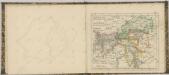

[Oesterreich, Tyrol mit Vorarlberg. Steyrmark und Illyrien]
Schul-Atlas in 36 Karten Völter, Daniel Verlag der J.M. Dannheimer'schen Buchhandlung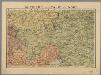
Autriche, Italie du Nord / P. Bineteau del.
1 : 900000 Bineteau, P. Paris : Taride
Circuli Austriaci
1 : 910000 1 Karte : Kupferdruck ; 48 x 57 cm Danckerts, Justus [Danckerts]