Cataloged map
[Oesterreich]
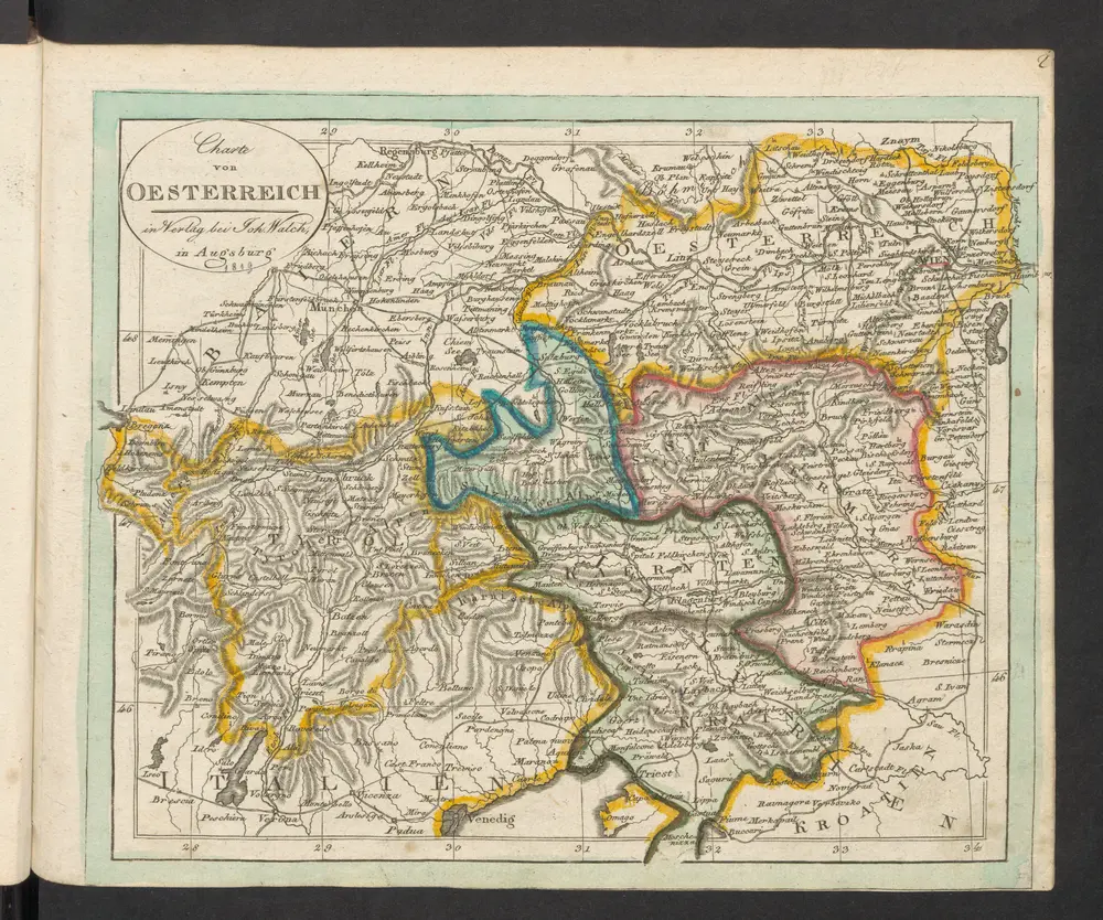

Full title:[Oesterreich]
Depicted:1819
Pubdate:1819
Publisher:im Verlag bei Joh. Walch
Physical Size:20 x 30 cm
Strassen und Gebirgs-Karte zur Reise von Wien durch Österreich, Salzburg, Kärnthen, Steyermark und Tyrol bis München : mit Berücksichtigung der oesterreichischen Alpen und des Bayerischen Hochgebirgs
1850
Artaria Co.
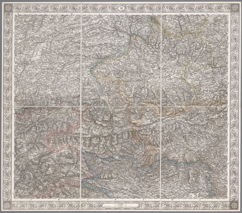
VII, uit: General-Karte des oesterreichischen Kaiserstaates mit einem grossen Theile der angrenzenden Länder / durch Josef Scheda ... bearb. und hrsg
1856
[Wien : K.K. Militärisch-Geografisches Institut]
1:576k
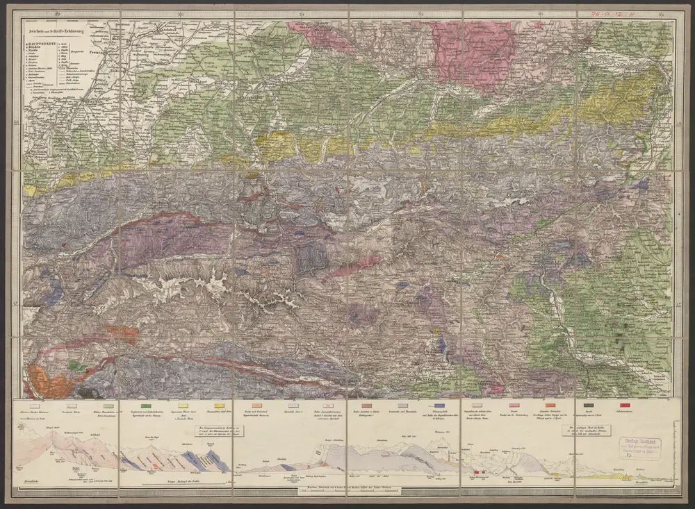
Geologische Uibersichts-Karte zur Reise von Wien durch Oesterreich, Salzburg, Kärnthen, Steyermark und Tyrol bis München, mit Berücksichtigung der österreichischen Alpen und des Bayer. Hochgebirgs
1847
Morlot, Adolph von
1:576k
Gewässer und Brücken
1810
Ronz, Joseph
Charte von Salzburg, Passau, Aichstædt und Berchtesgaden
1803
Kipferling
Der oesterreichische Kreis ohne die Vorlande
1804
Mannert
Avstriae dvcatvs chorographia
1579
Lazius; Ortelius
Avstriae dvcatvs chorographia
1573
Lazius; Ortelius
Circuli Austriaci
1698
Danckerts, Justus
1:910k
[München-Linz-Bruck].
1840
Blumtritt, H.
1:576k