Maps of Austria
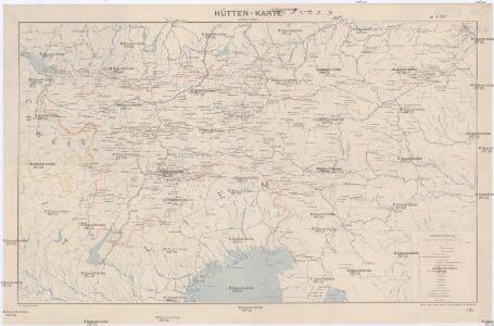
Hütten-Karte
1 : 800000 Alpy (pohoří : oblast) Edler von Prybila, Carl Kartogr. Institut v. H. Petters
Karte der Alpen
1 : 850000 Alpy (pohoří) Petters, Hugo Lampart's Alpiner Verlag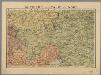
Autriche, Italie du Nord / P. Bineteau del.
1 : 900000 Bineteau, P. Paris : Taride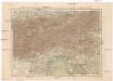
Korutany, Krajina, Salcbursko, Štýrsko, Tyrolsko a Vorarlbersko
Korutansko (Rakousko) Köb, Kajetano Luther, Th. nákladem J. Otty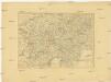
Charte von Oestreich Steyermark, Illyrien und Tyrol
1 : 1600000 Ilýrie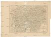
Charte von Oestreich Steyermark Illyrien und Tyrol
1 : 1550000 Ilýrie
Kärnten, Krain, Steiermark, Tirol und Vorarberg
1 : 1750000 Korutansko (Rakousko) F.A. Brockhaus' geogr.-artist. Anstalt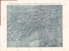
Plastická mapa severovýchodní Italie a Alpských zemí rakouských s Přímořím a Istrií

Generalcharte von Oesterreich, Tyrol, Steyermark und Illyrien
1 : 1600000 Horní Rakousko (Rakousko) Schönberg, Johann bey Johann Schönberg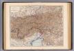
Oesterreich. Alpenlander.
1 : 1125000 Andree, Richard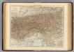
Austrian Alps.
1 : 1125000 Andree, Richard; Times (London, England)
Circuli Austriaci
1 : 910000 1 Karte : Kupferdruck ; 48 x 57 cm Danckerts, Justus [Danckerts]
Géographie. croquis n4, Entre Pô et Danube
1 : 1000000 Molard, Jules, Commandant [Paris] : Service Géographique de l'Armée
Bez titulu: Slepá hydrografická mapa jihovýchodní Evropy

Karte der Republik Österreich
1 : 1500000 Rakousko Rothaug, Johann Georg Kartogr. Anstalt G. Freytag & Berndt
Übersichtskarte der evangelischen Kirche Augsb. und Helv. Confession
1 : 864000 Chorvatsko Strehl, Anton k. k. evangel. Oberkirchenrathe
Leopoldi Magni Filio Iosepho I. Avgvsto Romanorvm et Hvng: Regi Ad capeßendum Rhenanae Militia Imperium in Castra proficiscenti Hanc Germaniae Avstriacae Generalem Tabvlam
1 : 1430000 Mollova mapová sbírka Homann, Johann Baptist Homann, Johann Baptista
Die Ostalpenländer
1 : 2750000 Alpenländer Skizzenbuch
Ost-Alpenländer
Neuer Handatlas über alle Theile der Erde Kiepert, Heinrich Verlag von Dietrich Reimer
Der südwesten der Österreichis - ungarischen Monarchie mit den angrenzenden Gebieten

[Süd-Östliches Deutschland]
Hand-Atlas über alle Theile der Erde nach dem neuesten Zustande und über das Weltgebäude Stieler, Adolf bei Justus Perthes
Oesterreich, Süd Westlicher Theil
Handatlas über alle Theile der Erde und über das Weltgebäude Stieler, Adolf Justus Perthes
Der oesterreichische Kreis ohne die Vorlande
1 Karte : Kupferdruck ; 50 x 63 cm Mannert in der kais. priv. Kunsthandlung Adam Gottl: Schneider u: Weigel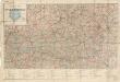
Automobil-Karte der Republik Österreich: Österreichischen Touring-Buch

[Oesterreich]
Neuester Schul-Atlas Walch, Johann im Verlag bei Joh. Walch
Cercle d'Autriche
1 : 1740000 Rakousko Bonne, Rigobert André
[Süd-Östliches Deutschland, Erzherzogth. Oesterreich, Tirol, Illyrien, Steyermark]
Hand-Atlas über alle Theile der Erde nach dem neuesten Zustande und über das Weltgebäude Stieler, Adolf bei Justus Perthes
Oestereichischer Kreis
Allgemeiner Atlas [Walch, Johannes] im Verlag bei Johannes Walch