Maps of Scotland

Argyll and Bute Sheet LXIII & LXIV - OS 6 Inch map
1 : 10560 Topographic maps Ordnance Survey Ordnance Survey
Argyllshire, Sheet LXIII - OS 6 Inch map
1 : 10560 Topographic maps Ordnance Survey Ordnance Survey
Argyll and Bute, Sheet LXIII.12 (Tiree) - OS 25 Inch map
1 : 2500 Topographic maps Ordnance Survey Ordnance Survey
Argyll and Bute, Sheet LXIII.16 (Tiree) - OS 25 Inch map
1 : 2500 Topographic maps Ordnance Survey Ordnance Survey
Argyll, Sheet 063.12 & 16 - 25 Inch Map
1 : 2500 Topographic maps Ordnance Survey Ordnance Survey
The west side of the island Mull with the islands Tiri and Coll.
Mackenzie, Murdoch (Senior), 1712-1797
The west coast of Scotland from Ila to Mull.
Mackenzie, Murdoch (Senior), 1712-1797
Scotland / J. Ainslie, 4
1 Blatt : 67 x 58 cm Ainslie, Faden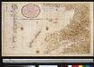
Nieuwe afteekening van de West kust van SchotLandt als mede een gedeelte van de Lewijs Eijlanden en Skie, Mulla, Tijrrif, Col int groot
Scotland Gerard van Keulen
Lochabria, omnesq[ue] insulæ versus occidentem sitæ, ut Visto, Mulla, aliæque
1 Karte : Kupferdruck ; 42 x 51 cm Valck; Schenk sumptibus Gerardi Valk et Petri Schenk
A Map of the North West part of the Western Islands / by H. Moll.
Moll, Herman, d. 1732
Lochabria, omnesque Insulae versus Occidentem sitae, ut Uisto, Mulla, aliaeque. [Karte], in: Novus atlas absolutissimus, Bd. 8, S. 172.
1 Karte aus Atlas Janssonius Offizin
Carte particuliere de la cote occidentale d'Escosse, depuis la Pointe d'Ardnamurchan jusqu'au Mull de Galloway.
Depot Generale de la Marine, Paris
Lorna, Knapdalia, Cantire, Iura, Ila, Glota, et Buthe Insulae. [Karte], in: Novus atlas absolutissimus, Bd. 8, S. 175.
1 Karte aus Atlas Janssonius Offizin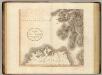
Scotland SW.
1 : 500000 Cary, John, ca. 1754-1835
Scotland SW.
1 : 486830 Stanford, Edward
Aebudae Insulae sive Hebrides ; quae Scotiae ad occasum praetenduntur / lustratae et descriptae a Timotheo Pont. Western Isles of Scotland.
Pont, Timothy, 1560?-1614? Blaeu, Joan, 1596-1673
A general map of Scotland and islands thereto belonging, 3
2 Blätter : 91 x 76 cm s.n.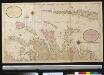
Nieuwe afteekening van de West kust van Schotlant en de Lewijs Eijlanden met alle de tussen leggende eijlanden
Scotland Gerard van Keulen
To the Honorable Sr. Charles Wager, this Draught of Part of the Highlands of Scotland / is humblely Presented by... Mark Tiddeman.
Tiddeman, Mark, fl. ca. 1730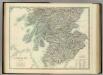
Scotland (southern sheet).
1 : 633600 Johnston, Alexander Keith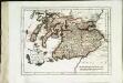
Des Königreichs Scotland südlicher Theil
1 Karte : Kupferdruck ; 19 x 25 cm Reilly F. J. J. von Reilly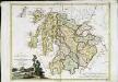
La Scozia meridionale
1 Karte : Kupferdruck ; 30 x 39 cm Zatta; Zuliani; Pitteri presso Antonio Zatta
Pascaart van de noortcust van Yrland als meede de westcust van Schotland / by Johannes van Keulen.
Keulen, Johannes van, 1654-1715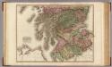
Scotland, southern part.
1 : 518000 Pinkerton, John, 1758-1826
Scotland (southern sheet).
1 : 633600 Johnston, Alexander Keith
Scotland southern.
1 : 700000 Lizars, Daniel
A general chart of the west coast and western islands of Scotland from Cantire to Cape Wrath and Butt of the Lewis.
Mackenzie, Murdoch (Senior), 1712-1797 Terry, G.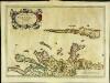
Æbudæ insulæ sive Hebrides
1 Karte : Kupferdruck ; 37 x 52 cm Blaeu; Pont Joan Blaeu


