Maps of Grampian Mountains
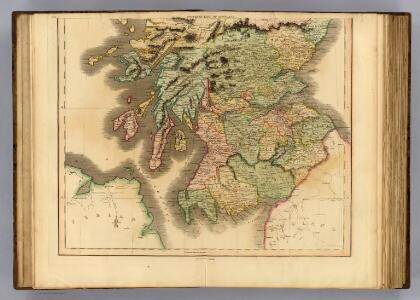
Scotland southern.
1 : 700000 Lizars, Daniel
Scotland (southern sheet).
1 : 633600 Johnston, Alexander Keith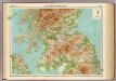
Scotland - southern section.
1 : 633600 John Bartholomew & Co.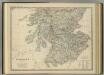
Scotland (southern sheet).
1 : 633600 Johnston, Alexander Keith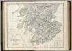
Scotland S.
1 : 633600 Johnston, Alexander Keith, 1804-1871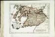
Des Königreichs Scotland südlicher Theil
1 Karte : Kupferdruck ; 19 x 25 cm Reilly F. J. J. von Reilly
La Scozia meridionale
1 Karte : Kupferdruck ; 30 x 39 cm Zatta; Zuliani; Pitteri presso Antonio Zatta
L'Escosse deçà le Tay
1 Karte : Kupferdruck ; 39 x 52 cm Sanson; Fortin; Gordon; Pont chez Fortin ing.r mecanicien du roi p.r les globes rue de la Harpe pres celle du Foin
L'Escosse deçà le Tay
1 Karte : Kupferdruck ; 39 x 53 cm Sanson; Gordon; Pont chez l'autheur
Scotland (south)
1 : 450000 Campbell, Robert, Lieutenant; Kitchin, Thomas; Robert Laurie & James Whittle
[Südschottland]
1 Karte : Kupferdruck ; 17 x 23 cm Mercator Cloppenburgh
[Südschottland]
1 Karte : Kupferdruck ; 33 x 44 cm Mercator; Hondius Henricus Hondius
[Südschottland]
1 Karte : Kupferdruck ; 33 x 44 cm Mercator; Hondius Jodocus Hondius
A new and correct map of Scotland or North Britain (Southern section)
1 : 447000 Campbell, Robert, Lieutenant
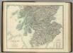
Scotland, southern part.
1 : 518000 Pinkerton, John, 1758-1826
Scotland (southern sheet).
1 : 633600 Johnston, W. & A.K.
[Scotia] [Karte], in: Atlas, sive, Cosmographicae meditationes de fabrica mundi et fabricati figura, S. 89.
1 Karte aus Atlas Mercator, Gerhard
[Scotia] [Karte], in: Gerardi Mercatoris Atlas, sive, Cosmographicae meditationes de fabrica mundi et fabricati figura, S. 103.
1 Karte aus Atlas Mercator, Gerhard Montanus, Petrus

[Scotiae regnum] or Seconde table d'Escosse
1 : 1100000
Map of Scotland with railway routes
1 : 1192000 Skotsko Waterlow & sons
North British railway
Skotsko John Miller
Scotiae Provintiae; Inter Taum Fluvium et Septentrionales oras Angliae. [Karte], in: Novus atlas absolutissimus, Bd. 8, S. 160.
1 Karte aus Atlas Janssonius Offizin
Composite: Lanarkshire.
1 : 82000 Thomson, John
Scotland I.
1 : 765000 Society for the Diffusion of Useful Knowledge (Great Britain)
Scotland 1.
1 : 760320 Letts, Son & Co.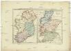
Postkarte von Scotland und Ireland
Irsko, ostrov Stenger, Johann im von Reillyschen Landkarten und Kunstwerke Verschleiss Komptoir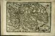
Scotiæ tabula
1 Karte : Kupferdruck ; 18 x 27 cm Quad; Nagel Johannes Bussemacher