Maps of East Dunbartonshire
To the Noblemen and Gentlemen of the County of Stirling...
Grassom, John, fl. 1817-1819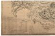
To the Noblemen and Gentlemen of the County of Stirling...
Grassom, John, fl. 1817-1819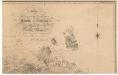
To the Noblemen and Gentlemen of the County of Stirling...
Grassom, John, fl. 1817-1819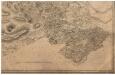
To the Noblemen and Gentlemen of the County of Stirling...
Grassom, John, fl. 1817-1819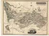
Stirlingshire.
Thomson, John, 1777- ca. 1840 Johnson, William, fl. 1806-1840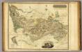
Stirlingshire.
1 : 108000 Thomson, John
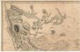
A Mape of the countries about Stirling / authore Jo. Adair.
Adair, John, ca. 1650-1722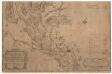
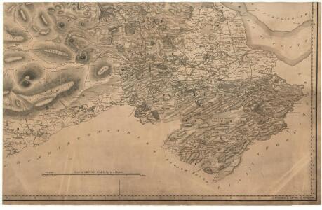
A map of the Shire of Dumbarton.
Ross, Charles, 1722-1806
A map of the Shire of Dumbarton.
Ross, Charles, 1722-1806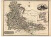
Dumbartonshire.
Thomson, John, 1777- ca. 1840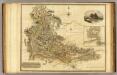
Dumbartonshire.
1 : 130000 Thomson, John
Stirling - OS One-Inch Map
1 : 63360 Topographic maps Ordnance Survey Ordnance Survey
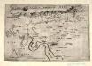
The Shire of Lenox [i.e. Lennox] or Dunbarton / by H. Moll.
Moll, Herman, d. 1732
LEVINIA, | VICE COMITATVS. | The Province of LENNOX, | called the Shyre of Dun-Britton.
Auct: Timoth: Pont. [Amsterdam : Joan Blaeu]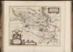
Sterlinensis praefectura, [vulgo], Sterlin-Shyr / Auct. Timoth. Pont.
Pont, Timothy, 1560?-1614? Blaeu, Joan, 1596-1673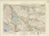
Loch Lomond (66) - OS One-Inch map
1 : 63360 Topographic maps Ordnance Survey Ordnance Survey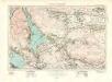
Loch Lomond (66) - OS One-Inch map
1 : 63360 Topographic maps Ordnance Survey Ordnance Survey
Stirling - OS One-Inch map
1 : 63360 Topographic maps Ordnance Survey Ordnance Survey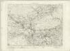
Stirling - OS One-Inch map
1 : 63360 Topographic maps Ordnance Survey Ordnance Survey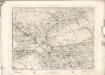
Stirling - OS One-Inch map
1 : 63360 Topographic maps Ordnance Survey Ordnance Survey
Levinia, vice comitatvs
1 Karte : Kupferdruck ; 38 x 52 cm Blaeu; Pont Joan Blaeu
Sterlinensis præfectvra
1 Karte : Kupferdruck ; 40 x 51 cm Blaeu; Pont Joan Blaeu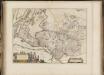
Levinia Vicecomitatus, [or],The Province of Lennox called the Shyre of Dun-Britton / Auct. Timoth. Pont.
Pont, Timothy, 1560?-1614? Blaeu, Joan, 1596-1673
Loch Lomond - OS One-Inch map
1 : 63360 Topographic maps Ordnance Survey Ordnance Survey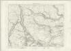
Loch Lomond - OS One-Inch map
1 : 63360 Topographic maps Ordnance Survey Ordnance Survey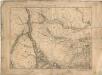
Loch Lomond - OS One-Inch map
1 : 63360 Topographic maps Ordnance Survey Ordnance Survey
Volume 1: Sheet 38 - Loch Lomond
1 : 63360 Farquharson, J.
Stirling & Dunfermline (67) - OS One-Inch map
1 : 63360 Topographic maps Ordnance Survey Ordnance Survey
Stirling & Dunfermline (67) - OS One-Inch map
1 : 63360 Topographic maps Ordnance Survey Ordnance Survey