Maps of Stirling

Loch Lomond - OS One-Inch map
1 : 63360 Topographic maps Ordnance Survey Ordnance Survey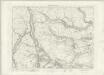
Loch Lomond - OS One-Inch map
1 : 63360 Topographic maps Ordnance Survey Ordnance Survey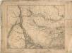
Loch Lomond - OS One-Inch map
1 : 63360 Topographic maps Ordnance Survey Ordnance Survey
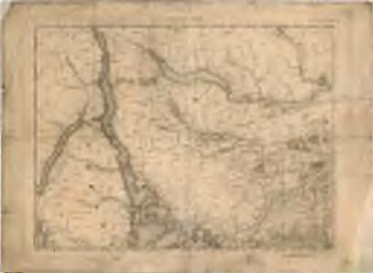
Volume 1: Sheet 38 - Loch Lomond
1 : 63360 Farquharson, J.
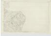
NN50 - OS 1:25,000 Provisional Series Map
1 : 25000 Topographic maps Ordnance Survey Ordnance Survey
NS59 - OS 1:25,000 Provisional Series Map
1 : 25000 Topographic maps Ordnance Survey Ordnance Survey
Argyllshire, Sheet CXLIII - OS 6 Inch map
1 : 10560 Topographic maps Ordnance Survey Ordnance Survey
Stirlingshire, Sheet III (with inset of sheet V) - OS 6 Inch map
1 : 10560 Topographic maps Ordnance Survey Ordnance Survey
Stirlingshire, Sheet II (inset IIA) - OS 6 Inch map
1 : 10560 Topographic maps Ordnance Survey Ordnance Survey
Stirlingshire, Sheet I (inset IA) - OS 6 Inch map
1 : 10560 Topographic maps Ordnance Survey Ordnance Survey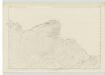
Stirlingshire, Sheet VII - OS 6 Inch map
1 : 10560 Topographic maps Ordnance Survey Ordnance Survey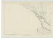
Perthshire, Sheet CXII - OS 6 Inch map
1 : 10560 Topographic maps Ordnance Survey Ordnance Survey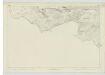
Perthshire, Sheet CXXIX - OS 6 Inch map
1 : 10560 Topographic maps Ordnance Survey Ordnance Survey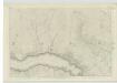
Perthshire, Sheet CXIII - OS 6 Inch map
1 : 10560 Topographic maps Ordnance Survey Ordnance Survey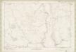
Dunbartonshire Sheet n IV - OS 6 Inch map
1 : 10560 Topographic maps Ordnance Survey Ordnance Survey
Perthshire, Sheet CXXI - OS 6 Inch map
1 : 10560 Topographic maps Ordnance Survey Ordnance Survey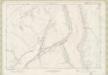
Dunbartonshire Sheet n V - OS 6 Inch map
1 : 10560 Topographic maps Ordnance Survey Ordnance Survey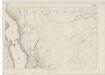
Stirlingshire, Sheet VI (& parts of Dumbartonshire sheets VIII, * - OS 6 Inch map
1 : 10560 Topographic maps Ordnance Survey Ordnance Survey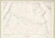
Dunbartonshire Sheet n VII - OS 6 Inch map
1 : 10560 Topographic maps Ordnance Survey Ordnance Survey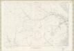
Dunbartonshire Sheet n X - OS 6 Inch map
1 : 10560 Topographic maps Ordnance Survey Ordnance Survey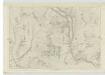
Perthshire, Sheet CXIV - OS 6 Inch map
1 : 10560 Topographic maps Ordnance Survey Ordnance Survey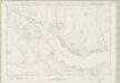
Stirlingshire Sheet n III - OS 6 Inch map
1 : 10560 Topographic maps Ordnance Survey Ordnance Survey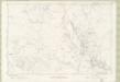
Stirlingshire Sheet n V - OS 6 Inch map
1 : 10560 Topographic maps Ordnance Survey Ordnance Survey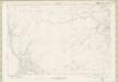
Dunbartonshire Sheet n VIII - OS 6 Inch map
1 : 10560 Topographic maps Ordnance Survey Ordnance Survey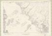
Dunbartonshire Sheet n XI - OS 6 Inch map
1 : 10560 Topographic maps Ordnance Survey Ordnance Survey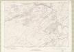
Stirlingshire Sheet n VIII - OS 6 Inch map
1 : 10560 Topographic maps Ordnance Survey Ordnance Survey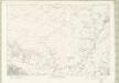
Stirlingshire Sheet n XIV - OS 6 Inch map
1 : 10560 Topographic maps Ordnance Survey Ordnance Survey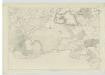
Perthshire, Sheet CXXX - OS 6 Inch map
1 : 10560 Topographic maps Ordnance Survey Ordnance Survey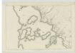
Stirlingshire, Sheet XIII - OS 6 Inch map
1 : 10560 Topographic maps Ordnance Survey Ordnance Survey