Maps of Havering
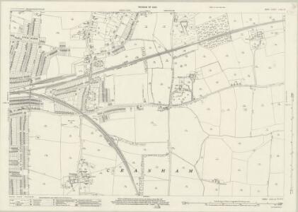
Essex (New Series 1913-) n LXXX.13 (includes: Cranham) - 25 Inch Map
1 : 2500 Topographic maps Ordnance Survey Ordnance Survey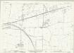
Essex (New Series 1913-) n LXXX.13 (includes: Cranham) - 25 Inch Map
1 : 2500 Topographic maps Ordnance Survey Ordnance Survey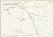
Essex (1st Ed/Rev 1862-96) LXXV.6 (includes: Cranham; Upminster) - 25 Inch Map
1 : 2500 Topographic maps Ordnance Survey Ordnance Survey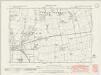
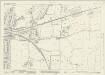
Essex nLXXX.SW - OS Six-Inch Map
1 : 10560 Topographic maps Ordnance Survey Ordnance Survey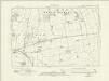
Essex nLXXX.SW - OS Six-Inch Map
1 : 10560 Topographic maps Ordnance Survey Ordnance Survey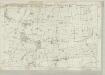
Essex LXXV - OS Six-Inch Map
1 : 10560 Topographic maps Ordnance Survey Ordnance Survey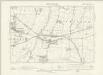
Essex LXXV.NW - OS Six-Inch Map
1 : 10560 Topographic maps Ordnance Survey Ordnance Survey
Essex nLXXX - OS Six-Inch Map
1 : 10560 Topographic maps Ordnance Survey Ordnance Survey
TQ58 - OS 1:25,000 Provisional Series Map
1 : 25000 Topographic maps Ordnance Survey Ordnance Survey
Purfleet(002OSD000000006U00391000)
1 : 21120 .This is a very rough pencil and ink field sketch (known as a 'foul plan') of the north bank of the River Thames, running from Purfleet, at the bottom of the map, to Upminster, at the top. The Essex landscape was described on 10 pieces of irregularly cut thin paper and shows considerable mismatching along the joins. The more detailed fair drawing OSD 133 serial 390 covers the same area. This map was made in the field by the draughtsman to augment the angle and distance measurements recorded in the Ordnance Survey field books.
Purfleet(002OSD000000006U00390000)
1 : 21120 This fair plan describes the north bank of the River Thames from Purfleet and West Thurrock, at the bottom, to Upminster, at the top. The manuscript is covered with pencil rays. Radiating from trigonometrical stations, these were used for measuring and plotting topographical features. Field boundaries infilled with stripes depict cultivated land. Marshes and untilled agricultural land are identified by 'open dotting' at the bottom of the map.
Ordnance Survey of England. Sheet 257, Romford
1 : 63360 Ordnance survey. GB Southampton : Ordnance Survey Office
Romford (Outline) - OS One-Inch Revised New Series
1 : 63360 Topographic maps Ordnance Survey Ordnance Survey
Romford (Hills) - OS One-Inch Revised New Series
1 : 63360 Topographic maps Ordnance Survey Ordnance Survey
Die Environs von London
Londýn (Anglie) Kitchin, Thomas Bowles, Carington
London passenger transport map
Ordnance Survey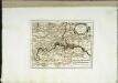
Die Gegend um London
1 Karte : Kupferdruck ; 20 x 26 cm Reilly F. J. J. von Reilly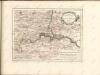

Ordnance Survey of England and Wales (Sheet 7), South Wales
Ordnance Survey, Great Britain
Delineatio ac finitima regio Magnae Brittaniae metropoleos Londini
Londýn (Anglie) Seutter, Matthäus a Matt. Seutter
London N.E. - OS One-Inch Map
1 : 63360 Topographic maps Ordnance Survey Ordnance Survey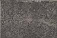
THE ENVIRONS OF LONDON
This map of London and part of the Home Counties was published in Pinnock's 'Guide to Knowledge'. Reduced from an original Ordnance Survey drawing, the map is printed in white on black, with the title in inset table at top centre. Though none of the sheets of the first edition of the Ordnance Survey covered London, part of the metropolitan area was contained in the maps of Middlesex, Essex, Surrey and Kent issued between 1805 and 1822. Archer, Joshua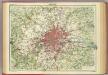
London.
1 : 126720 John Bartholomew & Co.

An accurate MAP of the Country TWENTY MILES round LONDON. From GRAVESEND to WINDSOR East and West, and from ST. ALBANS to WESTERHAM North and South with the CIRCUIT of the PENNY POST
In the second half of the18th century, the introduction of turnpike roads and the increased coach-traffic in and out of London contributed to the popularity of the maps of the countryside around the capital. The title of this plan runs along the top, with borders divided in degrees of latitude and longitude, county boundaries outlined in colour and the circuit of the Penny Postmarked in red. Before William Dockwra set up the Penny Post in 1680, there was no local delivery of letters in London, except by private courier. Dockwra opened seven sorting offices and hundreds of receiving houses. Letters were delivered to addresses in London for the charge of a penny, paid by the sender. An extra penny was charged for deliveries in the London Country area within ten miles of the city. In 1682, the Post Office took over the running of the service. Cary, John
To the Nobility & Gentry of Essex
Pask, Joseph Robert Morden
Delineatio ac finitima regio Magnae Brittaniae metropoleos Londini
1 : 120000 ad novissimam Normam repraesentata et excusa a T. Conr. Lotter, Augustano Chalcogr. Et Geogr. [Augsburg] : [Tobias Konrad Lotter]
Leigh's new map of the environs of London
1 : 247000 drawn and engraved by Sidy. Hall, 14 Bury St., Bloomsby London : Leigh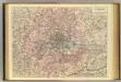
Outer London.
1 : 106065 Stanford, Edward