Maps of Havering
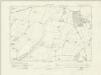
Essex LXXV - OS Six-Inch Map
1 : 10560 Topographic maps Ordnance Survey Ordnance Survey
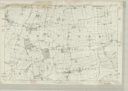
Essex nLXXXVIII.NW - OS Six-Inch Map
1 : 10560 Topographic maps Ordnance Survey Ordnance Survey
Essex nLXXXVIII.NW - OS Six-Inch Map
1 : 10560 Topographic maps Ordnance Survey Ordnance Survey
Essex LXXV.NW - OS Six-Inch Map
1 : 10560 Topographic maps Ordnance Survey Ordnance Survey
Essex LXXV.SW - OS Six-Inch Map
1 : 10560 Topographic maps Ordnance Survey Ordnance Survey
Essex LXXV.NE - OS Six-Inch Map
1 : 10560 Topographic maps Ordnance Survey Ordnance Survey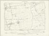
Essex LXXV.SE - OS Six-Inch Map
1 : 10560 Topographic maps Ordnance Survey Ordnance Survey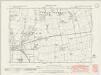
Essex nLXXX.SW - OS Six-Inch Map
1 : 10560 Topographic maps Ordnance Survey Ordnance Survey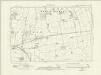
Essex nLXXX.SW - OS Six-Inch Map
1 : 10560 Topographic maps Ordnance Survey Ordnance Survey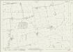
Essex (New Series 1913-) n LXXX.14 (includes: Brentwood; Great Warley; Thurrock) - 25 Inch Map
1 : 2500 Topographic maps Ordnance Survey Ordnance Survey
Essex (New Series 1913-) n LXXX.14 (includes: Brentwood; Great Warley; Thurrock) - 25 Inch Map
1 : 2500 Topographic maps Ordnance Survey Ordnance Survey
Essex (New Series 1913-) n LXXXVIII.2 (includes: Cranham; Great Warley; Thurrock) - 25 Inch Map
1 : 2500 Topographic maps Ordnance Survey Ordnance Survey
Essex (New Series 1913-) n LXXXVIII.6 (includes: Thurrock) - 25 Inch Map
1 : 2500 Topographic maps Ordnance Survey Ordnance Survey
Essex (New Series 1913-) n LXXX.13 (includes: Cranham) - 25 Inch Map
1 : 2500 Topographic maps Ordnance Survey Ordnance Survey
Essex (New Series 1913-) n LXXX.13 (includes: Cranham) - 25 Inch Map
1 : 2500 Topographic maps Ordnance Survey Ordnance Survey
Essex (New Series 1913-) n LXXXVIII.1 (includes: Cranham) - 25 Inch Map
1 : 2500 Topographic maps Ordnance Survey Ordnance Survey
Essex (New Series 1913-) n LXXXVIII.5 (includes: Cranham; Thurrock; Upminster) - 25 Inch Map
1 : 2500 Topographic maps Ordnance Survey Ordnance Survey
Essex (1st Ed/Rev 1862-96) LXXV.5 (includes: Hornchurch; Upminster) - 25 Inch Map
1 : 2500 Topographic maps Ordnance Survey Ordnance Survey
Essex (New Series 1913-) n LXXIX.16 (includes: Hornchurch; Upminster) - 25 Inch Map
1 : 2500 Topographic maps Ordnance Survey Ordnance Survey
Essex (1st Ed/Rev 1862-96) LXXV.9 (includes: Rainham; Upminster) - 25 Inch Map
1 : 2500 Topographic maps Ordnance Survey Ordnance Survey
Essex (New Series 1913-) n LXXXVII.4 (includes: Rainham; Upminster) - 25 Inch Map
1 : 2500 Topographic maps Ordnance Survey Ordnance Survey
Essex (New Series 1913-) n LXXXVII.4 (includes: Rainham; Upminster) - 25 Inch Map
1 : 2500 Topographic maps Ordnance Survey Ordnance Survey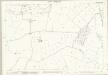
Essex (1st Ed/Rev 1862-96) LXXV.13 (includes: Rainham; Thurrock) - 25 Inch Map
1 : 2500 Topographic maps Ordnance Survey Ordnance Survey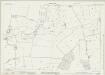
Essex (New Series 1913-) n LXXXVII.8 (includes: Rainham; Thurrock; Upminster) - 25 Inch Map
1 : 2500 Topographic maps Ordnance Survey Ordnance Survey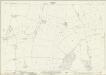
Essex (New Series 1913-) n LXXXVII.8 (includes: Rainham; Thurrock; Upminster) - 25 Inch Map
1 : 2500 Topographic maps Ordnance Survey Ordnance Survey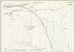
Essex (1st Ed/Rev 1862-96) LXXV.6 (includes: Cranham; Upminster) - 25 Inch Map
1 : 2500 Topographic maps Ordnance Survey Ordnance Survey
Essex (1st Ed/Rev 1862-96) LXXV.10 (includes: Cranham; Thurrock; Upminster) - 25 Inch Map
1 : 2500 Topographic maps Ordnance Survey Ordnance Survey
Essex (1st Ed/Rev 1862-96) LXXV.14 (includes: Thurrock; Upminster) - 25 Inch Map
1 : 2500 Topographic maps Ordnance Survey Ordnance Survey
Essex nLXXXVII.NE - OS Six-Inch Map
1 : 10560 Topographic maps Ordnance Survey Ordnance Survey