Maps of Milton Keynes
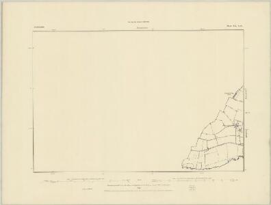
Bedfordshire XX.SE - OS Six-Inch Map
1 : 10560 Topographic maps Ordnance Survey Ordnance Survey
Bedfordshire XX.SE - OS Six-Inch Map
1 : 10560 Topographic maps Ordnance Survey Ordnance Survey
Bedfordshire XX.SE - OS Six-Inch Map
1 : 10560 Topographic maps Ordnance Survey Ordnance Survey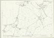
Bedfordshire XX.11 (includes: Aspley Guise; Hulcote and Salford; Wavendon) - 25 Inch Map
1 : 2500 Topographic maps Ordnance Survey Ordnance Survey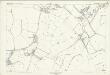
Bedfordshire XX.11 (includes: Aspley Guise; Hulcote and Salford; Wavendon) - 25 Inch Map
1 : 2500 Topographic maps Ordnance Survey Ordnance Survey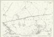
Bedfordshire XX.15 (includes: Aspley Guise; Husborne Crawley; Wavendon; Woburn Sands) - 25 Inch Map
1 : 2500 Topographic maps Ordnance Survey Ordnance Survey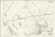
Bedfordshire XX.15 (includes: Aspley Guise; Husborne Crawley; Wavendon; Woburn Sands) - 25 Inch Map
1 : 2500 Topographic maps Ordnance Survey Ordnance Survey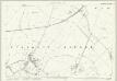
Bedfordshire XX.16 (includes: Aspley Guise; Hulcote and Salford; Husborne Crawley; Ridgmont) - 25 Inch Map
1 : 2500 Topographic maps Ordnance Survey Ordnance Survey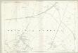
Bedfordshire XX.16 (includes: Aspley Guise; Hulcote and Salford; Husborne Crawley; Ridgmont) - 25 Inch Map
1 : 2500 Topographic maps Ordnance Survey Ordnance Survey
Bedfordshire XX.12 (includes: Aspley Guise; Hulcote and Salford; Husborne Crawley; Lidlington; Ridgmont) - 25 Inch Map
1 : 2500 Topographic maps Ordnance Survey Ordnance Survey
Bedfordshire XX.12 (includes: Aspley Guise; Hulcote and Salford; Husborne Crawley; Lidlington; Ridgmont) - 25 Inch Map
1 : 2500 Topographic maps Ordnance Survey Ordnance Survey
Buckinghamshire XV.4 (includes: Aspley Guise; Wavendon) - 25 Inch Map
1 : 2500 Topographic maps Ordnance Survey Ordnance Survey
Buckinghamshire XV.4 (includes: Aspley Guise; Wavendon) - 25 Inch Map
1 : 2500 Topographic maps Ordnance Survey Ordnance Survey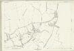
Buckinghamshire XV.4 (includes: Aspley Guise; Wavendon) - 25 Inch Map
1 : 2500 Topographic maps Ordnance Survey Ordnance Survey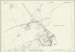
Buckinghamshire XV.8 (includes: Aspley Guise; Aspley Heath; Wavendon; Woburn Sands) - 25 Inch Map
1 : 2500 Topographic maps Ordnance Survey Ordnance Survey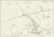
Buckinghamshire XV.8 (includes: Aspley Guise; Aspley Heath; Wavendon; Woburn Sands) - 25 Inch Map
1 : 2500 Topographic maps Ordnance Survey Ordnance Survey
SP93 - OS 1:25,000 Provisional Series Map
1 : 25000 Topographic maps Ordnance Survey Ordnance Survey
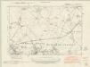
Detail from OSD 232 (Woburn)
1 : 31680 A detail of the area around Woburn, taken from OSD 232. Hyett, William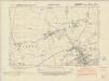
Buckinghamshire XV.NE - OS Six-Inch Map
1 : 10560 Topographic maps Ordnance Survey Ordnance Survey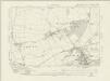
Buckinghamshire XV.NE - OS Six-Inch Map
1 : 10560 Topographic maps Ordnance Survey Ordnance Survey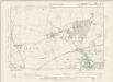
Buckinghamshire XV.NE - OS Six-Inch Map
1 : 10560 Topographic maps Ordnance Survey Ordnance Survey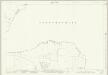
Buckinghamshire X.16 (includes: Hulcote and Salford; Wavendon) - 25 Inch Map
1 : 2500 Topographic maps Ordnance Survey Ordnance Survey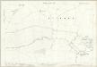
Buckinghamshire X.16 (includes: Hulcote and Salford; Wavendon) - 25 Inch Map
1 : 2500 Topographic maps Ordnance Survey Ordnance Survey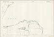
Buckinghamshire X.16 (includes: Hulcote and Salford; Wavendon) - 25 Inch Map
1 : 2500 Topographic maps Ordnance Survey Ordnance Survey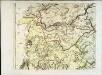
The county of Bedford, 5
1 Blatt : 53 x 72 cm s.n.
Woburn
1 : 31680 This county boundary of Bedfordshire and Buckinghamshire is depicted as a black dotted line at bottom left. Down the right of the sheet, many triangulation points are marked in red ink. Toll roads are highlighted in yellow, with turnpikes indicated along their routes. A section of the Watling Street, between Dunstable and Little Brickhill, is indicated near the bottom of the sheet. This Roman road ran from London to Wroxeter in Wales, via St. Albans. Symbols distinguish different types land use, while shading is used to indicate relief. Hyett, William
Bedfordiensis comitatvs; anglis Bedford Shire
2 Karten auf einem Blatt : Kupferdruck ; Bildgrösse 42 x 53 cm Blaeu Joan Blaeu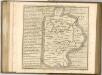

Buckingham - OS One-Inch Map
1 : 63360 Topographic maps Ordnance Survey Ordnance Survey