Maps of Milton Keynes

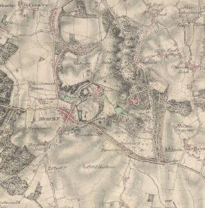
Detail from OSD 232 (Woburn)
1 : 31680 A detail of the area around Woburn, taken from OSD 232. Hyett, William
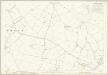
Bedfordshire XXIV.NE - OS Six-Inch Map
1 : 10560 Topographic maps Ordnance Survey Ordnance Survey
Bedfordshire XXIV.NE - OS Six-Inch Map
1 : 10560 Topographic maps Ordnance Survey Ordnance Survey
Bedfordshire XXIV.NE - OS Six-Inch Map
1 : 10560 Topographic maps Ordnance Survey Ordnance Survey
Bedfordshire XXIV.SE - OS Six-Inch Map
1 : 10560 Topographic maps Ordnance Survey Ordnance Survey
Bedfordshire XXIV.SE - OS Six-Inch Map
1 : 10560 Topographic maps Ordnance Survey Ordnance Survey
Bedfordshire XXIV.SE - OS Six-Inch Map
1 : 10560 Topographic maps Ordnance Survey Ordnance Survey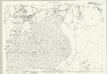
Bedfordshire XXIV.3 (includes: Aspley Guise; Aspley Heath; Husborne Crawley; Wavendon; Woburn Sands; Woburn) - 25 Inch Map
1 : 2500 Topographic maps Ordnance Survey Ordnance Survey
Bedfordshire XXIV.3 & 7 (includes: Aspley Guise; Aspley Heath; Husborne Crawley; Wavendon; Woburn Sands; Woburn) - 25 Inch Map
1 : 2500 Topographic maps Ordnance Survey Ordnance Survey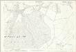
Bedfordshire XXIV.3 (includes: Aspley Guise; Aspley Heath; Husborne Crawley; Wavendon; Woburn Sands; Woburn) - 25 Inch Map
1 : 2500 Topographic maps Ordnance Survey Ordnance Survey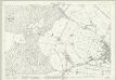
Bedfordshire XXIV.7 (includes: Aspley Guise; Aspley Heath; Woburn) - 25 Inch Map
1 : 2500 Topographic maps Ordnance Survey Ordnance Survey
Bedfordshire XXIV.3 & 7 (includes: Aspley Guise; Aspley Heath; Husborne Crawley; Wavendon; Woburn Sands; Woburn) - 25 Inch Map
1 : 2500 Topographic maps Ordnance Survey Ordnance Survey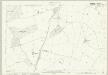
Bedfordshire XXIV.11 (includes: Heath and Reach; Little Brickhill; Potsgrove; Soulbury; Woburn) - 25 Inch Map
1 : 2500 Topographic maps Ordnance Survey Ordnance Survey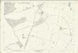
Bedfordshire XXIV.11 (includes: Heath and Reach; Little Brickhill; Potsgrove; Soulbury; Woburn) - 25 Inch Map
1 : 2500 Topographic maps Ordnance Survey Ordnance Survey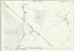
Bedfordshire XXIV.15 (includes: Heath and Reach; Potsgrove; Soulbury) - 25 Inch Map
1 : 2500 Topographic maps Ordnance Survey Ordnance Survey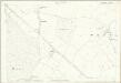
Bedfordshire XXIV.15 (includes: Heath and Reach; Potsgrove; Soulbury) - 25 Inch Map
1 : 2500 Topographic maps Ordnance Survey Ordnance Survey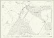
Bedfordshire XXIV.4 (includes: Aspley Guise; Husborne Crawley; Ridgmont; Woburn) - 25 Inch Map
1 : 2500 Topographic maps Ordnance Survey Ordnance Survey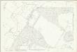
Bedfordshire XXIV.4 (includes: Aspley Guise; Husborne Crawley; Ridgmont; Woburn) - 25 Inch Map
1 : 2500 Topographic maps Ordnance Survey Ordnance Survey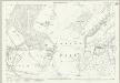
Bedfordshire XXIV.8 (includes: Eversholt; Woburn) - 25 Inch Map
1 : 2500 Topographic maps Ordnance Survey Ordnance Survey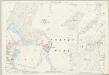
Bedfordshire XXIV.8 (includes: Eversholt; Woburn) - 25 Inch Map
1 : 2500 Topographic maps Ordnance Survey Ordnance Survey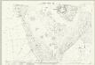
Bedfordshire XXIV.12 (includes: Eversholt; Milton Bryan; Potsgrove; Woburn) - 25 Inch Map
1 : 2500 Topographic maps Ordnance Survey Ordnance Survey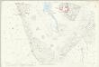
Bedfordshire XXIV.12 (includes: Eversholt; Milton Bryan; Potsgrove; Woburn) - 25 Inch Map
1 : 2500 Topographic maps Ordnance Survey Ordnance Survey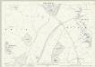
Bedfordshire XXIV.16 (includes: Battlesden; Milton Bryan; Potsgrove) - 25 Inch Map
1 : 2500 Topographic maps Ordnance Survey Ordnance Survey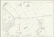
Bedfordshire XXV.1 (includes: Eversholt; Husborne Crawley; Ridgmont; Steppingley; Woburn) - 25 Inch Map
1 : 2500 Topographic maps Ordnance Survey Ordnance Survey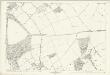
Bedfordshire XXV.1 (includes: Eversholt; Husborne Crawley; Ridgmont; Steppingley; Woburn) - 25 Inch Map
1 : 2500 Topographic maps Ordnance Survey Ordnance Survey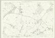
Bedfordshire XXV.5 (includes: Eversholt; Tingrith; Woburn) - 25 Inch Map
1 : 2500 Topographic maps Ordnance Survey Ordnance Survey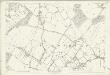
Bedfordshire XXV.5 (includes: Eversholt; Tingrith; Woburn) - 25 Inch Map
1 : 2500 Topographic maps Ordnance Survey Ordnance Survey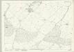
Bedfordshire XXV.9 (includes: Eversholt; Milton Bryan; Tingrith; Toddington; Woburn) - 25 Inch Map
1 : 2500 Topographic maps Ordnance Survey Ordnance Survey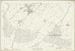
Bedfordshire XXV.9 (includes: Eversholt; Milton Bryan; Tingrith; Toddington; Woburn) - 25 Inch Map
1 : 2500 Topographic maps Ordnance Survey Ordnance Survey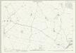
Bedfordshire XXV.13 (includes: Milton Bryan; Toddington) - 25 Inch Map
1 : 2500 Topographic maps Ordnance Survey Ordnance Survey