Maps of Torbay
Devonshire CXXVIII.NW - OS Six-Inch Map
1 : 10560 Topographic maps Ordnance Survey Ordnance Survey
Devonshire CXXVIII.NW - OS Six-Inch Map
1 : 10560 Topographic maps Ordnance Survey Ordnance Survey
Devon CXXVIII.2 (includes: Brixham; Churston Ferrers) - 25 Inch Map
1 : 2500 Topographic maps Ordnance Survey Ordnance Survey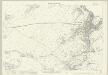
Devon CXXVIII.2 (includes: Brixham; Churston Ferrers) - 25 Inch Map
1 : 2500 Topographic maps Ordnance Survey Ordnance Survey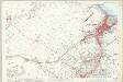
Devon CXXVIII.2 (includes: Brixham; Churston Ferrers) - 25 Inch Map
1 : 2500 Topographic maps Ordnance Survey Ordnance Survey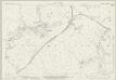
Devon CXXVIII.1 (includes: Brixham; Churston Ferrers; Stoke Gabriel) - 25 Inch Map
1 : 2500 Topographic maps Ordnance Survey Ordnance Survey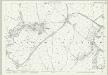
Devon CXXVIII.1 (includes: Brixham; Churston Ferrers; Stoke Gabriel) - 25 Inch Map
1 : 2500 Topographic maps Ordnance Survey Ordnance Survey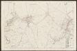
Devon CXXVIII.1 (includes: Brixham; Churston Ferrers; Stoke Gabriel) - 25 Inch Map
1 : 2500 Topographic maps Ordnance Survey Ordnance Survey
Devon CXXVIII.5 (inset CXXVIII.1) (includes: Brixham; Churston Ferrers; Stoke Gabriel) - 25 Inch Map
1 : 2500 Topographic maps Ordnance Survey Ordnance Survey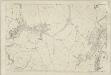
Devon CXXVIII.1 (includes: Brixham; Churston Ferrers; Stoke Gabriel) - 25 Inch Map
1 : 2500 Topographic maps Ordnance Survey Ordnance Survey
Devon CXXVIII.5 & 1 (includes: Brixham; Churston Ferrers; Stoke Gabriel) - 25 Inch Map
1 : 2500 Topographic maps Ordnance Survey Ordnance Survey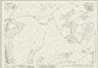
Devon CXXVIII.5 (includes: Brixham; Churston Ferrers) - 25 Inch Map
1 : 2500 Topographic maps Ordnance Survey Ordnance Survey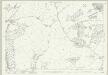
Devon CXXVIII.5 (includes: Brixham; Churston Ferrers) - 25 Inch Map
1 : 2500 Topographic maps Ordnance Survey Ordnance Survey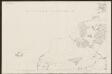
Devon CXXVIII.5 (inset CXXVIII.1) (includes: Brixham; Churston Ferrers; Stoke Gabriel) - 25 Inch Map
1 : 2500 Topographic maps Ordnance Survey Ordnance Survey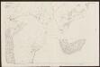
Devon CXXVIII.5 (inset CXXVIII.9) (includes: Brixham; Churston Ferrers; Stoke Gabriel) - 25 Inch Map
1 : 2500 Topographic maps Ordnance Survey Ordnance Survey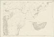
Devon CXXVIII.5 & 9 (includes: Brixham; Churston Ferrers; Dartmouth) - 25 Inch Map
1 : 2500 Topographic maps Ordnance Survey Ordnance Survey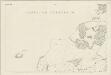
Devon CXXVIII.5 & 1 (includes: Brixham; Churston Ferrers; Stoke Gabriel) - 25 Inch Map
1 : 2500 Topographic maps Ordnance Survey Ordnance Survey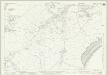
Devon CXXVIII.6 (includes: Brixham) - 25 Inch Map
1 : 2500 Topographic maps Ordnance Survey Ordnance Survey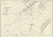
Devon CXXVIII.6 (includes: Brixham) - 25 Inch Map
1 : 2500 Topographic maps Ordnance Survey Ordnance Survey
Devon CXXVIII.6 (includes: Brixham) - 25 Inch Map
1 : 2500 Topographic maps Ordnance Survey Ordnance Survey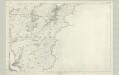
Devonshire CXXVIII - OS Six-Inch Map
1 : 10560 Topographic maps Ordnance Survey Ordnance Survey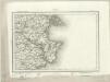
Torquay (Outline) - OS One-Inch Revised New Series
1 : 63360 Topographic maps Ordnance Survey Ordnance Survey
Torquay (Hills) - OS One-Inch Revised New Series
1 : 63360 Topographic maps Ordnance Survey Ordnance Survey
Dartmoor, Devon
This drawing shows the estuary of the River Dart flowing into the English Channel. Numerous slate and limestone quarries surround the busy port at Dartmouth Harbour. Dartmouth Port also served the tin and copper mines on Dartmoor. Tan yards are marked at Totnes and Ashburton. Many cider orchards are noted. An Old Cross is drawn at Saint Petrocks (St Petrox) near the ruins of a castle across the estuary at Kiln Cove. Another castle appears at Totnes. The ancient earthworks at Woodbury Camp and many other early settlements are recorded in this area. While the authorship of this drawing is unknown, the elaborate hill shading and attention to communications routes conform to the military and cartographic standards employed by the West Country survey. The map is made up of three pieces. Its margins are trimmed and the drawing is in good condition.
Torquay - OS One-Inch Map
1 : 63360 Topographic maps Ordnance Survey Ordnance Survey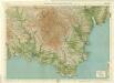
South Devon, Sheet 36 - Bartholomew's "Half Inch to the Mile Maps" of England & Wales
1 : 126720 Topographic maps Bartholomew, John George John Bartholomew & Co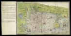
Ottermouth Haven [Coasts of Devon and Dorset from Dartmouth to Weymouth with a written description of Ottermouth Haven]
This is a map of the coast of Devon and Cornwall from Dartmouth to Weymouth which forms part of an atlas that belonged to William Cecil Lord Burghley, Secretary of State to Elizabeth I. Burghley used this atlas to illustrate domestic matters. This map shows the coastline in a pictorial fashion, with buildings indicated by generic, rather than individualized images of various building types. In the left hand margin is a written description of Ottermouth haven, which also features on the map itself. A dominating feature of the map in the compass rose in the centre which has lines radiating from it, each with a direction written along side it. From the style of the lettering and the depiction of the ships the map can be dated to the around 1540. Lord Burghley has annotated the map, adding a we’y of xviii foot brod’ to a narrow bridge of land and adding Sandfoot castle to the coastline to the right of the Isle Portland. The map may have originally been drawn in connection with the 1539-40 invasion scare caused by the alliance against England of France and Spain. The fortification of the Dorset coast was an essential part of the defensive preparations and in April 1539 Lord Russell surveyed the area, sending a plat’ to Cromwell which suggested a much more ambitious fortification program than was actually carried out. Sandfoot, which Lord Burghley has inserted onto this map, was in commission by 1541-1542. The fact that it does not originally appear on the map suggests that it was not built at the time of the maps execution. This is curious however as Portland Castle, built at the same time as Sandfoot, was included by the original draughtsman. The castles were intended to be able to cross fire over the important anchorage known as Portland Roads. Lord Burghley’s interest in the area can be attributed to a new invasion threat from Spain. This threat was also rooted in religious ideology as the Catholic Philip II of Spain wanted to remove the ardently Protestant Elizabeth I from the English Throne. Unfortunately, the coastal forts in Dorset, as with others in England, had been allowed to fall into disrepair. Finally in 1584 action to repair the Dorset forts was authorised by the Privy Council. William Cecil, Lord Burghley
Sheets 3-4. (Cary's England, Wales, and Scotland).
1 : 360000 Cary, John, ca. 1754-1835
Een gedeelte vant Kanaal van Kingsbudg tot Big Berrij
England Gerard van Keulen