Maps of West Devon
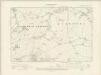
Devonshire CV.NW - OS Six-Inch Map
1 : 10560 Topographic maps Ordnance Survey Ordnance Survey
Devonshire CV.NW - OS Six-Inch Map
1 : 10560 Topographic maps Ordnance Survey Ordnance Survey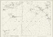
Devon CV.2 (includes: Lamerton; Sydenham Damerel) - 25 Inch Map
1 : 2500 Topographic maps Ordnance Survey Ordnance Survey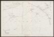
Devon CV.2 (includes: Lamerton; Sydenham Damerel) - 25 Inch Map
1 : 2500 Topographic maps Ordnance Survey Ordnance Survey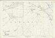
Devon CV.2 (includes: Lamerton; Sydenham Damerel) - 25 Inch Map
1 : 2500 Topographic maps Ordnance Survey Ordnance Survey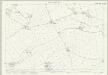
Devon CV.6 (includes: Lamerton; Tavistock Hamlets) - 25 Inch Map
1 : 2500 Topographic maps Ordnance Survey Ordnance Survey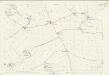
Devon CV.6 (includes: Lamerton; Tavistock Hamlets) - 25 Inch Map
1 : 2500 Topographic maps Ordnance Survey Ordnance Survey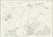
Devon CV.5 (includes: Lamerton; Sydenham Damerel; Tavistock Hamlets) - 25 Inch Map
1 : 2500 Topographic maps Ordnance Survey Ordnance Survey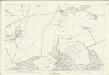
Devon CV.5 (includes: Lamerton; Sydenham Damerel; Tavistock Hamlets) - 25 Inch Map
1 : 2500 Topographic maps Ordnance Survey Ordnance Survey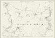
Devon CV.1 (includes: Lamerton; Milton Abbot; Sydenham Damerel) - 25 Inch Map
1 : 2500 Topographic maps Ordnance Survey Ordnance Survey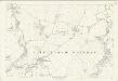
Devon CV.1 (includes: Lamerton; Milton Abbot; Sydenham Damerel) - 25 Inch Map
1 : 2500 Topographic maps Ordnance Survey Ordnance Survey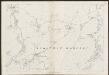
Devon CV.1 (includes: Lamerton; Milton Abbot; Sydenham Damerel) - 25 Inch Map
1 : 2500 Topographic maps Ordnance Survey Ordnance Survey
Cornwall XXIII.12 (includes: Lamerton; Milton Abbot; Stoke Climsland; Sydenham Damerel) - 25 Inch Map
1 : 2500 Topographic maps Ordnance Survey Ordnance Survey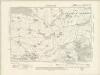
Cornwall XXIII.SE - OS Six-Inch Map
1 : 10560 Topographic maps Ordnance Survey Ordnance Survey
Cornwall XXIII.SE - OS Six-Inch Map
1 : 10560 Topographic maps Ordnance Survey Ordnance Survey
Cornwall XXIII.16 (includes: Calstock; Lamerton; Stoke Climsland; Sydenham Damerel; Tavistock Hamlets) - 25 Inch Map
1 : 2500 Topographic maps Ordnance Survey Ordnance Survey
Cornwall XXIII.16 (includes: Calstock; Lamerton; Stoke Climsland; Sydenham Damerel; Tavistock Hamlets) - 25 Inch Map
1 : 2500 Topographic maps Ordnance Survey Ordnance Survey
SX47 - OS 1:25,000 Provisional Series Map
1 : 25000 Topographic maps Ordnance Survey Ordnance Survey
Cornwall XXIII.NE - OS Six-Inch Map
1 : 10560 Topographic maps Ordnance Survey Ordnance Survey
Cornwall XXIII.NE - OS Six-Inch Map
1 : 10560 Topographic maps Ordnance Survey Ordnance Survey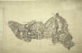
Tavistock
The border between Devon and Cornwall is shown running along the River Tamer from Horse Bridge to New Bridge., Mining is evident around Peter Tavy to the central right of the picture, while Mill Hill Slate Quarry is prominent in the middle of the region., There are more quarries just above Sampford Spiny, to the bottom right of the map., At the topmost point is Brent Tor, with the Church of St Michael enclosed by a red boundary signifying a stone wall., Authorship is unconfirmed.
Tavistock (Hills) - OS One-Inch Revised New Series
1 : 63360 Topographic maps Ordnance Survey Ordnance Survey
Tavistock (Outline) - OS One-Inch Revised New Series
1 : 63360 Topographic maps Ordnance Survey Ordnance Survey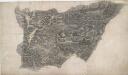
Launceston
A red dashed line running along the path of the River Tamer denotes the border between Devon and Cornwall. The settlement at Launceston appears on the Cornish side of the border. On the bottom right of the manuscript, Budgens calculations of the area survive in red ink as do triangulation lines. The map is drawn on an irregularly cut sheet which is torn and pieced together with detail extending over the joins. Archaeological details such as at Rowdown Barrows are documented even though recording such sites did not become obligatory until 1816. Budgen, Charles
Plymouth - OS One-Inch Map
1 : 63360 Topographic maps Ordnance Survey Ordnance Survey
Okehampton - OS One-Inch Map
1 : 63360 Topographic maps Ordnance Survey Ordnance Survey
South Devon, Sheet 36 - Bartholomew's "Half Inch to the Mile Maps" of England & Wales
1 : 126720 Topographic maps Bartholomew, John George John Bartholomew & Co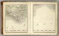
Sheets 3-4. (Cary's England, Wales, and Scotland).
1 : 360000 Cary, John, ca. 1754-1835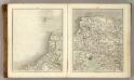
Sheets 11-12. (Cary's England, Wales, and Scotland).
1 : 360000 Cary, John, ca. 1754-1835


