Maps of Eastbourne
Sussex LXXX.NE - OS Six-Inch Map
1 : 10560 Topographic maps Ordnance Survey Ordnance Survey
Sussex LXXX.NE - OS Six-Inch Map
1 : 10560 Topographic maps Ordnance Survey Ordnance Survey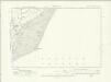
Sussex LXXX.NE - OS Six-Inch Map
1 : 10560 Topographic maps Ordnance Survey Ordnance Survey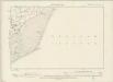
Sussex LXXX.NE - OS Six-Inch Map
1 : 10560 Topographic maps Ordnance Survey Ordnance Survey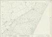
Sussex LXXX.3 (includes: Eastbourne; Westham) - 25 Inch Map
1 : 2500 Topographic maps Ordnance Survey Ordnance Survey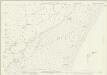
Sussex LXXX.3 & 4 (includes: Eastbourne; Westham) - 25 Inch Map
1 : 2500 Topographic maps Ordnance Survey Ordnance Survey
Sussex LXXX.3 & 4 (includes: Eastbourne; Westham) - 25 Inch Map
1 : 2500 Topographic maps Ordnance Survey Ordnance Survey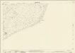
Sussex LXXX.7 (includes: Eastbourne) - 25 Inch Map
1 : 2500 Topographic maps Ordnance Survey Ordnance Survey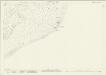
Sussex LXXX.7 (includes: Eastbourne) - 25 Inch Map
1 : 2500 Topographic maps Ordnance Survey Ordnance Survey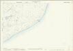
Sussex LXXX.7 (includes: Eastbourne) - 25 Inch Map
1 : 2500 Topographic maps Ordnance Survey Ordnance Survey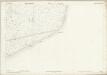
Sussex LXXX.7 (includes: Eastbourne) - 25 Inch Map
1 : 2500 Topographic maps Ordnance Survey Ordnance Survey
Sussex LXXX.3 & 4 (includes: Eastbourne; Westham) - 25 Inch Map
1 : 2500 Topographic maps Ordnance Survey Ordnance Survey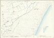
Sussex LXXX.3 & 4 (includes: Eastbourne; Westham) - 25 Inch Map
1 : 2500 Topographic maps Ordnance Survey Ordnance Survey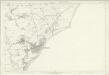
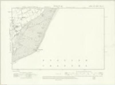
Sussex LXXX - OS Six-Inch Map
1 : 10560 Topographic maps Ordnance Survey Ordnance Survey
TQ60 - OS 1:25,000 Provisional Series Map
1 : 25000 Topographic maps Ordnance Survey Ordnance Survey
Eastbourne (Hills) - OS One-Inch Revised New Series
1 : 63360 Topographic maps Ordnance Survey Ordnance Survey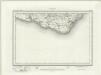
Eastbourne (Outline) - OS One-Inch Revised New Series
1 : 63360 Topographic maps Ordnance Survey Ordnance Survey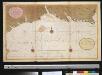
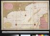
Een gedeelte van het Kanaal van de Hoek van Bevesier tot Bowleij
England Gerard van Keulen
Eastbourne - OS One-Inch Map
1 : 63360 Topographic maps Ordnance Survey Ordnance Survey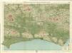
Sussex, Sheet 32 - Bartholomew's "Half Inch to the Mile Maps" of England & Wales
1 : 126720 Topographic maps Bartholomew, John George John Bartholomew & Co
Suthsexia vernacule Sussex
1 Karte : Kupferdruck ; 36 x 49 cm Valck; Schenk apud Gerardum Valk et Petrum Schenk
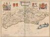
Svthsexia; vernacule Svssex
1 Karte : Kupferdruck ; 37 x 51 cm Blaeu Joan Blaeu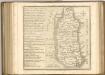
Een gedeelte van het Kanaal van de Hoofden tot den hoek van Bevesier als meede een gedeelte van de cust van Vrankrijk
English Channel Gerard van Keulen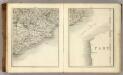
Sheets 17-18. (Cary's England, Wales, and Scotland).
1 : 360000 Cary, John, ca. 1754-1835
SVTHSEXIA, | Vernacule | SUSSEX.
[Amsterdam : Joan Blaeu]
Suthsexia vernacule Sussex
1 : 240000 Amstelodami : apud Joannem Janssonium
Der Kanal
1 : 150000 Dover (Anglie) Reichs-Marine-Amt
Suthsexia. Vernacule Sussex. [Karte], in: Novus atlas absolutissimus, Bd. 7, S. 137.
1 Karte aus Atlas Janssonius Offizin