Maps of Tonbridge and Malling
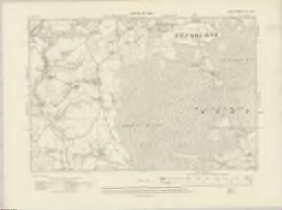
Kent XLI.NW - OS Six-Inch Map
1 : 10560 Topographic maps Ordnance Survey Ordnance Survey
Kent XLI.NW - OS Six-Inch Map
1 : 10560 Topographic maps Ordnance Survey Ordnance Survey
Kent XLI.NW - OS Six-Inch Map
1 : 10560 Topographic maps Ordnance Survey Ordnance Survey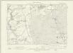
Kent XLI.NW - OS Six-Inch Map
1 : 10560 Topographic maps Ordnance Survey Ordnance Survey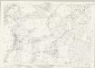
Kent XLI.1 (includes: Borough Green; Platt; Plaxtol) - 25 Inch Map
1 : 2500 Topographic maps Ordnance Survey Ordnance Survey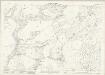
Kent XLI.1 (includes: Borough Green; Platt; Plaxtol) - 25 Inch Map
1 : 2500 Topographic maps Ordnance Survey Ordnance Survey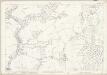
Kent XLI.1 (includes: Borough Green; Platt; Plaxtol) - 25 Inch Map
1 : 2500 Topographic maps Ordnance Survey Ordnance Survey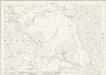
Kent XLI.5 (includes: Platt; Plaxtol) - 25 Inch Map
1 : 2500 Topographic maps Ordnance Survey Ordnance Survey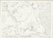
Kent XLI.5 (includes: Platt; Plaxtol) - 25 Inch Map
1 : 2500 Topographic maps Ordnance Survey Ordnance Survey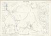
Kent XLI.5 (includes: Platt; Plaxtol) - 25 Inch Map
1 : 2500 Topographic maps Ordnance Survey Ordnance Survey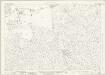
Kent XLI.2 (includes: Mereworth; Offham; Platt) - 25 Inch Map
1 : 2500 Topographic maps Ordnance Survey Ordnance Survey
Kent XLI.2 (includes: Mereworth; Offham; Platt) - 25 Inch Map
1 : 2500 Topographic maps Ordnance Survey Ordnance Survey
Kent XLI.2 (includes: Mereworth; Offham; Platt) - 25 Inch Map
1 : 2500 Topographic maps Ordnance Survey Ordnance Survey
Kent XLI.6 (includes: Mereworth; Platt; West Peckham) - 25 Inch Map
1 : 2500 Topographic maps Ordnance Survey Ordnance Survey
Kent XLI.6 (includes: Mereworth; Platt; West Peckham) - 25 Inch Map
1 : 2500 Topographic maps Ordnance Survey Ordnance Survey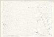
Kent XLI.6 (includes: Mereworth; Platt; West Peckham) - 25 Inch Map
1 : 2500 Topographic maps Ordnance Survey Ordnance Survey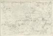
Kent XLI - OS Six-Inch Map
1 : 10560 Topographic maps Ordnance Survey Ordnance Survey
TQ65 - OS 1:25,000 Provisional Series Map
1 : 25000 Topographic maps Ordnance Survey Ordnance Survey
Tonbridge (Kent)(002OSD000000005U00352000)
1 : 21120 Drawing showing the area around Tonbridge in Kent. Annotations in ink confirm these drawings as being field sketches. The loose nature of the hill sketching contrasts with that of later, finished drawings. A cross marked Bluborough indicates an observation station from which angular measurements were taken during the surveying.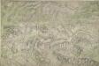
Addington (Kent)
1 : 10560 This map of north-west Kent is drawn on rectangular sheet lines and enclosed by a black border. Fields are coloured brown where cultivated, and green or blank if untilled. Stonework buildings and structures are drawn in red ink at major settlements. Infilled or blocked areas of black or sepia ink indicate structures and buildings made from less permanent materials, such as wood. Spot heights (altitudes)are drawn in red ink figures. This is the earliest plan to distinguish pictorially between coniferous and deciduous trees.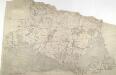
Hadlow, Kent
1 : 31680 This plan of the North Downs in Kent extends from Addington and Ryarsh, on the left, to Barming Heath, on the bottom right. Rays in red ink intersect across the map, evidence of angular measurements taken by the surveyor between fixed triangulation points. The ruled black sheet lines indicate the edges of the area that will be copied for the finished drawing OSD 120. Pink, George
Mereworth, Kent
1 : 10560 Irregular field boundaries enclosing agricultural land dominate the Medway Valley in Kent, around the main settlements of Hadlow, Mereworth and Yalding. Rays in red ink intersect the map, evidence of measurements taken by the surveyor between fixed triangulation points. The ruled black-sheet lines indicate the edges of the area that was copied for plans 100 and 119.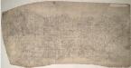
Sevenoaks (Kent) 16
This drawing records the field boundaries and woodland surrounding the towns of Sevenoaks and Kingsdown in Kent. Cultivated land is indicated by a striped pattern, purposely aping the furrows of actual tilled land. Precise instructions for the arrangement of these lines were given in the military manuals. For example, adjacent fields could not have stripes running in the same direction. An 'Old Roman Camp' is recorded on Ightham Common. Pink, George
Sevenoaks (Hills) - OS One-Inch Revised New Series
1 : 63360 Topographic maps Ordnance Survey Ordnance Survey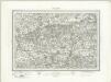
Sevenoaks (Outline) - OS One-Inch Revised New Series
1 : 63360 Topographic maps Ordnance Survey Ordnance Survey
A sketch of the roads within fourteen miles of Tunbridge Wells
1 : 100000 Brackett, William Clifford, J J. Clifford
London passenger transport map
Ordnance Survey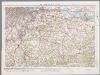
[Kaart], uit: S.E. London & Sevenoaks
1 : 64000 titelvariant: Ordnance Survey contoured road map of S.E. London and Sevenoaks; Annotatie: Omslagtitel: Ordnance Survey contoured road map of S.E. London and Sevenoaks Ordnance Survey Southampton : The Director General, at the Ordnance Survey Office
London SE - OS One-Inch Map
1 : 63360 Topographic maps Ordnance Survey Ordnance Survey