Maps of Sevenoaks

Tonbridge (Kent)(002OSD000000005U00352000)
1 : 21120 Drawing showing the area around Tonbridge in Kent. Annotations in ink confirm these drawings as being field sketches. The loose nature of the hill sketching contrasts with that of later, finished drawings. A cross marked Bluborough indicates an observation station from which angular measurements were taken during the surveying.
Tonbridge (Kent)(002OSD000000005U00354000)
1 : 21120 Drawing showing the area around Tonbridge in Kent. The lack of hill sketching on this drawing suggests an intermediate rather than a finished plan. Field boundaries, woodland and buildings are intricately presented. Individual trees are meticulously drawn along the avenue in Knowle Park. Measurements in ink are given in the bottom left of this drawing. A triangulation diagram appears on the reverse of the manuscript. This was used by the draughtsman to plot topographical features.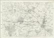
Kent L - OS Six-Inch Map
1 : 10560 Topographic maps Ordnance Survey Ordnance Survey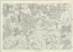
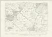
Kent XL - OS Six-Inch Map
1 : 10560 Topographic maps Ordnance Survey Ordnance Survey
TQ54 - OS 1:25,000 Provisional Series Map
1 : 25000 Topographic maps Ordnance Survey Ordnance Survey
TQ55 - OS 1:25,000 Provisional Series Map
1 : 25000 Topographic maps Ordnance Survey Ordnance Survey
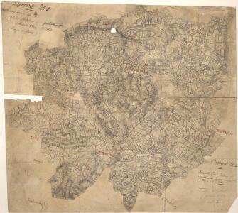
Knole Park ,amp; Whitely Row, near Sevenoaks, Kent
1 : 21120 Two drawings of areas near Sevenoaks in Kent. The top drawing shows the area around Knole Park, to the southeast of Sevenoaks. Although this field sketch appears loosely drawn, closer inspection reveals it to be meticulously observed. Individual trees with tiny shadows are depicted in Knole Park. The drawing underneath is of the area around Whitley Row, which is slightly southwest of Sevenoaks.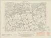
Kent XL.SW - OS Six-Inch Map
1 : 10560 Topographic maps Ordnance Survey Ordnance Survey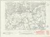
Kent XL.SW - OS Six-Inch Map
1 : 10560 Topographic maps Ordnance Survey Ordnance Survey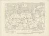
Kent XL.SW - OS Six-Inch Map
1 : 10560 Topographic maps Ordnance Survey Ordnance Survey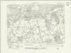
Kent XL.SW - OS Six-Inch Map
1 : 10560 Topographic maps Ordnance Survey Ordnance Survey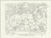
Kent XL.SW - OS Six-Inch Map
1 : 10560 Topographic maps Ordnance Survey Ordnance Survey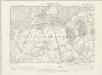
Kent XL.SW - OS Six-Inch Map
1 : 10560 Topographic maps Ordnance Survey Ordnance Survey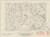
Kent L.NW - OS Six-Inch Map
1 : 10560 Topographic maps Ordnance Survey Ordnance Survey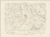
Kent L.NW - OS Six-Inch Map
1 : 10560 Topographic maps Ordnance Survey Ordnance Survey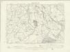
Kent L.NW - OS Six-Inch Map
1 : 10560 Topographic maps Ordnance Survey Ordnance Survey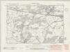
Kent L.SW - OS Six-Inch Map
1 : 10560 Topographic maps Ordnance Survey Ordnance Survey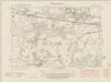
Kent L.SW - OS Six-Inch Map
1 : 10560 Topographic maps Ordnance Survey Ordnance Survey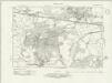
Kent L.SW - OS Six-Inch Map
1 : 10560 Topographic maps Ordnance Survey Ordnance Survey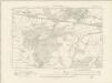
Kent L.SW - OS Six-Inch Map
1 : 10560 Topographic maps Ordnance Survey Ordnance Survey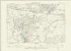
Kent L.SW - OS Six-Inch Map
1 : 10560 Topographic maps Ordnance Survey Ordnance Survey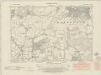
Kent XL.SE - OS Six-Inch Map
1 : 10560 Topographic maps Ordnance Survey Ordnance Survey
Kent XL.SE - OS Six-Inch Map
1 : 10560 Topographic maps Ordnance Survey Ordnance Survey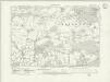
Kent XL.SE - OS Six-Inch Map
1 : 10560 Topographic maps Ordnance Survey Ordnance Survey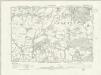
Kent XL.SE - OS Six-Inch Map
1 : 10560 Topographic maps Ordnance Survey Ordnance Survey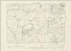
Kent XL.SE - OS Six-Inch Map
1 : 10560 Topographic maps Ordnance Survey Ordnance Survey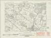
Kent L.NE - OS Six-Inch Map
1 : 10560 Topographic maps Ordnance Survey Ordnance Survey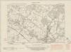
Kent L.NE - OS Six-Inch Map
1 : 10560 Topographic maps Ordnance Survey Ordnance Survey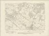
Kent L.NE - OS Six-Inch Map
1 : 10560 Topographic maps Ordnance Survey Ordnance Survey