Maps of East Malling and Larkfield
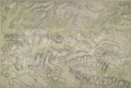
Addington (Kent)
1 : 10560 This map of north-west Kent is drawn on rectangular sheet lines and enclosed by a black border. Fields are coloured brown where cultivated, and green or blank if untilled. Stonework buildings and structures are drawn in red ink at major settlements. Infilled or blocked areas of black or sepia ink indicate structures and buildings made from less permanent materials, such as wood. Spot heights (altitudes)are drawn in red ink figures. This is the earliest plan to distinguish pictorially between coniferous and deciduous trees.
Kent XLI - OS Six-Inch Map
1 : 10560 Topographic maps Ordnance Survey Ordnance Survey
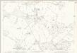
Mereworth, Kent
1 : 10560 Irregular field boundaries enclosing agricultural land dominate the Medway Valley in Kent, around the main settlements of Hadlow, Mereworth and Yalding. Rays in red ink intersect the map, evidence of measurements taken by the surveyor between fixed triangulation points. The ruled black-sheet lines indicate the edges of the area that was copied for plans 100 and 119.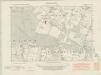
Kent XLI.NE - OS Six-Inch Map
1 : 10560 Topographic maps Ordnance Survey Ordnance Survey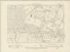
Kent XLI.NE - OS Six-Inch Map
1 : 10560 Topographic maps Ordnance Survey Ordnance Survey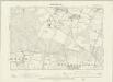
Kent XLI.NE - OS Six-Inch Map
1 : 10560 Topographic maps Ordnance Survey Ordnance Survey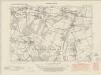
Kent XLI.SE - OS Six-Inch Map
1 : 10560 Topographic maps Ordnance Survey Ordnance Survey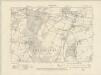
Kent XLI.SE - OS Six-Inch Map
1 : 10560 Topographic maps Ordnance Survey Ordnance Survey
Kent XLI.SE - OS Six-Inch Map
1 : 10560 Topographic maps Ordnance Survey Ordnance Survey
Kent XLII.NW - OS Six-Inch Map
1 : 10560 Topographic maps Ordnance Survey Ordnance Survey
Kent XLII.NW - OS Six-Inch Map
1 : 10560 Topographic maps Ordnance Survey Ordnance Survey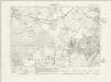
Kent XLII.NW - OS Six-Inch Map
1 : 10560 Topographic maps Ordnance Survey Ordnance Survey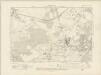
Kent XLII.NW - OS Six-Inch Map
1 : 10560 Topographic maps Ordnance Survey Ordnance Survey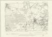
Kent XLII.NW - OS Six-Inch Map
1 : 10560 Topographic maps Ordnance Survey Ordnance Survey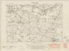
Kent XLII.SW - OS Six-Inch Map
1 : 10560 Topographic maps Ordnance Survey Ordnance Survey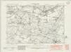
Kent XLII.SW - OS Six-Inch Map
1 : 10560 Topographic maps Ordnance Survey Ordnance Survey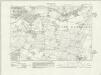
Kent XLII.SW - OS Six-Inch Map
1 : 10560 Topographic maps Ordnance Survey Ordnance Survey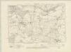
Kent XLII.SW - OS Six-Inch Map
1 : 10560 Topographic maps Ordnance Survey Ordnance Survey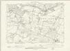
Kent XLII.SW - OS Six-Inch Map
1 : 10560 Topographic maps Ordnance Survey Ordnance Survey
Kent XLI.3 (includes: Mereworth; Offham; Ryarsh; West Malling) - 25 Inch Map
1 : 2500 Topographic maps Ordnance Survey Ordnance Survey
Kent XLI.3 (includes: Mereworth; Offham; Ryarsh; West Malling) - 25 Inch Map
1 : 2500 Topographic maps Ordnance Survey Ordnance Survey
Kent XLI.3 (includes: Mereworth; Offham; Ryarsh; West Malling) - 25 Inch Map
1 : 2500 Topographic maps Ordnance Survey Ordnance Survey
Kent XLI.7 (includes: Mereworth; Wateringbury; West Malling) - 25 Inch Map
1 : 2500 Topographic maps Ordnance Survey Ordnance Survey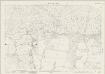
Kent XLI.7 (includes: Mereworth; Wateringbury; West Malling) - 25 Inch Map
1 : 2500 Topographic maps Ordnance Survey Ordnance Survey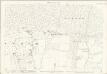
Kent XLI.7 (includes: Mereworth; Wateringbury; West Malling) - 25 Inch Map
1 : 2500 Topographic maps Ordnance Survey Ordnance Survey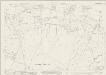
Kent XLI.11 (includes: Mereworth; Wateringbury) - 25 Inch Map
1 : 2500 Topographic maps Ordnance Survey Ordnance Survey
Kent XLI.11 (includes: Mereworth; Wateringbury) - 25 Inch Map
1 : 2500 Topographic maps Ordnance Survey Ordnance Survey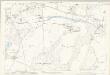
Kent XLI.11 (includes: Mereworth; Wateringbury) - 25 Inch Map
1 : 2500 Topographic maps Ordnance Survey Ordnance Survey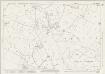
Kent XLI.15 (includes: East Peckham; Mereworth; Nettlestead; Wateringbury) - 25 Inch Map
1 : 2500 Topographic maps Ordnance Survey Ordnance Survey
Kent XLI.15 (includes: East Peckham; Mereworth; Nettlestead; Wateringbury) - 25 Inch Map
1 : 2500 Topographic maps Ordnance Survey Ordnance Survey