Maps of Netherlands
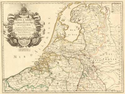
La Hollande ou les Provinces Unies des Pays Bas
1 : 890000 Mollova mapová sbírka La Pointe, François de Danet, Guillaume
Summaria descriptio Fresiae Universae, cum latissime patuit nomen post emigrationem Francorum, Saxonumq. accessionem
auctore Mensone Alting Gerard de Broen fecit Amstelodami. [Amstelaedami] : [apud Henricum Wetstenium]
Théatre de la guerre actuelle, en Allemagne, en Pologne et en Turquie. n2
1 : 900000 Chanlaire, Pierre Grégoire 1758-1817 Paris : chez l'auteur P. G. Chanlaire
Provinces-Unies des Pays-Bas : avec leurs acquisitions dans la Flandre, le Brabant, le Limbourg et le Lyege
1 : 700000 par le Sr. Sanson, Géographe ordinaire du Roy Cordier, sculp. Paris : H. Jaillot
Provinces-Unies des Pays-Bas avec leurs Acquisitions dans la Flandre, le Brabant, le Limbourg et le Lyege
1 : 770000 Mollova mapová sbírka Sanson, Guillaume Cordier, Louis Jaillot, Alexis Hubert
Provinces-Unies des Pays-Bas
1 : 625000 Mollova mapová sbírka Sanson, Guillaume Jaillot, Alexis Hubert
Belgica foederata complectens septem provincias, ducatum Geldriae, comitatus Hollandiae et Zelandiae, dioeceses Trajectum, Transisulaniam, Groningam et Frisiam et circumjacentes provincias.
1 : 650000 Amsterdam : venalis habent Ger. et Leon Valk
Artificiosa et geographica tabula sub leonis figura XVII. inferiori Germaniae provincias representans, cui addita sunt singularum insignia, una cum ordinaria praefecturarum distinctione, longe elimatius quam hactenus unquam expressa
1 : 1480000 Belgie Visscher, Claes Jansz. C.I. Visscher
Les Dix-Sept Provinces Des Pays-Bas
1 : 760000 Mollova mapová sbírka Sanson, Guillaume Sanson, Guillaume
Le Cours de la Riviere du Rhein
1 : 1100000 Mollova mapová sbírka Sanson, Guillaume Mortier, Pierre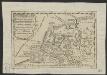
Oud Nederland zo als het zelve door de Batavieren, Marezaaten, Sturien, Frisiabonen ... en andere volkeren oudtijds bewoond wierd, naar de plaatsing der beste schrijveren.
1 : 3500000 Te Amsterdam : bij Arend Fokke Simonsz.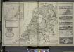
A new and exact map of the United Provinces, or Netherlands &c.
from The world described, or, A new and correct sett of maps : shewing the kingdoms and states in all the known parts of the earth, with the principal cities, and most considerable towns in the world ... / ... by Herman Moll, geographer ...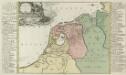
Summaria Descriptio Fresiae Vniversae; cum latissimè patuit nomen Post emigrationem Francorvm; Saxonvmq; accessionem
1 : 1400000 Mollova mapová sbírka Alting, Menso Broen, Gerrit de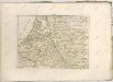

XVII Provinciarum Inferioris Germaniae
1 : 1200000 Mollova mapová sbírka Visscher, Nicolaes Fuchs, Jobst Christoph
XVII Provinciarum Inferioris Germaniae
1 : 1200000 Mollova mapová sbírka Visscher, Claes Jansz. Goos, Abraham Visscher, Claes Janszoon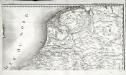
Carte de la république de France, 8
1 Blatt : 35 x 59 cm s.n.
Holland und Berg
Allgemeiner Atlas [Walch, Johannes] im Verlag bei Johannes Walch
Provinces unies des Pays-Bas avec leurs acquisitions dans la Flandre, le Brabant, le Limbourg, et le Lyege et les places qu'elles tiennent sur le Rhin dans le Duché de Cleves, et dans l'Archevesché et Eslectorat de Cologne
1 : 700000 par G. Valck. À Amsterdam : chez G. Valck
Tabula Geographica qua Pars Septentrionalis sive Inferior Rheni, Mosae et Moselle
1 : 1100000 Mollova mapová sbírka Visscher, Nicolaes Jansz. Visscher, Nicolaus
Tabula Geographica qua Pars Septentrionalis sive Inferior Rheni, Mosae et Moselle
1 : 1100000 Mollova mapová sbírka Visscher, Nicolaes Jansz. Visscher, Nicolaus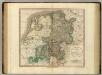
Westphalia.
1 : 1020000 Cary, John, ca. 1754-1835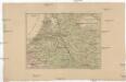
Kriegsschauplatz der Maas und Sambre Armeen
1 : 2780000 Belgie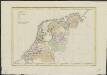
La Hollande
1 : 650000 W.C. v. Baarsel del. et sculp. [S.l.] : J. R. Poster excudit
Descriptio veteris agri Batavi et Frisii omnisque regionis quae hodie est in dicione VII. Foederatorum cis et ultra Rhenum
1 : 950000 auctore Mensone Alting. [Amstelaedami] : [apud Henricum Wetstenium]

Niederland u. Belgien.
1 : 1000000 Ziegler, J. M.
Holland or the United Provinces.
from A new systeme of the mathematicks: containing I. Arithmetick, as well natural and decimal, as in species, or the principles of algebra. II. Practical geometry, together with the first six books of Euclid's Elements, as also the eleventh and twelfth, symbo
La republica Battava
1 : 2400000 Nizozemsko Zatta, Antonio Zatta