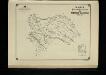
Maps of Vinnytsya
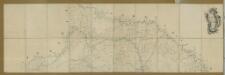
Karta putej dviženīja armīi Minicha v 1739 g.
Ukraine Černivci Krieg Minich, Burchard-Christofor
Übersichtskarte von Mittel - Europa

Bałta, Umań, Bracław
1 : 750000 Braslaw (Bělorusko : oblast) Mach, O. K. u. k. Militärgeographisches Institut
Balta, Uman, Braclaw
1 : 750000 Braslaw (Bělorusko : oblast) K. k. militär-geographisches Institut
Carte de la Roumanie et pays limitrophes. Balta
1 : 500000 France. Service géographique de l'armée [Paris] : Service géographique de l'armée
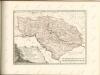
[Ukraine]
1 Karte : Kupferdruck ; 18 x 13 cm [Trattner]
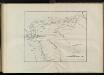
[Bodolien, Moldawien]
1 Karte : Kupferdruck ; 18 x 13 cm [Trattner]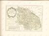

Czernowitz
1 : 400000 Instytut wojskowo-geograficzny
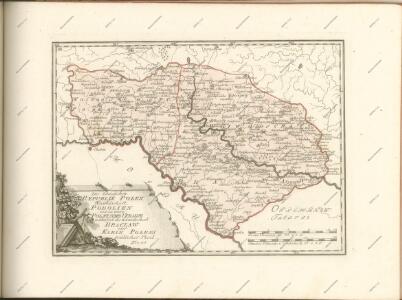
Ukrainae pars, quae Podolia palatinatus vulgo dicitur / per Guil. le Vasseur de Beauplan s. r. m.tis
1 : 420000 1 Karte : Kupferdruck ; 43 x 52 cm Beauplan, Guillaume le Vasseur de [Verlag nicht ermittelbar]
Generalkarte von Zentraleuropa
Carte de la Moldavie
1 : 330000 Moldawien, Bessarabien
Generalkarte von Zentraleuropa

Generalkarte von Zentraleuropa

G. Freytags Karte der Bukowina
1 : 400000 Bukovina (Rumunsko a Ukrajina) Freytag, Gustav Kartogr. Anstalt G. Freytag & Berndt
G. Freytags Karte der Bukowina
1 : 400000 Bukovina (Rumunsko a Ukrajina) Freytag, Gustav G. Freytag & Berndt
Harta Cailor de Comunicatie din Judetul Dorohoi
Rumänien Judeţ Dorohoi Verkehrsweg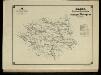
Harta Cailor de Comunicatie din Judetul Botosani
Rumänien Judeţ Botoşani Verkehrsweg


Kamieniec Podolski.
from Spezialkarte der osterreichisch-ungarischen Monarchie.
Borszczow.
from Spezialkarte der osterreichisch-ungarischen Monarchie.
Mielnica.
from Spezialkarte der osterreichisch-ungarischen Monarchie.
Czernowitz.
from Spezialkarte der osterreichisch-ungarischen Monarchie.
Suczawa.
from Spezialkarte der osterreichisch-ungarischen Monarchie.
Skalat und Grzymakow.
from Spezialkarte der osterreichisch-ungarischen Monarchie.
Skałat und Grzymałów
1 : 75000 Ukrajina Steindl, F. K. u. k. Militärgeographisches Institut