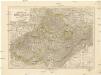
Maps of Western Slovakia
Podrobný přehled politického rozdělení Slovenska
Vojenský zeměpisný ústav
Flusskarte für die Projectirung der Ent- und Bewässerung der March und Thaya Gebiete
1 : 500000 Dolní Rakousko (Rakousko) Mannsfeld, Grafen Hieronymus, zu Edwards, Edward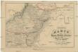
Uibersichts Karte der Eisen-Bahn-Route, zwischen Wien und Bochnia, nebst den Flügel-Bahnen
1 : 1150000 Bochnia (Polsko) H. Engel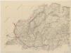
Podrobný přehled politického rozdělení Slovenska

Conjuctio Danubij cum Oder vel per Moravam et Beczwam vel per Vagum, et Olsam
Mollova mapová sbírka Vogemont, Lothar
Braun: Autová mapa I-III (Slovensko, Podkarpatská Rus)

Markgrafschaft Mähren und Herzogthum Ober u. Nieder-Schlesien
1 : 1850000 Morava (Česko) Stieler, Adolf Mädel, Adolf Justus Perthes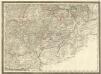
Markgrafthum Mähren]
1 : 500000 Mollova mapová sbírka
Die Kronländer Maehren und Schlesien
Morava (Česko) Marco Berra
Brünn, Troppau, Neutra
1 : 750000 Brno (Česko : oblast) Fendl, Jos. K. u. k. Militärgeographisches Institut
Brünn, Troppau, Neutra
1 : 750000 Brno (Česko : oblast) K. u. k. Militär-geographisches Institut
Brünn, Troppau, Neutra
1 : 750000 Brno (Česko : oblast) K. k. militär-geographisches Institut
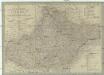
Podrobný přehled politického rozdělení Slovenska a Podkarp. Rusi
Vojenský zeměpisný ústav
Podrobný přehled politického rozdělení země Slovenské a Podkarpatoruské
Vojenský zeměpisný ústav
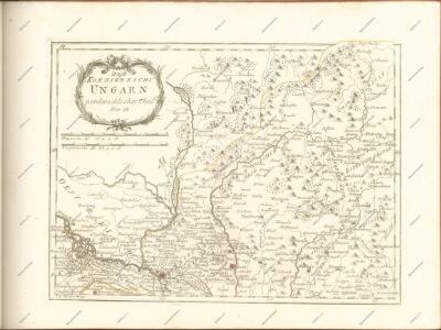
Nieder-Ungern
Slovensko západní Kipferling, Karl Joseph Berken von Ottendorff, Johann im Verlage des Kunst- und Industrie Comptoirs
Nieder-Ungern
Slovensko západní Kipferling, Karl Joseph Berken von Ottendorff, Johann im Verlage des Kunst- und Industrie Comptoirs
Nástěnná mapa hejtmanství Čáslavského

Übersichtskarte von Mittel - Europa

Novissima et accuratissima Hungariae cum circumjacentibus

Die March
Morava, řeka-oblast
Bez titulu: Přehledná mapa střední Evropy

Orohydrographisches tableau aus der überschts-karte von Mittel -Europa

Carte générale du marquisat de Moravie divisée en six cercles dressée sur les memoires les plus nouveaux
1 : 510000 Morava (Česko) Condet, Johannes Cóvens et Mortier
MORAVIAE olim Regnum nunc Marchionatus
1 : 488000 Morava (Česko) Dvořák, Samuel
Flusskarte für die Projektirung der Ent- und Bewässerung der March und Thaya Gebiete : auf Anordnung Seiner Excellenz des Hrr. k.k. Ackerbau-Ministers Hieronymus Grafen zu Mannsfeld
Hobohm, H. Stockinger & Morsack
Tabula generalis Marchionatus Moraviae in sex circulos divisae
1 : 500000 Morava (Česko) Müller, Johann Christoph Johann Baptist Homann
Juhovýchodné Moravskoslezsko, Západné Slovensko
1 : 300000 Bratislava (Slovensko) Fastr Eduard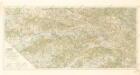
Střední Pováží
Die Markgrafschaft Mähren nebst dem oesterreichischen Antheile an Schlesien
1 : 490000 Morava (Česko) Weiland, Karl Ferdinand Hensgen, C. im Verlage des Geograph. Instituts
Die Markgrafschaft Mähren nebst Oesterreichisch Schlesien
1 : 807000 Morava (Česko) Weiland, Karl Ferdinand Jungmann, Carl Im Verlage de Geograph. Instituts
Die Markgrafschaft Mähren nebst Oesterreichisch Schlesien
1 : 500000 Morava (Česko) Weiland, Karl Ferdinand Jungmann, Carl Geograph. Institut
Die Markgrafschaft Mähren nebst Oesterreichisch Schlesien
1 : 530000 Morava (Česko) Weiland, Karl Ferdinand Jungmann, Carl Geograph. Institut
Die Markgrafschaft Mähren nebst Oesterreichisch Schlesien
1 : 510000 Morava (Česko) Weiland, Karl Ferdinand Jungmann, Carl im Verlage des Geograph. Instituts