Maps of Belarus

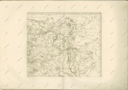
Charte von Russisch Litauen
1 : 1320000 Bělorusko auf Kosten der Homännischen Erben
Charte von Russisch Litauen
1 : 1320000 Bělorusko auf Kosten der Homännischen Erben
Charte von Russisch Litauen
1 : 1320000 Bělorusko auf Kosten der Homännischen Erben
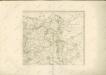
IV, uit: General-Karte von Mittel-Europa in 12 Blättern, im Masse 1:1.200.000 / entworfen, bearb. und hrsg. von Josef Schlacher
1 : 1200000 Annotatie: Blad 6 ontbreekt; Annotatie geografische gegevens: 21 maatstokken op blad 9; Legenda op blad 9 Wien : K.K. Militär Geografisches Institut
Li palatinati di Minsk, Mscislaw, Polok, e Witebsk nella Littuania / tratta dall'atlante polacco del
1 : 1400000 1 Karte : Kupferdruck ; 40 x 30 cm Zuliani, Giuliano presso Antonio Zatta
Delineatio memorabilis conflictus et victoriae Lithuanorum Duce Radivilio de Cricevio
Bělorusko
Castra defensiva Ducis Radiuly Reciciae, obiecta aduentui Eliae Bohaczenlio
Bělorusko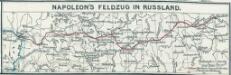
Napoleon's Feldzug in Russland
1 : 7500000 Russland / Europäischer Teil Russlandfeldzug <1812>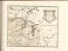

Raspoloženīe vojska 1. ījulja.
Litauen Weißrussland Russlandfeldzug <1812>
Wiłkomierz, Dwinsk (Dünaburg), Wilna, Wilejka, Słonim, Mińsk
1 : 300000 Minsk (Bělorusko : oblast)
Połock, Witebsk, Smolensk
1 : 750000 Polack (Bělorusko) K. u. k. Militärgeographisches Institut
Übersichtskarte von Mittel - Europa

Wilna, Minsk, Grodno, Słonim
1 : 750000 Grodno (Bělorusko : oblast) Jakupec, M. K. u. k. Militärgeographisches Institut
Wilna, Minsk, Grodno, Słonim
1 : 750000 Grodno (Bělorusko : oblast) K. k. militär-geographisches Institut
Strategische Übersichts-Karte des polnisch-litaurischen Armee-Bewegungraumes

Kijew, Žitomir, Owrucz, Czernobyl, Mozyr, Łojew
1 : 750000 Kyjev (Ukrajina : oblast) Korb, L. K. u. k. Militärgeographisches Institut
Bobrujsk, Czerikow, Str. Szkłow
1 : 750000 Bobrujsk (Bělorusko) Dornhofer, J. K. u. k. Militärgeographisches Institut
Bobrujsk, Czerikow, Str. Szkłow
1 : 750000 Bobrujsk (Bělorusko) K. k. militär-geographisches Institut
Kijew, Žitomir, Owrucz, Czernobyl, Mozyr, Łoiew
1 : 750000 Kyjev (Ukrajina : oblast) K. k. militär-geographisches Institut
Übersichtskarte von Mittel - Europa

[Lietuvos žemelapis]
Litva
Dwinsk (Dünaburg), Friedrichstadt
1 : 750000 Dokšycy (Bělorusko) K. u. k. Militärgeographisches Institut
Übersichtskarte von Mittel - Europa

Übersichtskarte von Mittel - Europa

Dviženīe 1j i 2j armīi k Smolensku.
Russland Smolensk Russlandfeldzug <1812>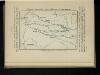
Karta di’jstvij ot‘‘ Bereziny k‘‘ Vil’ně
Litauen Vilnius Russlandfeldzug <1812>
Trigonometrisk grunnlag, vedlegg 65, 6-9: Grunnlagspunkter for Struves meridianbue fra Vilnius, Hrodna og Kurland
1 : 200000 de Tenner