Maps of Barysaw District

Maps of Barysaw District

$title$

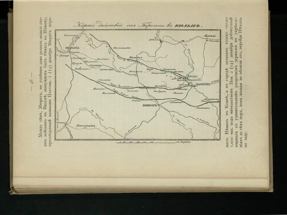
Karta di’jstvij ot‘‘ Bereziny k‘‘ Vil’ně

Litauen Vilnius Russlandfeldzug <1812>
$title$

Trigonometrisk grunnlag, vedlegg 65, 6-9: Grunnlagspunkter for Struves meridianbue fra Vilnius, Hrodna og Kurland

1 : 200000 de Tenner
$title$

Iwje, Ljubtscha, Nowogródek, Korelitschi, Zdzienciol, Gorodischtsche

1 : 100000 Dzjatlava (Bělorusko)
$title$

Plan mi''stopoloženija meždu Borisovym i Zembinom

Russland Borisov Russlandfeldzug <1812>
$title$

Die Beresina

1 : 500000 Beresina-Gebiet Schlacht an der Beresina
$title$

Vilnius. XVIII. šimtmečio pabaigoje

Vilnius Altstadt
$title$

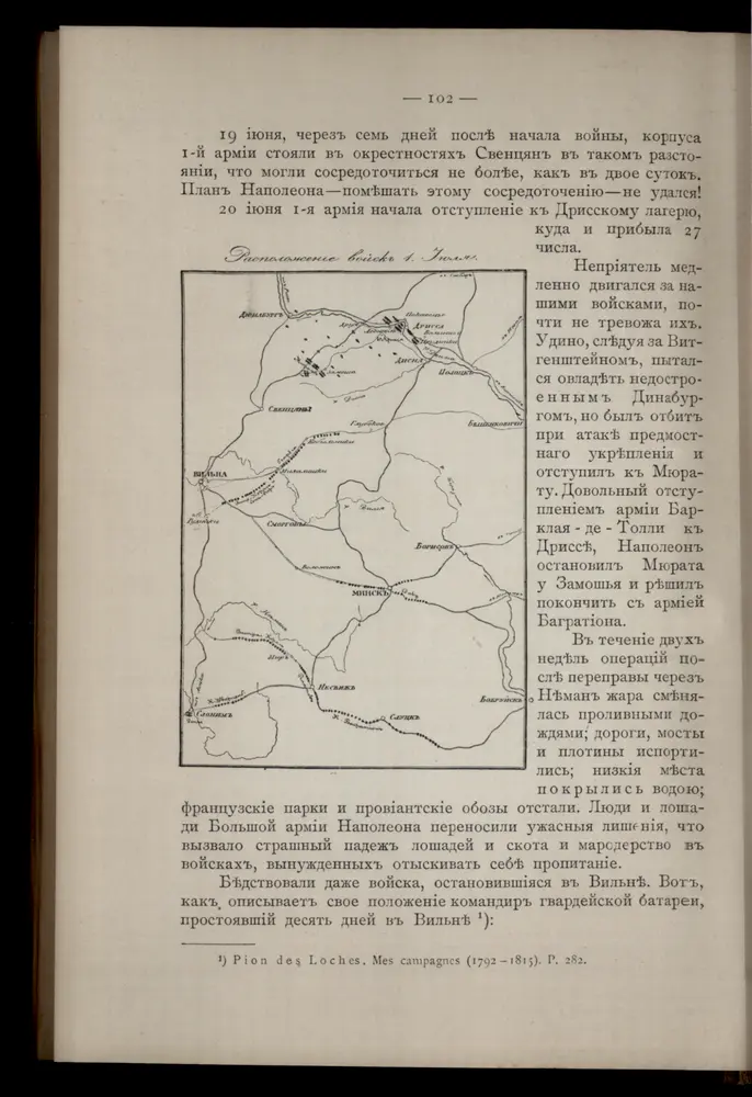
Raspoloženīe vojska 1. ījulja.

Litauen Weißrussland Russlandfeldzug <1812>
$title$

Wilna, Minsk, Grodno, Słonim

1 : 750000 Grodno (Bělorusko : oblast) Jakupec, M. K. u. k. Militärgeographisches Institut
$title$

Wilna, Minsk, Grodno, Słonim

1 : 750000 Grodno (Bělorusko : oblast) K. k. militär-geographisches Institut
$title$

Wiłkomierz, Dwinsk (Dünaburg), Wilna, Wilejka, Słonim, Mińsk

1 : 300000 Minsk (Bělorusko : oblast)
$title$

Übersichtskarte von Mittel - Europa

$title$

Übersichtskarte von Mittel - Europa

$title$

Zdzienciol, Gorodischtsche, Derewna, Ljachowitschi

1 : 100000 Bělorusko
$title$

[Lietuvos žemelapis]

Litva
$title$

[Vilnius a okolí]

1 : 38000 Vilnius-oblast (Litva) Frolov
$title$

Nowogródek

$title$

Delineatio memorabilis conflictus et victoriae Lithuanorum Duce Radivilio de Cricevio

Bělorusko
$title$

Castra defensiva Ducis Radiuly Reciciae, obiecta aduentui Eliae Bohaczenlio

Bělorusko
$title$

$title$

Mapa nowej unji Polski z Litwą

1 : 2000000 Bělorusko Romer, Eugeniusz Instytut kartograficzny Atlas
$title$

IV, uit: General-Karte von Mittel-Europa in 12 Blättern, im Masse 1:1.200.000 / entworfen, bearb. und hrsg. von Josef Schlacher

1 : 1200000 Annotatie: Blad 6 ontbreekt; Annotatie geografische gegevens: 21 maatstokken op blad 9; Legenda op blad 9 Wien : K.K. Militär Geografisches Institut
$title$

Magnus ducatus Lithuania

1 : 149000 Bělorusko Lotter, Tobias Conrad Lotter, Georg F. Tob. Conr. Lotter
$title$

Magnus ducatus Lithuania

1 : 149000 Bělorusko Lotter, Tobias Conrad Lotter, Georg F. Tob. Conr. Lotter
$title$

Europe Centrale (Partie Orientale).

1 : 1750000 Jouvet et Cie.
$title$

Magni Dvcatvs Litvaniae in svos Palatinatvs et Districtvs Divisvs

1 : 1600000 Mollova mapová sbírka Nieprzecki, Jan Homann, Johann Baptista - dědici
$title$

Magn[us] dvcatvs Litvaniae

1 : 1630000 Bělorusko Nieprzecki, Jan Mayer, Tobias impensis Homannianorum Heredum
$title$

MAGN[US] DVCATVS LITVANIAE

1 : 1670000 Bělorusko Nieprzecki, Jan Mayer, Tobias impensis Homannianorum Heredum
$title$

Magnus ducatus Lithuania in suos Palatinatus et Castellanias divisa non solum accuratisime delineata, sed etiam plurimis in alliis Mappis omissis locis

1 : 1350000 Georg Friderich Lotter, sculps. Aug. Vind. : Tob. Conr. Lotter
$title$

Russia in Europe Part V.

1 : 2100000 Society for the Diffusion of Useful Knowledge (Great Britain)
$title$

© MapTiler © OpenStreetMap contributors
How does it work?
These instructions will show you how to find historical maps online.
Getting started
Type the place name in the search box to find the exact location. You can further adjust the search by zooming in and out.
Zoom
Zoom in and out with the buttons or use your mouse or touchpad natively.
Exact Area tool
Click here and draw a rectangle over the map to precisely define the search area.
Set filters
Narrow your search with advanced settings, such as Years (from/to), Fulltext, Publisher, etc.
Results
See the results of your search on the right side. You can scroll down to find more maps of this location.
?

Download OldMapsOnline Mobile