Maps of Spain

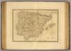
Spanien und Portugal
Espagne, Portugal.
1 : 3600000 Janvier, Jean
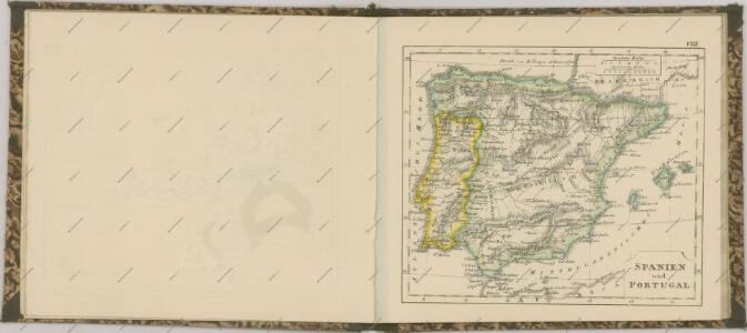
Spanien und Portugal
1 : 2300000 entworfen und gezeichnet von C. F. Weiland L.G. Jaeger sc. Weimar : Verlag des Geograph. Instituts
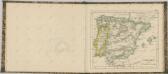
Spanien und Portugal
Schul-Atlas über alle Theile der Erde nach dem neuesten Zustande, und über das Weltgebäude Stieler, Adolf bei Justus Perthes
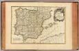
Spanien und Portugal
Volksschul-Atlas über alle Teile der Erde Lange, Henry Druck und Verlag von Georg Westermann
Spanien und Portugal
1 : 2300000 entworfen und gezeichnet von C. F. Weiland L.G. Jaeger sc. Weimar : Verlag des Geograph. Instituts
Španiely a Portugaly.


Spanien und Portugal
1 : 2350000 Cádiz (Španělsko) Weiland, Karl Ferdinand im Verlage des Geographischen Instituts
Spanien und Portugal
1 : 2350000 Cádiz (Španělsko) Weiland, Karl Ferdinand im Verlage des Geographischen Instituts
Spanien und Portugal
Stieler's Hand-Atlas Stieler, Adolf bei Justus Perthes
Accuratissima totius regni Hispaniae Portugalliaeq[ue] tabula et typus novissimus
1 : 2370000 Portugalsko Wit, Frederick de x [officina Frederici de Witt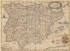
Typus Hispaniae ab Hesselo Gerardo delineata [...] [Karte], in: Novus atlas absolutissimus, Bd. 6, S. 15.
1 Karte aus Atlas Janssonius Offizin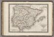
Espagne Ancienne ou Iberie.
1 : 3800000 Monin, C.V.
Spain and Portugal.
1 : 3000000 Colton, G.W.
Spanien und Portugal
1 Karte : Kupferdruck ; 25 x 29 cm Sotzmann; Ramberg s.n.
Regnorum Hispaniæ et Portvgalliæ tabula generalis
1 Karte : Kupferdruck ; 45 x 57 cm Güssefeld; López chez les Heret. de Homann
Regnorum Hispaniæ et Portvgalliæ tabula generalis
1 Karte : Kupferdruck ; 45 x 57 cm Güssefeld; López chez les Heret. de Homann
Novissima et accuratissima tabula regnorum Hispaniæ et Portugalliæ
1 Karte : Kupferdruck ; 46 x 59 cm Allard ex officina I. Cóvens et C. Mortier
Spanien und Portugal
1 : 2260000 entworfen und gezeichnet von C. F. Weiland Weimar : Verlag des Geographischen Instituts
Spanien und Portugal
1 : 2350000 Cádiz (Španělsko) Weiland, Karl Ferdinand im Verlage des Geographischen Instituts
Spanien und Portugal
1 : 2350000 Cádiz (Španělsko) Weiland, Karl Ferdinand im Verlage des Geographischen Instituts
Spanien und Portugal
1 : 2280000 Portugalsko Weiland, Karl Ferdinand im Verlage des Geograph. Instituts
El reyno de Espan[n]a
1 Karte : Kupferdruck ; 47 x 61 cm López; Julien; Nolin en casa de Thomas Lopez pensionista de S.M.C.a, chez le Sr. Julien a l'Hotel de soubise
El reyno de Espan[n]a
1 Karte : Kupferdruck ; 48 x 61 cm Nolin; Guérard en casa del autor
Hispaniarum Portugalliæque coronarum typus novus
1 Karte : Kupferdruck ; 48 x 59 cm Valck s.n.
Spanjen en Portúgal
1 : 6000000 [S.l. : s.n.]
Typus Hispaniae [Karte], in: Gerardi Mercatoris et I. Hondii Newer Atlas, oder, Grosses Weltbuch, Bd. 2, S. 168.
1 Karte aus Atlas Mercator, Gerhard und Hondius, Jodocus Jansson, Jan