Maps of Balikpapan

Balikpapan / Aust[ralian] Army S[ur]v[e]y Topo[graphic] Co[mpan]y
Australian Army Survey Topographic Compagny [S.l.] : Aust[ralian] Army S[ur]v[e]y Topo[graphic] Co[mpan]y
Balikpapan : opgenomen door den Topografischen Dienst in 1935-1939
Topografische Dienst Batavia Batavia : Reproductiebedrijf Topografische Dienst
Borneo : Res[identie] Z[uider-] en O[oster] Afd[eling] van Borneo : opgenomen door den Topografischen Dienst in 1926-1929 / Topografische Dienst, Batavia
[Batavia : Topografische Dienst]
Balikpapan : sheet C / compilation: Aust[ralian] Army Topo[graphic] S[ur]v[e]y Co[mpan]y
Svy. Dte. H.Q. SEALF Aust. Army Topo Sve Coy [S.l.] : Svy. Dte. H.Q. SEALF
Balikpapan : sheet A / compilation: Aust[ralian] Army Topo[graphic] S[ur]v[e]y Co[mpan]y
Svy. Dte. H.Q. SEALF Aust. Army Topo Sve Coy [S.l.] : Svy. Dte. H.Q. SEALF
Balikpapan : sheet B / compilation: Aust[ralian] Army Topo[graphic] S[ur]v[e]y Co[mpan]y
Svy. Dte. H.Q. SEALF Aust. Army Topo Sve Coy [S.l.] : Svy. Dte. H.Q. SEALF
[Batakan-Ketjil] : opgenomen door den Topografischen Dienst in 1926-1929
Topografische Dienst Batavia Batavia : Reproductiebedrijf Topografische Dienst
[Balikpapan] : opgenomen door den Topografischen Dienst in 1926-1929
Topografische Dienst Batavia Batavia : Reproductiebedrijf Topografische Dienst
[Karanganjar] : opgenomen door den Topografischen Dienst in 1926-1929
Topografische Dienst Batavia Batavia : Reproductiebedrijf Topografische Dienst
[Manggar-Besar] : opgenomen door den Topografischen Dienst in 1926-1929
Topografische Dienst Batavia Batavia : Reproductiebedrijf Topografische Dienst
Blad XII Ketoengau, blad o, uit: Residentie Wester-Afdeeling van Borneo : weg- en rivierkaart / Topographisch Bureau
1 : 50000 Annotatie: Voor aanwezige bladen zie overzichtsblad Topographisch Bureau, Batavia Batavia : Topographisch Bureau
Samarinda / Survey of India
Survey of India [S.l.] : Survey of India
Balikpapan / Survey of India
Survey of India [S.l.] : Survey of India
Balikpapan / prepared under the direction of the Chief of Engineers by the Army Map Service, US Army
US Army Washington D.C. . Army Map Service Washington D.C. : Army Map Service, US Army
Samarinda / prepared under the direction of the Chief of Engineers by the Army Map Service, US Army
US Army Washington D.C. . Army Map Service Washington D.C. : Army Map Service, US Army
Toenan : sheet B / compilation: Aust[ralian] Army Topo[graphic] S[ur]v[e]y Co[mpan]y
Svy. Dte. H.Q. SEALF Aust. Army Topo Sve Coy [S.l.] : Svy. Dte. H.Q. SEALF
Riko : sheet B / compilation: Aust[ralian] Army Topo[graphic] S[ur]v[e]y Co[mpan]y
Svy. Dte. H.Q. SEALF Aust. Army Topo Sve Coy [S.l.] : Svy. Dte. H.Q. SEALF
Kaart van het Landschap Koetai
[S.l. : s.n.]
Bandjarmasin / samengesteld en gedrukt bij den Topografischen Dienst
Topografische Dienst Batavia Batavia : Topografische Dienst
Bandjarmasin / Topografische Dienst
Topografische Dienst Batavia Batavia : Topografische Dienst
Bandjermasin / U.S. Army Map Service
U.S. Army Map Service Washington D.C. Washington D.C. : U.S. Army Map Service
Bladwijzer van Zuider- en Ooster Afd[eling] v[an] Borneo
[S.l. : s.n.]
Gouv[ernement] Borneo : Res[identie] Z[uider] en O[oster] Afd[eeling] van Borneo / Topografische Dienst, Batavia
[S.l. : s.n.]
Schetskaart van Midden-Borneo en het landschap Koetei
Topographisch Bureau Batavia Batavia : Topographisch Bureau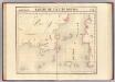
Partie, Borneo. Oceanique no. 20.
1 : 1641836 Vandermaelen, Philippe, 1795-1869
Blad XII Ketoengau, blad p, uit: Residentie Wester-Afdeeling van Borneo : weg- en rivierkaart / Topographisch Bureau
1 : 50000 Annotatie: Voor aanwezige bladen zie overzichtsblad Topographisch Bureau, Batavia Batavia : Topographisch Bureau
Blad XXII Boven-Kapoewas, blad o, uit: Residentie Wester-Afdeeling van Borneo : weg- en rivierkaart / Topographisch Bureau
1 : 50000 Annotatie: Voor aanwezige bladen zie overzichtsblad Topographisch Bureau, Batavia Batavia : Topographisch Bureau
Geologische kaart van zuidelijk Borneo / door H. von Gaffron
Aardrijkskundig Genootschap [Amsterdam : G.L. Brinkman]
Blad XV Kajoeng, uit: Residentie Wester-Afdeeling van Borneo / Topographisch Bureau
1 : 200000 titelvariant: Residentie Westerafdeeling van Borneo; Annotatie: Titelvariant: Residentie Westerafdeeling van Borneo; Voor aanwezige bladen zie overzichtsblad; Annotatie geografische gegevens: Opname: 1886-1895 Topographisch Bureau, Batavia Batavia : Topographisch Bureau
![Balikpapan / Aust[ralian] Army S[ur]v[e]y Topo[graphic] Co[mpan]y](https://images-2.georeferencer.com/images/iiif/670666052869/full/,300/0/native.jpg)

