Maps of Bontang

Blad XII Ketoengau, blad o, uit: Residentie Wester-Afdeeling van Borneo : weg- en rivierkaart / Topographisch Bureau
1 : 50000 Annotatie: Voor aanwezige bladen zie overzichtsblad Topographisch Bureau, Batavia Batavia : Topographisch Bureau
Blad XXV Boengan, blad k, uit: Residentie Wester-Afdeeling van Borneo : weg- en rivierkaart / Topographisch Bureau
1 : 50000 Annotatie: Voor aanwezige bladen zie overzichtsblad Topographisch Bureau, Batavia Batavia : Topographisch Bureau
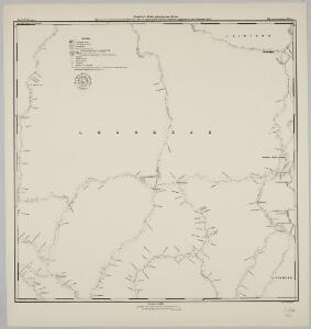
Balikpapan / Survey of India
Survey of India [S.l.] : Survey of India
Kaart van de Onderafdeeling Koetei de Afdeeling Koetei en N[oord] O[ost] Kust van Borneo
Den Haag : Smulders & Co
Blad XXVI Boven Mandai, blad a, uit: Residentie Wester-Afdeeling van Borneo : weg- en rivierkaart / Topographisch Bureau
1 : 50000 Annotatie: Voor aanwezige bladen zie overzichtsblad Topographisch Bureau, Batavia Batavia : Topographisch Bureau
Blad XIX Sintang, blad a, uit: Residentie Wester-Afdeeling van Borneo : weg- en rivierkaart / Topographisch Bureau
1 : 50000 Annotatie: Voor aanwezige bladen zie overzichtsblad Topographisch Bureau, Batavia Batavia : Topographisch Bureau
Schetskaart van de Midden-Doesoen in de Zuider- en Ooster Afdeeling van Borneo / C. Kramers, Kapitein der Infanterie O[ost] I[ndisch] L[eger]
[S.l.] : [s.n.]
Samarinda / prepared under the direction of the Chief of Engineers by the Army Map Service, US Army
US Army Washington D.C. . Army Map Service Washington D.C. : Army Map Service, US Army
Balikpapan / Aust[ralian] Army S[ur]v[e]y Topo[graphic] Co[mpan]y
Australian Army Survey Topographic Compagny [S.l.] : Aust[ralian] Army S[ur]v[e]y Topo[graphic] Co[mpan]y
Adang Bay / Aust[ralian] Army S[ur]v[e]y Topo[graphic] Co[mpan]y
Australian Army Survey Topographic Compagny [S.l.] : Aust[ralian] Army S[ur]v[e]y Topo[graphic] Co[mpan]y
Kn. Melintang / prepared under the direction of the Chief of Engineers by the Army Map Service, US Army ; reproduced by 71 Base Map Rep. Sec. R.E.
US Army Washington D.C. . Army Map Service Washington D.C. : Army Map Service, US Army
Blad XVIII Batang Loepar, blad p, uit: Residentie Wester-Afdeeling van Borneo : weg- en rivierkaart / Topographisch Bureau
1 : 50000 Annotatie: Voor aanwezige bladen zie overzichtsblad Topographisch Bureau, Batavia Batavia : Topographisch Bureau
Blad VII Siding, blad m, uit: Residentie Wester-Afdeeling van Borneo : weg- en rivierkaart / Topographisch Bureau
1 : 50000 Annotatie: Voor aanwezige bladen zie overzichtsblad Topographisch Bureau, Batavia Batavia : Topographisch Bureau
Boentok / prepared under the direction of the Chief of Engineers by the Army Map Service, US Army
US Army Washington D.C. . Army Map Service Washington D.C. : Army Map Service, US Army
Mahakam Delta / Aust[ralian] Army S[ur]v[e]y Topo[graphic] Co[mpan]y
Australian Army Survey Topographic Compagny [S.l.] : Aust[ralian] Army S[ur]v[e]y Topo[graphic] Co[mpan]y
Blad XXVI Boven Mandai, uit: Residentie Wester-Afdeeling van Borneo / Topographisch Bureau
1 : 200000 titelvariant: Residentie Westerafdeeling van Borneo; Annotatie: Titelvariant: Residentie Westerafdeeling van Borneo; Voor aanwezige bladen zie overzichtsblad; Annotatie geografische gegevens: Opname: 1886-1895 Topographisch Bureau, Batavia Batavia : Topographisch Bureau
Balikpapan / prepared under the direction of the Chief of Engineers by the Army Map Service, US Army
US Army Washington D.C. . Army Map Service Washington D.C. : Army Map Service, US Army
Dajoe / prepared under the direction of the Chief of Engineers by the Army Map Service, US Army
US Army Washington D.C. . Army Map Service Washington D.C. : Army Map Service, US Army
Muller Gebergte / Army Map Service
Army Map Service Washington D.C. Washington D.C. : Army Map Service
Borneo : Res[identie] Z[uider-] en O[oster] Afd[eling] van Borneo : opgenomen door den Topografischen Dienst in 1926-1929 / Topografische Dienst, Batavia
[Batavia : Topografische Dienst]
[G[oenoeng] Sarempaka] : vluchtig opgenomen door den Topografischen Dienst in 1926-1927
Topografische Dienst Batavia Batavia : Reproductiebedrijf Topografische Dienst
Samarinda : opgenomen door den Topografischen Dienst in 1934-1935
Topografische Dienst Batavia Batavia : Reproductiebedrijf Topografische Dienst
[G[oenong] Batoepandjang] : vluchtig opgenomen door den Topografischen Dienst in 1925-1926
Topografische Dienst Batavia Batavia : Reproductiebedrijf Topografische Dienst
Balikpapan : opgenomen door den Topografischen Dienst in 1935-1939
Topografische Dienst Batavia Batavia : Reproductiebedrijf Topografische Dienst
Mahakam-Delta Zuidwest : opgenomen door den Topografischen Dienst in 1935-1937
Topografische Dienst Batavia Batavia : Reproductiebedrijf Topografische Dienst
Blad XXV Boengan, blad n, uit: Residentie Wester-Afdeeling van Borneo : weg- en rivierkaart / Topographisch Bureau
1 : 50000 Annotatie: Voor aanwezige bladen zie overzichtsblad Topographisch Bureau, Batavia Batavia : Topographisch Bureau
Balikpapan : sheet C / compilation: Aust[ralian] Army Topo[graphic] S[ur]v[e]y Co[mpan]y
Svy. Dte. H.Q. SEALF Aust. Army Topo Sve Coy [S.l.] : Svy. Dte. H.Q. SEALF
S[oengai] Loahaoer : sheet C / compilation: Aust[ralian] Army Topo[graphic] S[ur]v[e]y Co[mpan]y
Svy. Dte. H.Q. SEALF Aust. Army Topo Sve Coy [S.l.] : Svy. Dte. H.Q. SEALF
S[oengai] Loahaoer : sheet D / compilation: Aust[ralian] Army Topo[graphic] S[ur]v[e]y Co[mpan]y
Svy. Dte. H.Q. SEALF Aust. Army Topo Sve Coy [S.l.] : Svy. Dte. H.Q. SEALF