Maps of Kalimantan Selatan

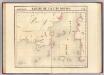
[G[oenong] Batoepandjang] : vluchtig opgenomen door den Topografischen Dienst in 1925-1926
Topografische Dienst Batavia Batavia : Reproductiebedrijf Topografische Dienst
Kandangan / compilation: LHQ Cartographic Coy., Aust. Svy. Corps
Australian Survey Corps . LHQ Cartographic Company [S.l.] : LHQ Cartographic Coy
Blad VII Siding, blad m, uit: Residentie Wester-Afdeeling van Borneo : weg- en rivierkaart / Topographisch Bureau
1 : 50000 Annotatie: Voor aanwezige bladen zie overzichtsblad Topographisch Bureau, Batavia Batavia : Topographisch Bureau
Blad XII Ketoengau, blad g, uit: Residentie Wester-Afdeeling van Borneo : weg- en rivierkaart / Topographisch Bureau
1 : 50000 Annotatie: Voor aanwezige bladen zie overzichtsblad Topographisch Bureau, Batavia Batavia : Topographisch Bureau
Bandjermasin / Survey of India
Survey of India [S.l.] : Survey of India
Blad XIX Sintang, blad a, uit: Residentie Wester-Afdeeling van Borneo : weg- en rivierkaart / Topographisch Bureau
1 : 50000 Annotatie: Voor aanwezige bladen zie overzichtsblad Topographisch Bureau, Batavia Batavia : Topographisch Bureau
Blad XXV Boengan, blad b, uit: Residentie Wester-Afdeeling van Borneo : weg- en rivierkaart / Topographisch Bureau
1 : 50000 Annotatie: Voor aanwezige bladen zie overzichtsblad Topographisch Bureau, Batavia Batavia : Topographisch Bureau
Blad XXVI Boven Mandai, uit: Residentie Wester-Afdeeling van Borneo / Topographisch Bureau
1 : 200000 titelvariant: Residentie Westerafdeeling van Borneo; Annotatie: Titelvariant: Residentie Westerafdeeling van Borneo; Voor aanwezige bladen zie overzichtsblad; Annotatie geografische gegevens: Opname: 1886-1895 Topographisch Bureau, Batavia Batavia : Topographisch Bureau
Kaart van de kust- en binnenlanden van Bandjermasing : behoorende tot de reize in het zuidelijk gedeelte van Borneo / Sal. Müller
[S.l. : s.n.]
Blad XXV Boengan, blad k, uit: Residentie Wester-Afdeeling van Borneo : weg- en rivierkaart / Topographisch Bureau
1 : 50000 Annotatie: Voor aanwezige bladen zie overzichtsblad Topographisch Bureau, Batavia Batavia : Topographisch Bureau
Blad XII Ketoengau, blad o, uit: Residentie Wester-Afdeeling van Borneo : weg- en rivierkaart / Topographisch Bureau
1 : 50000 Annotatie: Voor aanwezige bladen zie overzichtsblad Topographisch Bureau, Batavia Batavia : Topographisch Bureau
Blad XIX Sintang, blad m, uit: Residentie Wester-Afdeeling van Borneo : weg- en rivierkaart / Topographisch Bureau
1 : 50000 Annotatie: Voor aanwezige bladen zie overzichtsblad Topographisch Bureau, Batavia Batavia : Topographisch Bureau
Blad XVIII Batang Loepar, blad d, uit: Residentie Wester-Afdeeling van Borneo : weg- en rivierkaart / Topographisch Bureau
1 : 50000 Annotatie: Voor aanwezige bladen zie overzichtsblad Topographisch Bureau, Batavia Batavia : Topographisch Bureau
Blad IX Soekadana, blad l, uit: Residentie Wester-Afdeeling van Borneo : weg- en rivierkaart / Topographisch Bureau
1 : 50000 Annotatie: Voor aanwezige bladen zie overzichtsblad Topographisch Bureau, Batavia Batavia : Topographisch Bureau
Bandjarmasin / samengesteld en gedrukt bij den Topografischen Dienst
Topografische Dienst Batavia Batavia : Topografische Dienst
Bandjarmasin / Topografische Dienst
Topografische Dienst Batavia Batavia : Topografische Dienst
Blad VIII Tajan, blad p, uit: Residentie Wester-Afdeeling van Borneo : weg- en rivierkaart / Topographisch Bureau
1 : 50000 Annotatie: Voor aanwezige bladen zie overzichtsblad Topographisch Bureau, Batavia Batavia : Topographisch Bureau
Bandjermasin / U.S. Army Map Service
U.S. Army Map Service Washington D.C. Washington D.C. : U.S. Army Map Service
Bladwijzer van Zuider- en Ooster Afd[eling] v[an] Borneo
[S.l. : s.n.]
Gouv[ernement] Borneo : Res[identie] Z[uider] en O[oster] Afd[eeling] van Borneo / Topografische Dienst, Batavia
[S.l. : s.n.]
Blad XXV Boengan, blad c, uit: Residentie Wester-Afdeeling van Borneo : weg- en rivierkaart / Topographisch Bureau
1 : 50000 Annotatie: Voor aanwezige bladen zie overzichtsblad Topographisch Bureau, Batavia Batavia : Topographisch Bureau
Mission map of South Borneo
Partie, Borneo. Oceanique no. 20.
1 : 1641836 Vandermaelen, Philippe, 1795-1869
Blad XXIII Boven Melawi, blad o, uit: Residentie Wester-Afdeeling van Borneo : weg- en rivierkaart / Topographisch Bureau
1 : 50000 Annotatie: Voor aanwezige bladen zie overzichtsblad Topographisch Bureau, Batavia Batavia : Topographisch Bureau
Geologische kaart van zuidelijk Borneo / door H. von Gaffron
Aardrijkskundig Genootschap [Amsterdam : G.L. Brinkman]
Blad XVIII Batang Loepar, blad n, uit: Residentie Wester-Afdeeling van Borneo : weg- en rivierkaart / Topographisch Bureau
1 : 50000 Annotatie: Voor aanwezige bladen zie overzichtsblad Topographisch Bureau, Batavia Batavia : Topographisch Bureau
Overzichtskaart van de administratieve indeeling der Residentie Zuider- en Oosterafdeeling van Borneo / Top[ographische] Inr[ichting]
Topographische Inrichting Batavia Batavia : Top[ographische] Inr[ichting]
Kaart van het Zuidelijk gedeelte bezuiden 1ÿê N.B. van het eiland Borneo / [J.W. Stemfoort en J.J. ten Siethoff ; gereproduceerd op last van het Departement van Koloniën, aan de Topographische Inrichting te 's-Gravenhage, onder leiding van den Directeur C.A. Eckstein]
Ministerie van Koloniën Den Haag s-Gravenhage : Departement van Koloniën
Het Eiland Borneo / gelithogr. door E. de Geest
Amsterdam : Seyffardt's Boekhandel
![[G[oenong] Batoepandjang] : vluchtig opgenomen door den Topografischen Dienst in 1925-1926](https://images-2.georeferencer.com/images/iiif/542776684005/full/,300/0/native.jpg)

