Maps of Ringsaker

Kartblad nr 2: Kaart over Postveien fra Korsødegaarden til Trondhjem igjennom Gulbrandsdalen over Dovrefjeld
1 : 20000 J. H. Reichborn
Fra Stolvstad til Stein
1 : 20000 J. H. Reichborn
Fra Øgarden til Unset
J. H. Reichborn
25D 4
1 : 50000 Hans Christian Smith Due
25B 12
1 : 50000 Oluf Holm
25D 4
1 : 50000 Hans Christian Smith Due
26C 1
1 : 50000 Johan Ferdinand Normann
25D 4
1 : 20000 Jørgen Scielderup Grimseth
Fra Moelv til Øgarden
1 : 20000 J. H. Reichborn
25B 12
1 : 50000 Oluf Holm
26A 9
1 : 50000 Ivar Hellesnes | Ole Jacob Broch
26A 9
1 : 50000 Ramm | Collin
26C 1
1 : 20000 Ramm
25B 12
1 : 20000 Collin
26A 9
1 : 20000 Svend Stenersen Collin
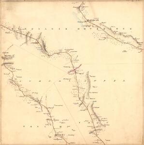
Kartblad 50: Militairisk Wej-Cart over det Westre Hedemarkske Compagnie District
De Place
Trigonometrisk grunnlag, vedlegg 51
1 : 50000
25B Gjøvik
1 : 100000 Holm | Ole Engh
Geologisk kart 8b: Jordbundskart over en del af Mjøsens Omegn
1 : 100000 Theodor Kjerulf | Irgens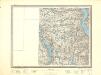
25B Gjøvik
1 : 100000 Ole Engh | Holm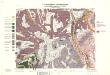
Geologisk kart 32a: Den Geologiske Undersøgelse, Rektangel 26 Åmot
1 : 100000 P. Krohn | Ths. Münster | Øgaard Norges geologiske undersøkelse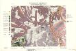
Geologisk kart 32b: Den Geologiske Undersøgelse, Rektangel 26 Åmot
1 : 100000 Øgaard | Ths. Münster | P. Krohn Norges geologiske undersøkelse
25B Gjøvik
1 : 100000 Holm | Ole Engh
25B Gjøvik
1 : 100000 Johan Nordhagen | Holm
25D Lillehammer
1 : 100000 Einar Sigurd Ween | Johan Ferdinand Normann
Geologisk kart 8a: Jordbundskart over en del af Mjøsens Omegn
1 : 100000 Irgens | Theodor Kjerulf
Kartblad 67: Vey-Cart over det Landske Compagnie Destrigst
Neumann
Kartblad 66: Vey-Cart over det Totenske Compagnie District
Niels Riis
5527 Lillehammer
1 : 100000