Maps of Lillesand

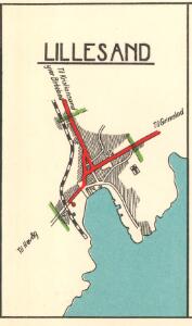
Lillesand
1 : 15000 P. M. Bye og Co. AS Oslo
5A 8 5A 12
1 : 50000 Birger Hielm
5A 4 5A 8 5B 5
1 : 50000 Thorvald Kristian Oscar Holtan
2C 11 5A 3
1 : 50000 Wilhelm Ernst Ramm Gran
5A 7 5A 8
1 : 50000 Jens Holst
Kartblad 14 Wey-Carte over det 3die Nedenæsske Compagnie District

1511-1 Lillesand
1 : 50000 Norges Geografiske Oppmåling
1511-1 Lillesand
1 : 50000 Norges Geografiske Oppmåling
1511-1 Lillesand
1 : 50000 Statens kartverk
5A Kristiansand
1 : 100000 Daniel Tønnesen | H. C. Wanggård
5A Kristiansand
1 : 100000 Daniel Tønnesen | H. C. Wanggård
5A Kristiansand
1 : 100000 C. Pedersen | Daniel Tønnesen
5A Kristiansand
1 : 100000 H. C. Wanggård | Daniel Tønnesen
5A Kristiansand
1 : 100000
Museumskart 60b: Kart over strekningen Kristiansand-Risør
1 : 200000 Rasmus Iuel
5A Kristiansand
1 : 100000 Daniel Tønnesen | H. C. Wanggård
5A Kristiansand
1 : 100000 C. Pedersen | Daniel Tønnesen
Museumskart 60a: Kart over strekningen Kristiansand-Risør
1 : 200000 Rasmus Iuel
Portefølje nr 3
1 : 100000
Museumskart 75: Speciel Kaart over en Deel af Den Norske SøeKyst
1 : 50000 Carl Frederik Grove
Museumskart 217-24: Kart over Den Norske Kyst fra Arendal til Christiansand
1 : 50000 H. Wille | C. Diriks | Vibe Opmaalings Directionen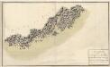
Museumskart 76: Speciel Kaart over en Deel af Den Norske SøeKyst
1 : 50000 Carl Frederik Grove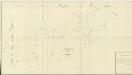
Trigonometrisk grunnlag, Squelet-Cart 18-2: Kysten fra Tromøy til Christiansand
Niels Andreas Wibe | B. Aubert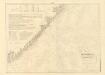
Museumskart 217-20: Kart over Den Norske Kyst fra Jomfruland og Kragerø til Christiansand
1 : 50000 Schie | C. Diriks | H. Wille Opmaalings Directionen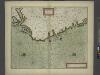
The coast of NORWAY from Bergen to the High Land of Horrel
from The sea-atlas : containing an hydrographical description of most of the sea-coasts of the known parts of the world.
Geologiske kart 121-V2: Kart med magnetisk totalfelt. Arendal
1 : 250000 Norges geologiske undersøkelse
Trigonometrisk grunnlag, Squelet-Cart 46: Kart for 1850
C. Bassøe
Trigonometrisk grunnlag, Squelet-Cart 18- Kysten fra Tromøy til Christiansand
Niels Andreas Wibe | B. Aubert
Trigonometrisk grunnlag, Squelet-Cart 65-1