Maps of Grimstad

Maps of Grimstad

$title$

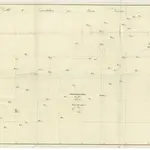
Trigonometrisk grunnlag, Squelet-Cart 18- Kysten fra Tromøy til Christiansand

Niels Andreas Wibe | B. Aubert
$title$

Trigonometrisk grunnlag, Squelet-Cart 18-2: Kysten fra Tromøy til Christiansand

Niels Andreas Wibe | B. Aubert
$title$

The coast of NORWAY from Bergen to the High Land of Horrel

from The sea-atlas : containing an hydrographical description of most of the sea-coasts of the known parts of the world.
$title$

Trigonometrisk grunnlag, Squelet-Cart 46: Kart for 1850

C. Bassøe
$title$

Museumskart 76: Speciel Kaart over en Deel af Den Norske SøeKyst

1 : 50000 Carl Frederik Grove
$title$

Museumskart 75: Speciel Kaart over en Deel af Den Norske SøeKyst

1 : 50000 Carl Frederik Grove
$title$

Portefølje nr 2

1 : 100000 H. Gill
$title$

Portefølje nr 2

1 : 100000 H. Gill
$title$

Museumskart 217-24: Kart over Den Norske Kyst fra Arendal til Christiansand

1 : 50000 H. Wille | C. Diriks | Vibe Opmaalings Directionen
$title$

Museumskart 217-25: Kart over Den Norske Kyst fra Christiansand til Lindesnæs

1 : 50000 H. Wille | Schie Opmaalings Directionen
$title$

Museumskart 217-2 Kart over Den Norske Kyst fra Christiansand til Ekersund

1 : 50000 H. Wille | Schie Opmaalings Directionen
$title$

Portefølje nr 3

1 : 100000
$title$

Museumskart 60a: Kart over strekningen Kristiansand-Risør

1 : 200000 Rasmus Iuel
$title$

5A Kristiansand

1 : 100000 C. Pedersen | Daniel Tønnesen
$title$

5A Kristiansand

1 : 100000 Daniel Tønnesen | H. C. Wanggård
$title$

Museumskart 60b: Kart over strekningen Kristiansand-Risør

1 : 200000 Rasmus Iuel
$title$

5A Kristiansand

1 : 100000
$title$

Museumskart 65: Kart over Den Norske Kyst fra Christiansand til Lindesnæs

1 : 150000 Schie
$title$

2C Oksø

1 : 100000
$title$

Kartblad 143-2: Geographiske Wej-Cart over det 2det Mandahlske Compagnie District; versjon 2

$title$

Kartblad 143- Geographiske Wej-Cart over det 2det Mandahlske Compagnie District; versjon 1

$title$

D39 aust Evje

1 : 100000
$title$

2C Oksø

1 : 100000 Oluf Lier | Johan Nordhagen
$title$

2C Oksø

1 : 100000 Oluf Lier | Johan Nordhagen
$title$

1D Mandal

1 : 100000 H. Wangård | Oluf Lier
$title$

5A Kristiansand

1 : 100000 H. C. Wanggård | Daniel Tønnesen
$title$

1D Mandal

1 : 100000 H. Wangård | Oluf Lier
$title$

2C Oksø

1 : 100000 Oluf Lier | Johan Nordhagen
$title$

E39 vest Froland

1 : 100000
$title$

1D Mandal

1 : 100000
© MapTiler © OpenStreetMap contributors
How does it work?
These instructions will show you how to find historical maps online.
Getting started
Type the place name in the search box to find the exact location. You can further adjust the search by zooming in and out.
Zoom
Zoom in and out with the buttons or use your mouse or touchpad natively.
Exact Area tool
Click here and draw a rectangle over the map to precisely define the search area.
Set filters
Narrow your search with advanced settings, such as Years (from/to), Fulltext, Publisher, etc.
Results
See the results of your search on the right side. You can scroll down to find more maps of this location.
?

Download OldMapsOnline Mobile