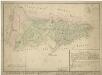
Maps of Mähring

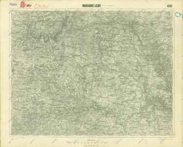
III. vojenské mapování 4049
1 : 75000
Mariánské Lázně
1 : 75000 Mariánské Lázně (Česko : oblast) Vojenský zeměpisný ústav
Mariánské Lázně
1 : 75000 Mariánské Lázně-oblast (Česko) Vojenský zeměpisný ústav
Mariánské Lázně
1 : 75000 Chodová Planá (Česko : oblast) Vojenský zeměpisný ústav
Marienbad und Tachau
1 : 75000 Mariánské Lázně (Česko : oblast) Höller, K. K. u. k. Militärgeographisches Institut
Marienbad und Tachau
1 : 75000 Mariánské Lázně (Česko : oblast) K. u. k. Militärgeographisches Institut
Přehledová mapa velkostatku Tachov
1 : 17280
Hayder Vicariat
Bor-oblast (Tachov, Česko)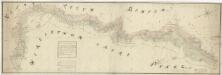
Mapa česko-bavorské hranice v prostoru panství Tachov, Planá a Chodová Planá
1 : 12842

Gradkartenblatt
1 : 25000 Čechy (Česko) Böhm, Karl
[Kartenblatt]
1 : 25000 Mähring (Německo) Reichsamt für Landesaufnahme
Umgebungskarte der Curstadt Marienbad
1 : 60000 Mariánské Lázně-oblast (Česko) E.A. Götz
Hospodářská mapa revíru Kočov
1 : 4350
Uibersichtskarte der Herrschaft Tachau
Tachov-oblast (Česko) Waraus, E. André Verlag des böhm. Forstvereins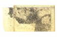

Gradkartenblatt
1 : 25000 Tachov-oblast (Česko) Bulla, Eduard
III. vojenské mapování 4049/2
1 : 25000
[Kartenblatt]
1 : 25000 Halže (Česko) Reichsamt für Landesaufnahme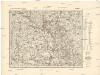
[Kartenblatt]
1 : 25000 Chodová Planá (Česko : oblast) Reichsamt für Landesaufnahme
III. vojenské mapování 4049/4
1 : 25000
[Kartenblatt]
1 : 25000 Planá (Tachov, Česko : oblast) Reichsamt für Landesaufnahme
Gradkartenblatt
1 : 25000 Mariánské Lázně-oblast (Česko) Böhm, Karl
Přehledná mapa panství Planá
1 : 25000
III. vojenské mapování 4049/3
1 : 25000
III. vojenské mapování 4049/1
1 : 25000
Lesní přehledová mapa velkostatku Tachov
1 : 20173
Gradkartenblatt
1 : 25000 Čechy (Česko) Bulla, Eduard
Přehledová mapa velkostatku Tachov
1 : 17280