Maps of Greater Poland Voivodeship

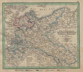
Die Königl. Preussischen Provinzen Brandenburg Pommern Sachsen und Schlesien nebst Mecklenburg
Mitteleuropa
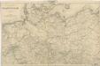
[Nordöstliches Deutschland]
Schul-Atlas über alle Theile der Erde nach dem neuesten Zustande, und über das Weltgebäude Stieler, Adolf bei Justus Perthes
Nordöstliches Deutschland
Preußen
NE pt. of Germany.
1 : 3150000 Bowen, Emanuel
The N. E. Part of Germany
1 : 3400000 Mollova mapová sbírka Moll, Herman Moll, Hermann
NO Deutschland.
1 : 5500000 Brudin, J. L.; Stieler, Adolf
The N.E. part of Germany.
1 : 3500000 Moll, Herman, d. 1732
Upper Saxony, Silesia, Lusatia.
1 : 1340000 Cary, John, ca. 1754-1835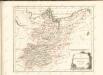

Le Cours de l'Elbe et de l'Oder où sont les Electorats de Saxe et de Brandebourg, les Duchés de Mekelbourg et de Pomeranie
1 : 1400000 Mollova mapová sbírka Duval, Pierre Duval, Pierre
Upper Saxony.
1 : 2900000 Bowen, Frances
Nord-östliches Deutschland
1 : 1850000 Braniborsko (Německo) Ausfeld, Johann Carl Justus Perthes
Mitteldeutschland
Volksschul-Atlas über alle Teile der Erde Lange, Henry Druck und Verlag von Georg Westermann
[Nord-Östliches Deutschland]
Hand-Atlas über alle Theile der Erde nach dem neuesten Zustande und über das Weltgebäude Stieler, Adolf bei Justus Perthes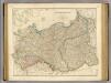
Prussia, Poland.
1 : 1570000 Arrowsmith, John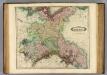
Upper Saxony.
1 : 1500000 Lizars, Daniel
Germany No.1, Prussia and Saxony.
1 : 2500000 Colton, G.W.
Prussia and Saxony.
1 : 3000000 Colton, G.W.
[Nordoestliches Deutschland]
Stieler's Hand-Atlas Stieler, Adolf bei Justus Perthes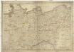
Die Königreiche Sachsen und Westphalen nach der neuesten astronomischen Beobachtungen und den besten Hülfsmitteln verfasst
1 : 1060000 Sasko (Německo) Mollo, Tranquillo T. Mollo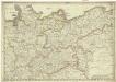
Die Königreiche Sachsen und Westphalen nach der neuesten astronomischen Beobachtungen und den besten Hülfsmitteln verfasst
1 : 1060000 Sasko (Německo) Mollo, Tranquillo T. Mollo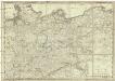
Die Königreiche Sachsen und Westphalen
1 : 1060000 Sasko (Německo) Mollo, Tranquillo T. Mollo
Prussia.
1 : 3300000 Tanner, Henry S.
Situation des armées Francaises depuis le 10 mars jusqu'á la bataille de Wurtchen (Campagne de 1813)
1 : 2281000
Nord-Ostliches Deutschland bearbeitet von C. Vogel.
1 : 1850000 Vogel, C.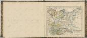

Prussia.
1 : 3400000 Finley, Anthony
Atlas für Handel und Industrie: Für Kaufleute, Fabrikante u. Gewerbetreibende, Handlungs- u. Gewerbe-Schulen

[Nord-Östliches Deutschland]
Hand-Atlas über alle Theile der Erde nach dem neuesten Zustande und über das Weltgebäude Stieler, Adolf bei Justus Perthes