Maps of Carpathian Mountains
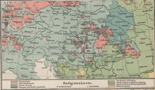
Religionskarte
Österreich-Ungarn Denomination
Bodenschätze u. Industrie
Österreich-Ungarn Industrie, Mineralischer Rohstoff
Bevölkerungsdichte
Österreich-Ungarn Bevölkerungsdichte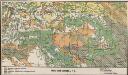
Bodenbenutzung
Österreich-Ungarn Bodennutzung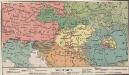
Völkerkarte
Österreich-Ungarn Ethnische Gruppe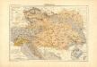
Atlas für Industrie- und Handelsgeographie: Für commercielle und technische Lehranstalten, für Kaufleute und Industrielle
Uibersichts-Karte der Österreichischen Monarchie
1 : 2600000 Evropa jihovýchodní Fleischans, Carl Medau, Karel Vilém C.W. Medau
Volkerkarte v. Oesterreich-Ungarn.
1 : 4000000 Andree, Richard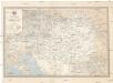
Übersichtskarte der k. k. österreichischen Staatsbahnen und der im Staatsbetriebe befindlichen Privatbahnen
1 : 1449000 Dalmácie jižní (Chorvatsko)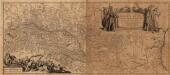
Danvbivs Fluvius Europae Maximus, A Fontibvs Ad Ostia
1 : 2100000 Mollova mapová sbírka Danckertsz, Cornelis Danckerts, Cornelis I.
Novissima Russiæ tabula / authore Isaaco Massa
1 : 840000 1 Karte : Kupferdruck ; 46 x 54 cm Massa, Isaac Abrahamsz Apud Janssonio-Waesbergios et Mosem Pitt
Tabula Russiae / ex mandato Foedor Borissowits delineata, Magno studio plurimis in locis aucta, edit
1 : 7900000 1 Karte : Kupferdruck ; 41 x 52 cm Visscher, Claes Jansz. [Nicolas Visscher]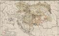
Österreich-Ungarn. Landwirtschaft
1 : 9000000 Österreich-Ungarn Landwirtschaft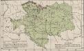
Österreich-Ungarn. Industrie, Bergbau
1 : 9000000 Österreich-Ungarn Industrie, Bergbau
The European part of the Russian Empire, from the maps publishd by the Imperial Academy at St. Peter
1 : 8200000 1 Karte auf 2 Bl. : Kupferdruck ; 47 x 128 cm ; Einzelbl. 47 x 64 cm published 12th May 1794 by Lawrie & Whittle, No.53 Fleet Street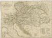
Charte der Oesterreichischen Monarchie
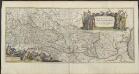
DANVBIVS, | FLUVIUS EUROPÆ MAXIMUS, | A FONTIBVS AD OSTIA. | Cum omnibus Fluminibus, ab utroque latere, | in illum defluentibus.
[Amsterdam : Joan Blaeu]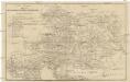
Neueste Postkarte der Oesterreichischen Monarchie
Evropa střední Rieder, Lorenz Otto Wigand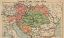
Österreich-Ungarn. Staaten
1 : 9000000 Österreich-Ungarn Politische Geografie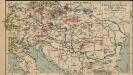
Österreich-Ungarn. Industrie und Verkehrswege
1 : 9000000 Österreich-Ungarn Industrie, Verkehrsnetz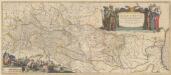
Danubius, Fluvius Europae Maximus, A Fontibus Ad Ostia, Cum omnibus Fluminibus, ab utroque latere, in illum defluentibus. [Karte], in: Novus Atlas, das ist, Weltbeschreibung, Bd. 1, S. 191.
1 Karte aus Atlas Blaeu, Joan Blaeu, Willem Janszoon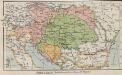
Österreich-Ungarn. Staaten
1 : 9000000 Österreich-Ungarn Verwaltungsgliederung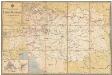
Übersichts-Karte der k. k. österr. Staatsbahnen
1 : 1550000 Evropa jihovýchodní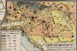
Bevölkerungsdichte
Österreich-Ungarn Bevölkerungsdichte
Austria.
1 : 5000000 Finley, Anthony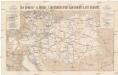
Die Oesterr. u. Ungar. Eisenbahnen der Gegenwart u. der Zukunft
1 : 1850000 Evropa střední Artaria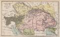
Östreich-Ungarn
1 : 7500000 Österreich-Ungarn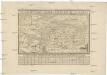
General-Charte der Oesterreichishen Staaten
1 : 6530000 Evropa jihovýchodní Blum von Kempen, Heinrich Wilhelm von Prixner, Gottfried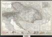
Der österreichische Kaiserstaat
Berghaus, Hermann; Stülpnagel, Friedrich von; Petermann, August; Habenicht, Hermann Perthes