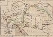
Maps of Carpathian Mountains
Übersichts-Karte der k. k. österr. Staatsbahnen
1 : 1550000 Evropa jihovýchodní
Übersichtskarte der k. k. österreichischen Staatsbahnen und der im Staatsbetriebe befindlichen Privatbahnen
1 : 1449000 Dalmácie jižní (Chorvatsko)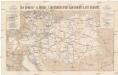
Die Oesterr. u. Ungar. Eisenbahnen der Gegenwart u. der Zukunft
1 : 1850000 Evropa střední Artaria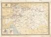
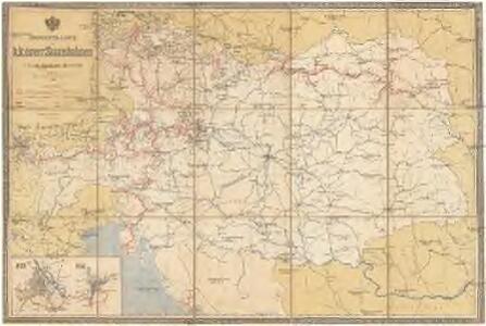
Übersichts-Karte der k.k. österr. Staatsbahnen mit dem Stande von Jänner 1889
1 : 1600000 Praha (Česko) K.k. general-Direction der österr. Staatsbahnen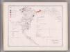
Coal Fields No. 1, Austria. Coal Resources of the World.
1 : 2395000 Petrascheck, W.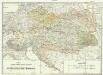
Projectirte Verpflegs-Bezirgs-Eintheilung der Oesterreichischen Monarchie
1 : 1480000 Evropa střední Hubert, D.
Isochronenkarte von Österreich-Ungarn
1 : 1500000 Rakousko-Uhersko Heiderich, Franz G. Freytag & Berndt
Atlas für Industrie- und Handelsgeographie: Für commercielle und technische Lehranstalten, für Kaufleute und Industrielle

Národopisná mapa císařství Rakousko - Uherského

Florenkarte von Österreich-Ungarn
1 : 6000000 Rakousko-Uhersko Wettstein, Richard Kerner von Marilaun, Anton
Composite: Austro-Hungarian Monarchy.
1 : 1642000 Johnston, Alexander Keith
Neueste Postkarte der Oesterreichischen Monarchie
Evropa střední Rieder, Lorenz Otto Wigand
Volkerkarte v. Oesterreich-Ungarn.
1 : 4000000 Andree, Richard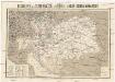
Reisekarte der Oesterreich. Ungarischen Monarchie
1 : 2250000 Evropa střední Moritz Perles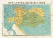
Reisekarte der Oesterreich. Ungarischen Monarchie
1 : 2250000 Evropa střední Moriz Perles
Ethnog. Austria-Hungary
1 : 4000000 Andree, Richard; Times (London, England)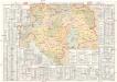
Dislokation der österr[eichischen]- ungar[ischen]- Wehrmacht
1 : 1800000 Rakousko-Uhersko G. Freytag & Berndt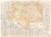
Dislokation der österr[eichischen]- ungar[ischen]- Wehrmacht
1 : 1800000 Rakousko-Uhersko G. Freytag & Berndt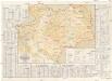
Übersichts-Karte der Dislocation des k.u.k. österr[eichischen] ung[arischen] Heeres und der Landwehren
1 : 1800000 Rakousko-Uhersko G. Freytag & Berndt
Höhenschichten-Karte von Österreich-Ungarn
Rakousko-Uhersko Chavanne, Joseph Ed. Hölzel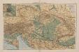
Österreich-Ungarn
1 : 4000000 Österreich-Ungarn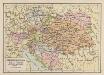
Österreich-Ungarn
1 : 6900000 Österreich-Ungarn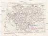
[Jugoslávie 1:200 000]
1 : 25000 Jugoslávie K. u. k Militärgeographisches Institut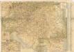
Neue verkehrskarte von Österreich-Ungarn...

Empire D'Autriche.
Andriveau-Goujon, J.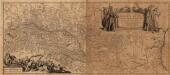
Danvbivs Fluvius Europae Maximus, A Fontibvs Ad Ostia
1 : 2100000 Mollova mapová sbírka Danckertsz, Cornelis Danckerts, Cornelis I.
Reichsraths-Parteien-Karte von Österreich
Evropa jihovýchodní Sedlak, Karl
Místopisná a železniční mapa nástupnických států
1 : 2000000 Evropa střední Brunclík, Josef Jos. Švíkal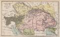
Östreich-Ungarn
1 : 7500000 Österreich-Ungarn