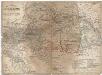
Maps of Carpathian Mountains

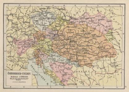
Österreich-Ungarn
1 : 6900000 Österreich-Ungarn
Reisekarte der Oesterreich. Ungarischen Monarchie
1 : 2250000 Evropa střední Moritz Perles
Reisekarte der Oesterreich. Ungarischen Monarchie
1 : 2250000 Evropa střední Moriz Perles
Florenkarte von Österreich-Ungarn
1 : 6000000 Rakousko-Uhersko Wettstein, Richard Kerner von Marilaun, Anton
Composite: Austro-Hungarian Monarchy.
1 : 1642000 Johnston, Alexander Keith
Osterreich.
1 : 2400000 Steinhauser, A.
Karte der zu Ende Juni 1857 thätigen Stationen für phänologische Beobachtungen in Oesterreich
Rakousko-Uhersko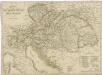
Charte der Oesterreichischen Monarchie
Bevölkerungsdichte
Österreich-Ungarn Bevölkerungsdichte
Routenkarte der eisenbahnen von Österreich, Ungarn und Bosnien-Herzegowina
Eberle, Joseph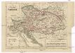
Císařství rakouské
1 : 6000000 Rakousko (1804-1867) Wagner, Jan Eduard Jaroslav Pospíšil
Císařství Rakouské
1 : 729000 Rakousko-Uhersko c. k. školní knihosklad
Kaiserthum Oesterreich
Evropa jihovýchodní Korb, Albert
Mapa císařství Rakouského

Eisenbahnkarte von Oesterreich-Ungarn
1 : 1900000 Budapešť (Maďarsko) Bomsdorff, Theodor von Karl Prochaska
Eisenbahnkarte von Oesterreich-Ungarn
1 : 1900000 Evropa jihovýchodní Bomsdorff, Theodor von Karl Prochaska
Eisenbahnkarte von Oesterreich-Ungarn
1 : 1900000 Budapešť (Maďarsko) Bomsdorff, Theodor von Karl Prochaska
Neue verkehrskarte von Österreich-Ungarn...
Das Kaiserthum Oesterreich
1 : 2310000 Evropa střední Holle, L. L. Holle
Empire D'Autriche.
Andriveau-Goujon, J.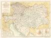
Eisenbahn - Karte von Österreich-Ungarn
Strassen- und Eisenbahnkarte des oesterreichischen Kaiserthumes
1 : 864000 Rakousko (1804-1867) Schaller, Georg k.k. militärisch-geographisches Institut
Übersichtskarte der Oesterreichisch-Ungarischen Monarchie
1 : 3000000 Rakousko-Uhersko Haardt von Hartenthurn, Vinzenz von Ed. Hölzel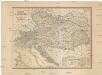
Mocnářství rakouské
1 : 2400000 Rakousko (1804-1867) Wagner, Jan Eduard Jaroslav Pospíšil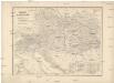
Mocnářství rakouské
1 : 2400000 Rakousko (1804-1867) Wagner, Jan Eduard Jaroslav Pospíšil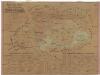
Uibersichts-Karte der Österreichischen Monarchie
1 : 2600000 Evropa jihovýchodní Fleischans, Carl Medau, Karel Vilém C.W. Medau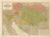
Šolcova nejnovější politická a železniční cestovní mapa Rakousko – Uherska

Oesterreich.
1 : 3900000 Radefeld, Carl Christian Franz, 1788-1874
Der Oesterreichische Kaiser-Staat
Hand-Atlas über alle Theile der Erde nach dem neuesten Zustande und über das Weltgebäude Stieler, Adolf bei Justus Perthes