Maps of Germany
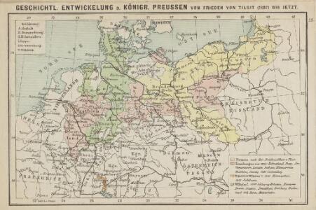
Geschichtl. Entwicklung d. Königr. Preussen vom Frieden von Tilsit (1807) bis jetzt
Deutschland
Mapa teatru wojny na morzu i na lądzie
1 : 3000000 Belgie Scheda, Joseph von Steinhauser, Anton Artaria
Karte der deutschen Wasser Wasserstrassen

Map of the German Empire.
1 : 3700000 Warner & Beers
The Germany 21
1 : 2700000 Appleton, D. & Co.
Deutsches Reich
Volksschul-Atlas über alle Teile der Erde Lange, Henry Druck und Verlag von Georg Westermann
Central Europe. Pergamon World Atlas.
1 : 2500000 Polish Army Topography Service
Mitteleuropa Volksdichte
1 : 6000000 Mitteleuropa Bevölkerungsdichte
Mitteleuropa. Bodengestalt
1 : 4000000 Mitteleuropa Physische Geografie
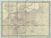
Neueste Laendereintheilung nach dem Frieden von Tilsit (9t[er] July 1807) oder Deutschland nebst angränzenden Ländern
Reise-, Post- und Zoll-Karte von Deutschland
1 : 2220000 Německo Hoffmann, Karl Friedrich Vollrath Erno, E. Carl Hoffmann
Prussia - Holland and the German States.
1 : 3380000 Sharpe, J.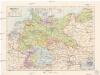
Německá říše
1 : 3250000 Evropa střední Státní nakladatelství
Post- und Eisenbahnkarte des Deutschen Reichs und der angrenzenden lander
1 : 3000000 [Lieu de publication inconnu] : [éditeur inconnu]
Deutschland
Plastischer Schul-Atlas über alle Theile der Erde : in 24 Karten Woldermann, G Verlag von P. Eckerlein
79-80. Europe, Central. The World Atlas.
1 : 2500000 USSR (Union of Soviet Socialist Republics).
Germany, Switzerland, Holland.
1 : 6500000 Peterson, Augusts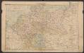
Deutsches Reich
Volksschul-Atlas über alle Teile der Erde Lange, Henry Druck und Verlag von Georg Westermann
Post Karte von Deutschland und den angraenzenden Laendern vorzüglich der preussischen Staaten
1 : 1700000 Evropa střední Mollo, Tranquillo T. Mollo
Post- & Reise-Karte von Deutschland und den nachbar Staaten
Evropa střední Handtke, Friedrich Flemming, C. C. Flemming
Post- & Reise-Karte von Deutschland und den nachbar Staaten
Evropa střední Handtke, Friedrich Weber, H. C. Fleming
Germania magna
1 : 2280000 Evropa severozápadní Reichard, Christian Gottlieb Campius, D. a D. Campio
Germany.
1 : 3000000 Andree, Richard; Times (London, England)
Map showing expansion of Prussia into the German Empire
1 : 2000000 Map showing expansion of Prussia into the German Empire. War Office
Tabula Geographica Imperii Germanici
1 : 2100000 Mollova mapová sbírka Rhode, Johann Christoph Berger, Friedrich Gottlieb
Deutschland
Neuer Handatlas über alle Theile der Erde Kiepert, Heinrich Verlag von Dietrich Reimer
Deutschland politisch.
1 : 2700000 Andree, Richard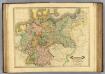
Germany.
1 : 2400000 Lizars, Daniel
Composite: Germany.
1 : 1250000 Robert Laurie & James Whittle