Maps of Germany

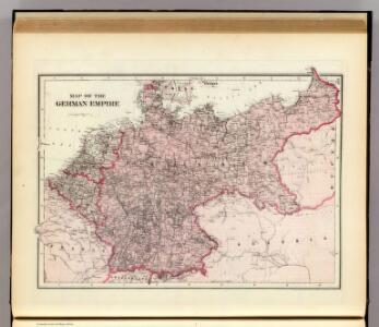
Map of the German Empire.
1 : 3700000 Warner & Beers
Deutsches Reich
Volksschul-Atlas über alle Teile der Erde Lange, Henry Druck und Verlag von Georg Westermann
Mitteleuropa Volksdichte
1 : 6000000 Mitteleuropa Bevölkerungsdichte
Mapa teatru wojny na morzu i na lądzie
1 : 3000000 Belgie Scheda, Joseph von Steinhauser, Anton Artaria
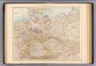
Deutsches Reich
Volksschul-Atlas über alle Teile der Erde Lange, Henry Druck und Verlag von Georg Westermann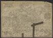
Post- und Eisenbahnkarte des Deutschen Reichs und der angrenzenden lander
1 : 3000000 [Lieu de publication inconnu] : [éditeur inconnu]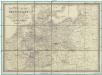
Reise-, Post- und Zoll-Karte von Deutschland
1 : 2220000 Německo Hoffmann, Karl Friedrich Vollrath Erno, E. Carl Hoffmann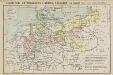
Geschichtl. Entwicklung d. Königr. Preussen vom Frieden von Tilsit (1807) bis jetzt
Deutschland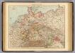
Germany.
1 : 3000000 Andree, Richard; Times (London, England)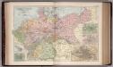
The Germany 21
1 : 2700000 Appleton, D. & Co.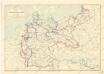
Karte der deutschen Wasser Wasserstrassen
Deutschland politisch.
1 : 2700000 Andree, Richard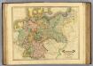
Germany.
1 : 2400000 Lizars, Daniel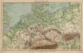
Mitteleuropa. Bodengestalt
1 : 4000000 Mitteleuropa Physische Geografie
Neueste Laendereintheilung nach dem Frieden von Tilsit (9t[er] July 1807) oder Deutschland nebst angränzenden Ländern

Uebersichts-Karte aller in Deutschland

Neueste Post-Karte durch ganz Deutschland, Helvetien, Ober Italien, Oestreich, Ungarn, Pohlen, Preussen, Dänemark, Holland und Frankreich bis Paris
Dánsko Ulrich, C. F. Börner Fr. Wilmans
Wandkarte des Deutschen Reiches.zum Schul- und Comptoir- Gebrauch
mapa VKOL Kiepert, Heinrich Verlag von Dietrich Reimer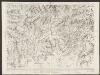
Nova Totius Germaniae Descriptio. [Karte], in: Theatrum orbis terrarum, sive, Atlas novus, Bd. 1, S. 120.
1 Karte aus Atlas Blaeu, Joan Blaeu, Willem Janszoon
Deutschland zur Zeit des 30 jaehrigen Krieges.
1 : 3800000 Spruner von Merz, Karl
Nova Totius Germaniae Descriptio. [Karte], in: Novus Atlas, das ist, Weltbeschreibung, Bd. 1, S. 79.
1 Karte aus Atlas Blaeu, Joan Blaeu, Willem Janszoon
Nova Totius Germaniae Descriptio. [Karte], in: Le théâtre du monde, ou, Nouvel atlas contenant les chartes et descriptions de tous les païs de la terre, Bd. 1, S. 102.
1 Karte aus Atlas Blaeu, Willem Janszoon und Blaeu, Joan Blaeu, Willem Janszoon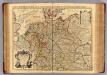
L'Allemagne.
1 : 2500000 L'Isle, Guillaume de, 1675-1726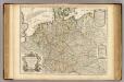
L'Allemagne.
1 : 2500000 L'Isle, Guillaume de, 1675-1726
Deutschland, Ubersicht Des Deutschen Reichs.
1 : 3700000 Berghaus, Hermann
Deutschland Und Benachbarte Lander. Zur Ubersicht Der Eisenbahnen Und Dampfschiffahrten.
1 : 3700000 Vogel, C.
Tabula Germaniae emendata recens [Karte], in: Novus atlas absolutissimus, Bd. 2, S. 16.
1 Karte aus Atlas Janssonius Offizin
Post- & Reise-Karte von Deutschland und den nachbar Staaten
Evropa střední Handtke, Friedrich Flemming, C. C. Flemming
Post- & Reise-Karte von Deutschland und den nachbar Staaten
Evropa střední Handtke, Friedrich Weber, H. C. Fleming