Maps of Potsdam

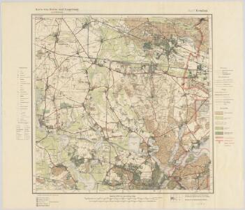
Blatt V Potsdam, uit: Karte von Berlin und Umgebung in 12 Blättern
1 : 50000 Annotatie: Toelichtingen opgeborgen bij kaart; Annotatie geografische gegevens: Met schaalstokken: Meter, Schritt, geographische Meile Paul Schneider Berlin : Reichsamt für Landesaufnahme
Gegend zwischen Spandau und Nauen
1 : 160000 Špandava (Berlín, Německo)
Meßtischblatt 1906 : Potsdam (Nord), 1938
1 : 250000 Potsdam (Nord). - Hrsg. 1903, bericht. 1920, einz. Nachtr. 1936, redakt. Änd. [19]38. - 1:25000. - [Berlin]: Reichsamt für Landesaufnahme, 1938. - 1 Kt.
Meßtischblatt 1906 : Potsdam (Nord), 1936
1 : 250000 Potsdam (Nord). - Hrsg. 1903, bericht. 1920, einz. Nachtr. 1936. - 1:25000. - [Berlin]: Reichsamt für Landesaufnahme, 1936. - 1 Kt.
Meßtischblatt 1906 : Potsdam (Nord), 1935
1 : 250000 Potsdam (Nord). - Hrsg. 1903. - 1:25000. - [Berlin]: Reichsamt für Landesaufnahme, 1935. - 1 Kt.
Meßtischblatt 1906 : Potsdam (Nord), 1933
1 : 250000 Potsdam (Nord). - Hrsg. 1903, bericht. 1920, einz. Nachtr. 1933. - 1:25000. - [Berlin]: Reichsamt für Landesaufnahme, 1933. - 1 Kt.
Meßtischblatt 1906 : Potsdam (Nord), 1917
1 : 250000 Potsdam (Nord). - Aufn. 1901, hrsg. 1903, N.12, 617, Aufldr. 1917. - 1:25000. - [Berlin]: Reichsamt für Landesaufnahme, 1917. - 1 Kt.
Meßtischblatt 3543 : Ketzin, 1945
1 : 250000 Ketzin. - Hrsg. 1903, bericht. 1920, einz. Nachtr. 1939. - 1:25000. - [Berlin]: Reichsamt für Landesaufnahme, 1945. - 1 Kt.
Meßtischblatt 1905 : Ketzin, 1920
1 : 250000 Ketzin. - Aufn. 1901, bericht. 1920. - 1:25000. - [Berlin]: Reichsamt für Landesaufnahme, 1920. - 1 Kt.
Meßtischblatt 1905 : Ketzin, 1917
1 : 250000 Ketzin. - Aufn. 1901, hrsg. 1903, N. 16, 1017. - 1:25000. - [Berlin]: Reichsamt für Landesaufnahme, 1917. - 1 Kt.
Meßtischblatt 1905/1906 (Doppelblatt)/ : Ketzin/Potsdam, 1917
1 : 250000 Ketzin/Potsdam. - Aufn. 1901, hrsg. 1903, Aufl.dr. 1917. - 1:25000. - [Berlin]: Reichsamt für Landesaufnahme, 1917. - 1 Kt.
Meßtischblatt 1835 : Dallgow- Döberitz, 1937
1 : 250000 Dallgow- Döberitz. - Hrsg. 1903, bericht. 1925, mehrfarb. Ausg. 1936, einz. Nachtr. 1937. - 1:25000. - [Berlin]: Reichsamt für Landesaufnahme, 1937. - 1 Kt.
Meßtischblatt 1835 : Dallgow- Döberitz, 1920
1 : 250000 Dallgow- Döberitz. - Aufn. 1901, bericht. 1920. - 1:25000. - [Berlin]: Reichsamt für Landesaufnahme, 1920. - 1 Kt.
Meßtischblatt 1835 : Dallgow- Döberitz, 1911
1 : 250000 Dallgow- Döberitz. - Aufn. 1901, hrsg. 1903, bericht. 1906, einzelne Nachtr. 1911. - 1:25000. - [Berlin]: Reichsamt für Landesaufnahme, 1911. - 1 Kt.
Meßtischblatt 1834 : Wustermark, 1911
1 : 250000 Wustermark. - Aufn. 1901, hrsg. 1903, einz. Nachtr. 1906, gedr. [19]11. - 1:25000. - [Berlin]: Reichsamt für Landesaufnahme, 1911. - 1 Kt.
Meßtischblatt 1834 : Wustermark, 1903
1 : 250000 Wustermark. - Aufn. 1901. - 1:25000. - [Berlin]: Reichsamt für Landesaufnahme, 1903. - 1 Kt.
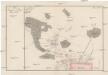
Umgegend von Potsdam
1 : 66666 gez[eichnet] v. L. Kraatz [...] Berlin : Reimer
Postdam
1 : 18000 Postupim (Německo) Meyer, Joseph der geographischen Anstalt des Bibliographischen Instituts
Umgebung von Potsdam
Plan der Situation des Dorfes Bornstedt
Bornstedt (Postupim, Německo)
Composite: 293. Potsdam.
1 : 100000 Reichsamt fur Landesaufnahme
268. Spandau.
1 : 100000 Reichsamt fur Landesaufnahme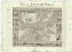
Plan von Potsdam und Umgegend
1 : 12000 Postupim (Německo) Möllendorf, Johann Karl Wolf Dietrich von Bimbé zu haben bei L. Fernabach junior
Potsdam
Grosser Hand-Atlas über alle Theile der Erde in 170 Karten Meyer, J. Verlag des Bibliographischen Instituts
Grundriss von der Stadt Potsdam
Mollova mapová sbírka Schleuen, Johann David
Geologische Übersichtskarte der Umgegend von Berlin
1 : 100000 Berendt, G. ; Laufer, E. Lithogr. Institut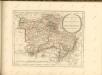

Topographische Carte : Hundert Quadrat-Meilen um Berlin
1 : 184000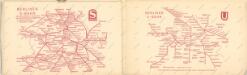
Taschenplan von Berlin