Carte cataloguée
Topographische Carte : Hundert Quadrat-Meilen um Berlin


Titre complet:Topographische Carte : Hundert Quadrat-Meilen um Berlin
Année de l'image:1811
Taille physique:20 x 30 cm
Échelle de la carte:1:184 000
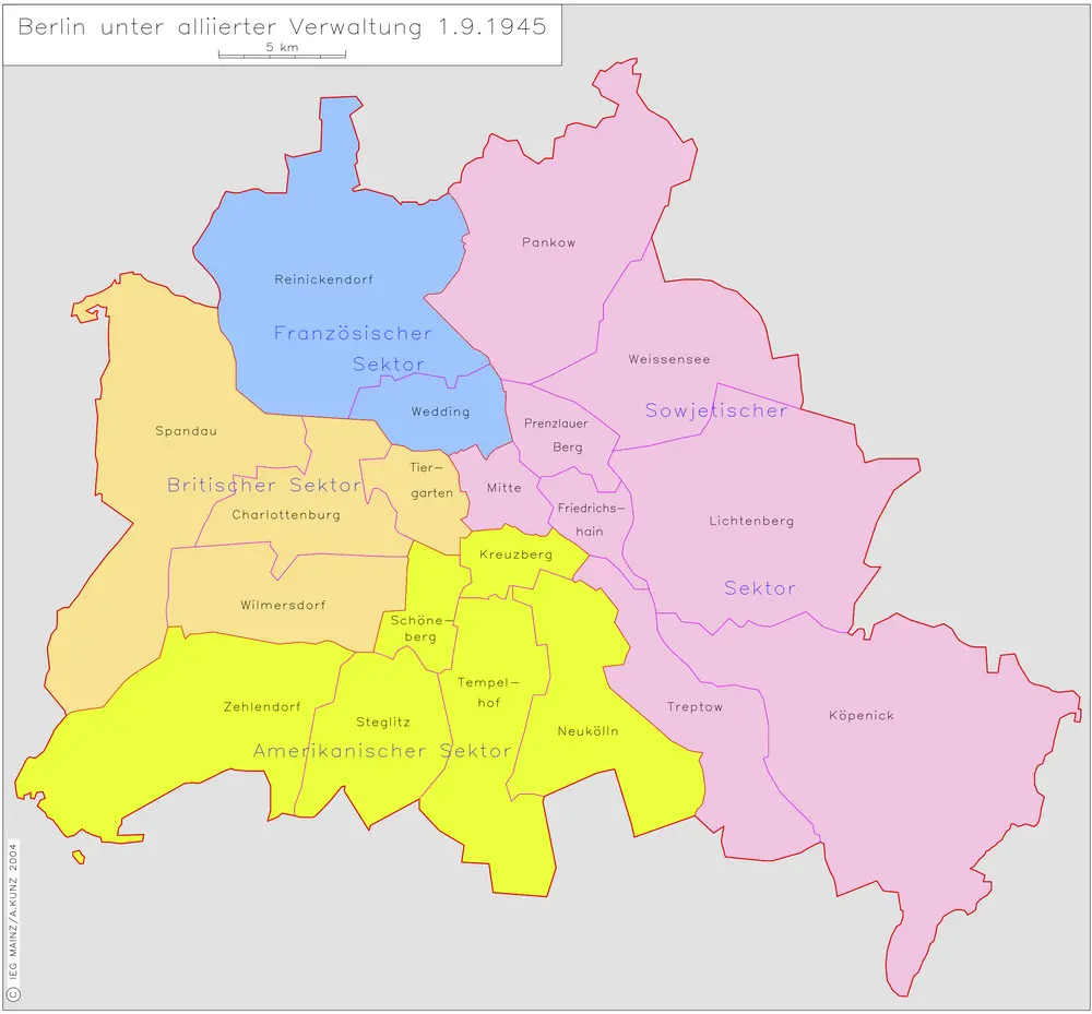
Berlin unter alliierter Verwaltung 1.9.1945
1945
Kunz, Andreas ; Moeschl, Joachim Robert
n/a
1791
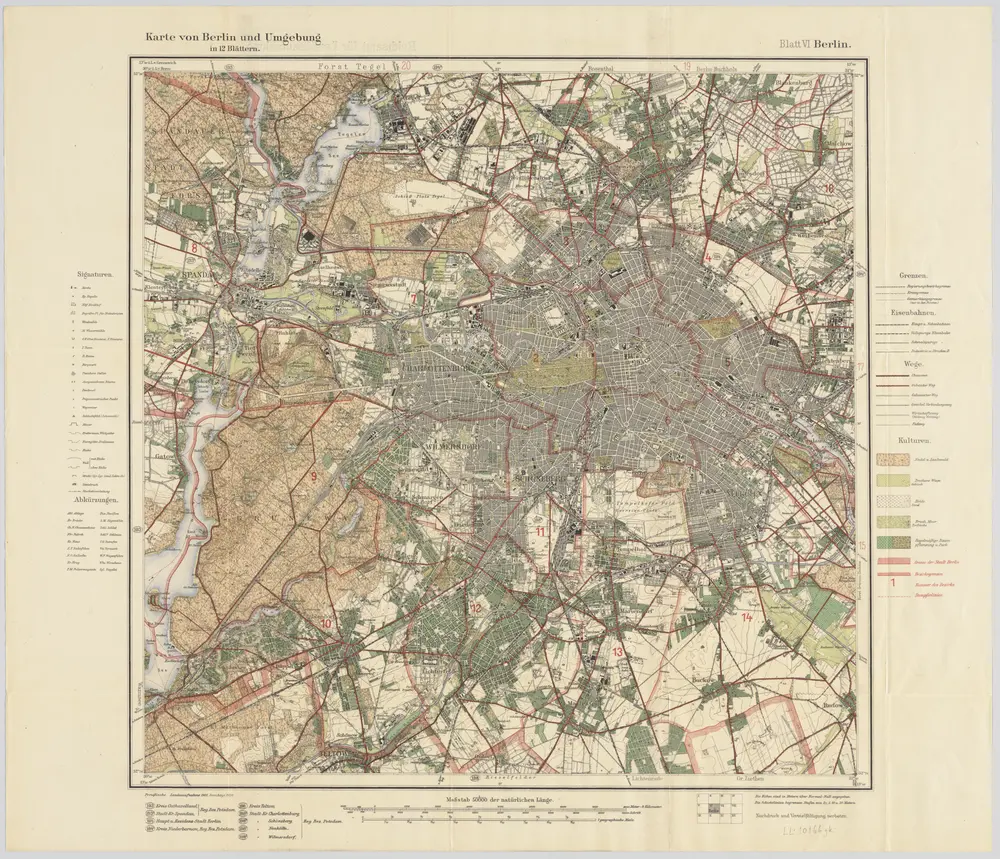
Blatt VI Berlin, uit: Karte von Berlin und Umgebung in 12 Blättern
1922
Paul Schneider
1:50k
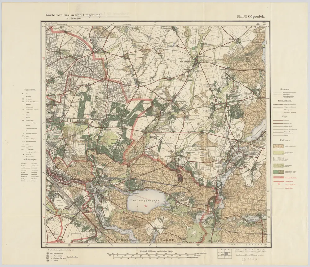
Blatt VII Cöpenick, uit: Karte von Berlin und Umgebung in 12 Blättern
1922
Paul Schneider
1:50k
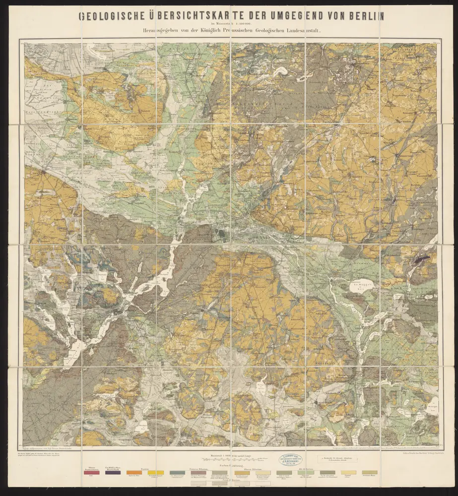
Geologische Übersichtskarte der Umgegend von Berlin
1885
Berendt, G. ; Laufer, E.
1:100k
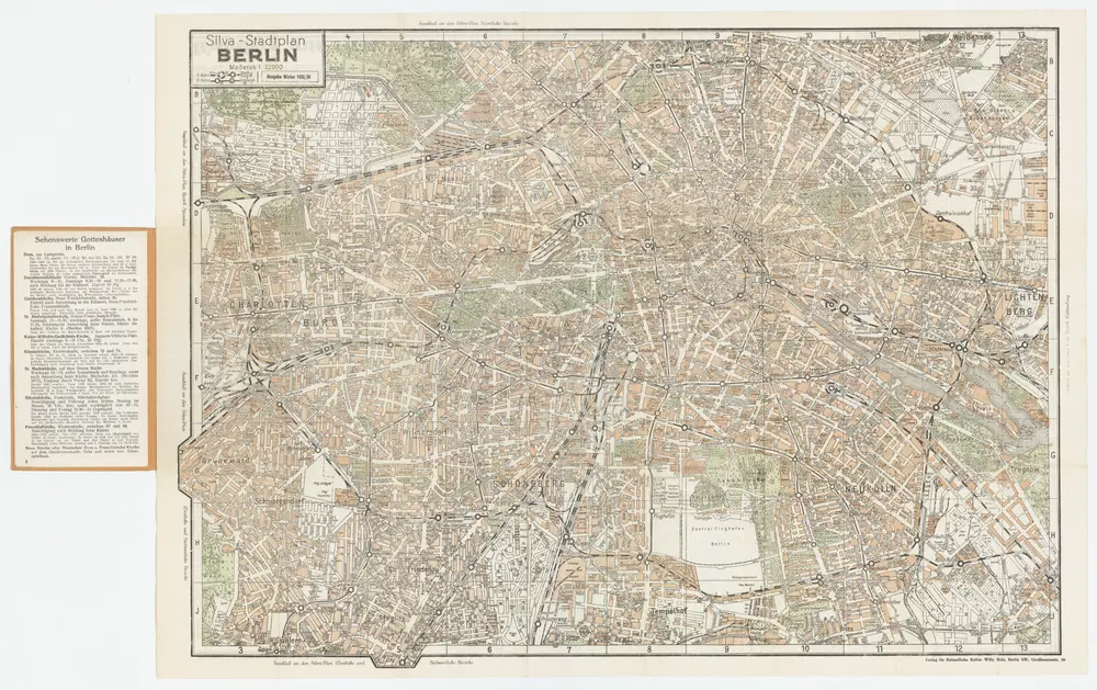
[Kaart], uit: Silva-Stadtplan Berlin
1935
Berlin : Verlag für Heimatliche Kultur Willy Holz
1:22k
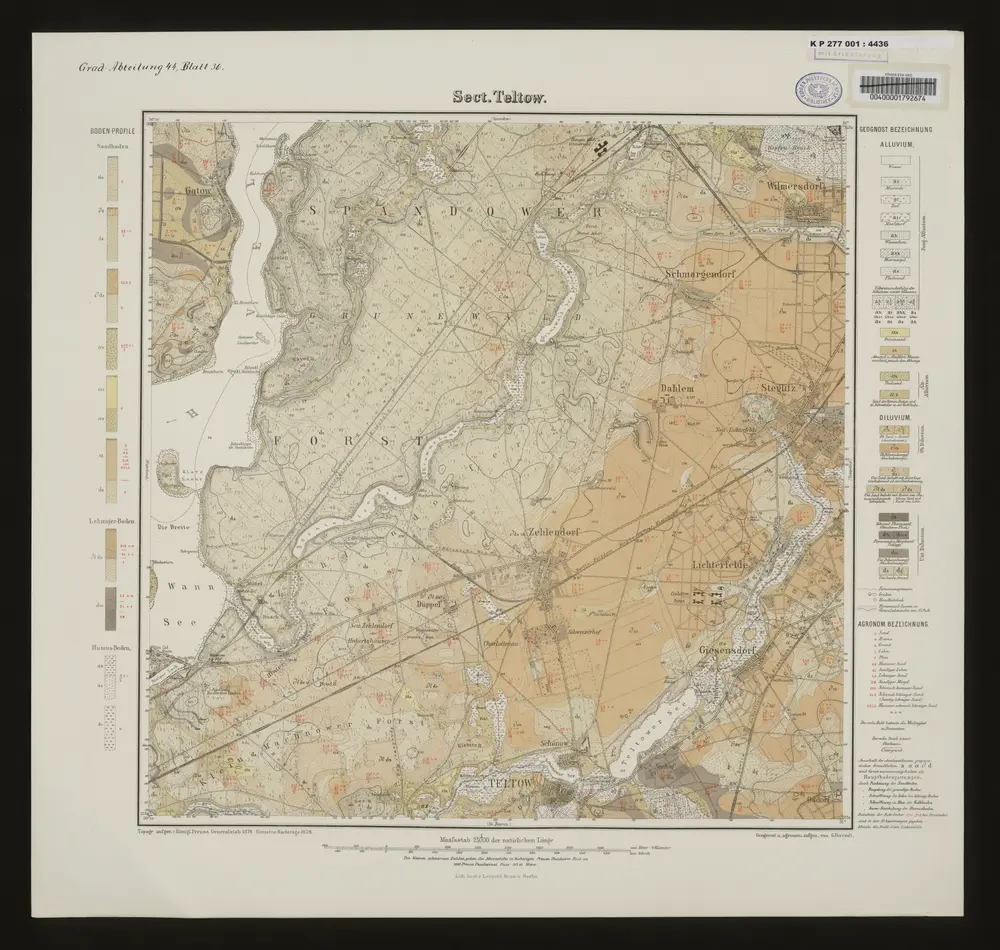
Sect. Teltow
1878
Berlin : Lith. Anst. v. Leop. Kraatz
Meßtischblatt 3547 : Köpenick, 1945
1945
1:250k
Meßtischblatt 3547 : Köpenick, 1942
1942
1:250k
Meßtischblatt 1909 : Cöpenick, 1920
1920
1:250k
Meßtischblatt 1909 : Cöpenick, 1912
1912
1:250k